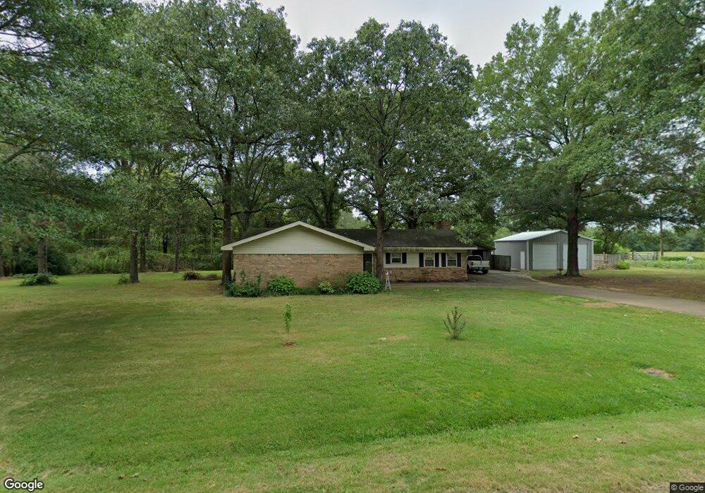
11 Starr Ln Conway, AR 72032
Estimated Value: $158,000 - $232,663
--
Bed
2
Baths
1,512
Sq Ft
$140/Sq Ft
Est. Value
About This Home
This home is located at 11 Starr Ln, Conway, AR 72032 and is currently estimated at $211,416, approximately $139 per square foot. 11 Starr Ln is a home located in Faulkner County with nearby schools including Preston & Florence Mattison Elementary School, Bob Courtway Middle School, and Conway Junior High School.
Ownership History
Date
Name
Owned For
Owner Type
Purchase Details
Closed on
May 4, 2005
Bought by
Cullum
Current Estimated Value
Home Financials for this Owner
Home Financials are based on the most recent Mortgage that was taken out on this home.
Original Mortgage
$100,000
Outstanding Balance
$52,439
Interest Rate
6.03%
Mortgage Type
Future Advance Clause Open End Mortgage
Estimated Equity
$158,977
Purchase Details
Closed on
May 2, 2005
Sold by
Johnson Robert N
Bought by
Cullum Gary Lee
Home Financials for this Owner
Home Financials are based on the most recent Mortgage that was taken out on this home.
Original Mortgage
$100,000
Outstanding Balance
$52,439
Interest Rate
6.03%
Mortgage Type
Future Advance Clause Open End Mortgage
Estimated Equity
$158,977
Create a Home Valuation Report for This Property
The Home Valuation Report is an in-depth analysis detailing your home's value as well as a comparison with similar homes in the area
Home Values in the Area
Average Home Value in this Area
Purchase History
| Date | Buyer | Sale Price | Title Company |
|---|---|---|---|
| Cullum | $130,000 | -- | |
| Cullum Gary Lee | $130,000 | None Available | |
| Cullum | $130,000 | -- |
Source: Public Records
Mortgage History
| Date | Status | Borrower | Loan Amount |
|---|---|---|---|
| Open | Cullum | $100,000 | |
| Closed | Cullum | $100,000 |
Source: Public Records
Tax History Compared to Growth
Tax History
| Year | Tax Paid | Tax Assessment Tax Assessment Total Assessment is a certain percentage of the fair market value that is determined by local assessors to be the total taxable value of land and additions on the property. | Land | Improvement |
|---|---|---|---|---|
| 2025 | $1,144 | $40,000 | $4,280 | $35,720 |
| 2024 | $1,144 | $40,000 | $4,280 | $35,720 |
| 2023 | $1,143 | $29,350 | $4,270 | $25,080 |
| 2022 | $818 | $29,350 | $4,270 | $25,080 |
| 2021 | $802 | $29,350 | $4,270 | $25,080 |
| 2020 | $802 | $24,600 | $3,230 | $21,370 |
| 2019 | $802 | $24,600 | $3,230 | $21,370 |
| 2018 | $827 | $24,600 | $3,230 | $21,370 |
| 2017 | $827 | $24,600 | $3,230 | $21,370 |
| 2016 | $826 | $24,580 | $3,230 | $21,350 |
| 2015 | $1,068 | $23,710 | $3,190 | $20,520 |
| 2014 | $753 | $23,710 | $3,190 | $20,520 |
Source: Public Records
Map
Nearby Homes
- 24 Lots Hays Add
- 62 Addi Ln
- 82 Addi Ln
- 30 Hazelwood Rd
- 425 Cheyenne Ln
- 2415 E Oak St
- 2365 E Oak St
- 135 Shiloh Dr
- 00 Caskay Dr
- 278-I U S Highway 64
- 278-H U S Highway 64
- 278 Hwy 64 E
- 278 C U S Highway 64 E
- 278-E Hwy 64 E
- 3420 Bentonville
- 3400 Perryville Dr
- 3320 Malvern Hill Dr
- 1012 Woodside Dr
- 000 Malvern Hills Dr
- 6 Eastwood Oaks St