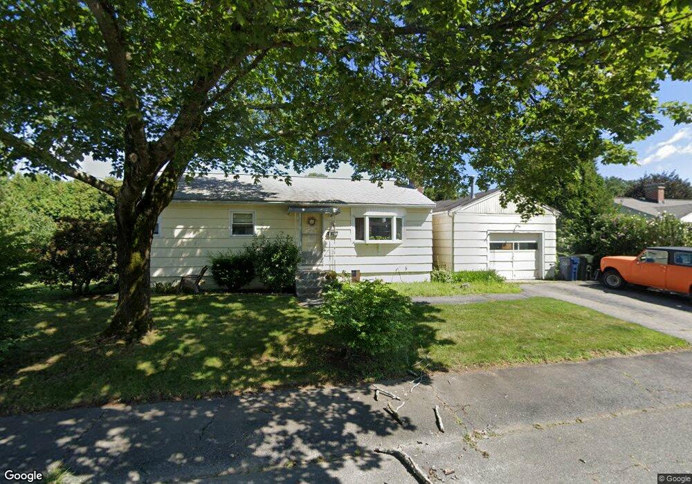
11 Summit Ave Marlborough, MA 01752
Estimated Value: $499,000 - $543,000
3
Beds
1
Bath
912
Sq Ft
$575/Sq Ft
Est. Value
About This Home
This home is located at 11 Summit Ave, Marlborough, MA 01752 and is currently estimated at $524,338, approximately $574 per square foot. 11 Summit Ave is a home located in Middlesex County with nearby schools including Marlborough High School, New Covenant Christian School, and Glenhaven Academy - JRI School.
Ownership History
Date
Name
Owned For
Owner Type
Purchase Details
Closed on
Nov 10, 1995
Sold by
Est Perkins Robert V and Perkins George W
Bought by
Santone Ii Robert B
Current Estimated Value
Home Financials for this Owner
Home Financials are based on the most recent Mortgage that was taken out on this home.
Original Mortgage
$97,500
Interest Rate
7.62%
Mortgage Type
Purchase Money Mortgage
Create a Home Valuation Report for This Property
The Home Valuation Report is an in-depth analysis detailing your home's value as well as a comparison with similar homes in the area
Home Values in the Area
Average Home Value in this Area
Purchase History
| Date | Buyer | Sale Price | Title Company |
|---|---|---|---|
| Santone Ii Robert B | $130,000 | -- |
Source: Public Records
Mortgage History
| Date | Status | Borrower | Loan Amount |
|---|---|---|---|
| Open | Santone Ii Robert B | $90,000 | |
| Closed | Santone Ii Robert B | $97,500 |
Source: Public Records
Tax History Compared to Growth
Tax History
| Year | Tax Paid | Tax Assessment Tax Assessment Total Assessment is a certain percentage of the fair market value that is determined by local assessors to be the total taxable value of land and additions on the property. | Land | Improvement |
|---|---|---|---|---|
| 2025 | $3,901 | $395,600 | $220,600 | $175,000 |
| 2024 | $3,922 | $383,000 | $200,500 | $182,500 |
| 2023 | $4,429 | $383,800 | $169,400 | $214,400 |
| 2022 | $4,351 | $331,600 | $161,400 | $170,200 |
| 2021 | $18,455 | $320,400 | $134,500 | $185,900 |
| 2020 | $4,308 | $308,600 | $128,000 | $180,600 |
| 2019 | $10,188 | $304,800 | $125,500 | $179,300 |
| 2018 | $3,887 | $265,700 | $100,300 | $165,400 |
| 2017 | $3,608 | $235,500 | $99,400 | $136,100 |
| 2016 | $3,459 | $225,500 | $99,400 | $126,100 |
| 2015 | $3,332 | $211,400 | $101,700 | $109,700 |
Source: Public Records
Map
Nearby Homes
- 45 Raffaele Rd
- 38 Airport Blvd
- 114 Lodi Rd
- 323 Robert Rd
- 256 Robert Rd
- 57 Paquin Dr
- 37 Hosmer St Unit 10
- 37 Hosmer St Unit 20
- 211 Stevens St
- 274 Naugler Ave
- 24 Clinton St
- 137 Naugler Ave
- 16 Clinton St
- 164 Stevens St
- 25 Walnut St
- 315 Bolton St
- 492 Stow Rd
- 97 Cook Ln
- 110 Boston Post Rd E Unit 104
- 48 Jewell Rd Unit Lot 6