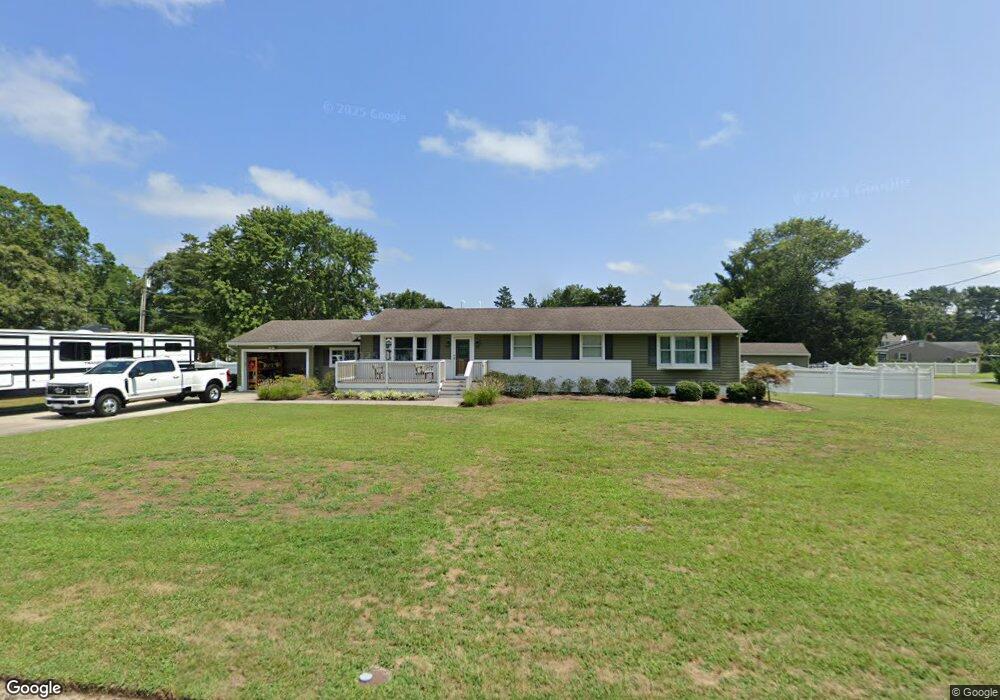
11 W Curran Dr Absecon, NJ 08201
Estimated Value: $411,000 - $460,000
3
Beds
2
Baths
2,081
Sq Ft
$208/Sq Ft
Est. Value
About This Home
This home is located at 11 W Curran Dr, Absecon, NJ 08201 and is currently estimated at $433,665, approximately $208 per square foot. 11 W Curran Dr is a home located in Atlantic County with nearby schools including Emma C. Attales Middle School, Champion Baptist Academy, and Assumption Regional Catholic School.
Ownership History
Date
Name
Owned For
Owner Type
Purchase Details
Closed on
Jun 25, 2009
Sold by
Gorman Mark W and Gorman Brooke
Bought by
Berthold Bryan J
Current Estimated Value
Home Financials for this Owner
Home Financials are based on the most recent Mortgage that was taken out on this home.
Original Mortgage
$245,000
Outstanding Balance
$162,082
Interest Rate
5.58%
Mortgage Type
VA
Estimated Equity
$271,583
Purchase Details
Closed on
Jul 28, 2004
Sold by
Sutton Eleanor
Bought by
Gorman Mark W
Create a Home Valuation Report for This Property
The Home Valuation Report is an in-depth analysis detailing your home's value as well as a comparison with similar homes in the area
Home Values in the Area
Average Home Value in this Area
Purchase History
| Date | Buyer | Sale Price | Title Company |
|---|---|---|---|
| Berthold Bryan J | $245,000 | First American Title Ins Co | |
| Gorman Mark W | $208,000 | The Title Company Of Jersey |
Source: Public Records
Mortgage History
| Date | Status | Borrower | Loan Amount |
|---|---|---|---|
| Open | Berthold Bryan J | $245,000 |
Source: Public Records
Tax History Compared to Growth
Tax History
| Year | Tax Paid | Tax Assessment Tax Assessment Total Assessment is a certain percentage of the fair market value that is determined by local assessors to be the total taxable value of land and additions on the property. | Land | Improvement |
|---|---|---|---|---|
| 2025 | $7,503 | $231,700 | $93,800 | $137,900 |
| 2024 | $7,503 | $231,700 | $93,800 | $137,900 |
| 2023 | $7,410 | $231,700 | $93,800 | $137,900 |
| 2022 | $7,410 | $231,700 | $93,800 | $137,900 |
| 2021 | $7,387 | $231,700 | $93,800 | $137,900 |
| 2020 | $7,401 | $231,700 | $93,800 | $137,900 |
| 2019 | $6,853 | $216,700 | $93,800 | $122,900 |
| 2018 | $6,884 | $216,700 | $93,800 | $122,900 |
| 2017 | $5,142 | $165,000 | $93,800 | $71,200 |
| 2016 | $4,990 | $165,000 | $93,800 | $71,200 |
| 2015 | $4,923 | $165,000 | $93,800 | $71,200 |
| 2014 | $4,852 | $165,000 | $93,800 | $71,200 |
Source: Public Records
Map
Nearby Homes
- 4 E Curran Dr
- 743 N Shore Rd
- 505 Sooy Ln
- 621 S New York Rd
- 625 N Shore Rd
- 613 S New York Rd
- 506 Lazy Ln
- 117 E Wyoming Ave
- 210 Coolidge Ave
- 0 E Dickinson Ave
- 00 California Ave
- 243 Pennsylvania Ave
- 506 E Forestbrook Dr
- 539 E Pennsylvania Ave
- 244 E Wyoming Ave
- 90 E Woodland Ave Unit E90
- 47 E Woodland Ave Unit C47
- 710 E Chip Shot Ln
- 709 E Chip Shot Ln
- 194 N Shore Rd