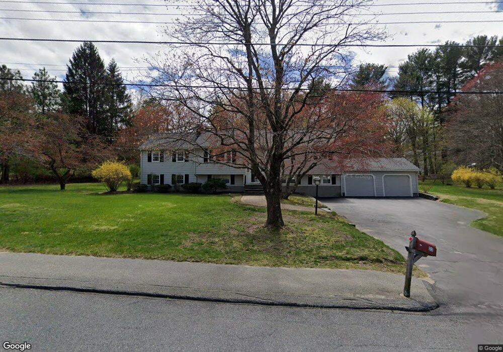
11 Warren Rd Sudbury, MA 01776
Estimated Value: $728,000 - $1,281,000
5
Beds
4
Baths
1,880
Sq Ft
$552/Sq Ft
Est. Value
About This Home
This home is located at 11 Warren Rd, Sudbury, MA 01776 and is currently estimated at $1,038,187, approximately $552 per square foot. 11 Warren Rd is a home located in Middlesex County with nearby schools including Israel Loring Elementary School, Ephraim Curtis Middle School, and Lincoln-Sudbury Regional High School.
Ownership History
Date
Name
Owned For
Owner Type
Purchase Details
Closed on
Jan 24, 2020
Sold by
Jencyowski Albert M and Falls Loraine M
Bought by
Jencyowski & Falls Rt 2019
Current Estimated Value
Purchase Details
Closed on
Aug 24, 1998
Sold by
Kutz Nt and Kutz Dale L
Bought by
Jencyowski Albert M and Falls Loraine M
Home Financials for this Owner
Home Financials are based on the most recent Mortgage that was taken out on this home.
Original Mortgage
$227,150
Interest Rate
6.86%
Mortgage Type
Purchase Money Mortgage
Create a Home Valuation Report for This Property
The Home Valuation Report is an in-depth analysis detailing your home's value as well as a comparison with similar homes in the area
Home Values in the Area
Average Home Value in this Area
Purchase History
| Date | Buyer | Sale Price | Title Company |
|---|---|---|---|
| Jencyowski & Falls Rt 2019 | -- | None Available | |
| Jencyowski-Falls Rt 2019 | -- | None Available | |
| Jencyowski Albert M | $383,000 | -- | |
| Jencyowski Albert M | $383,000 | -- |
Source: Public Records
Mortgage History
| Date | Status | Borrower | Loan Amount |
|---|---|---|---|
| Previous Owner | Jencyowski Albert M | $227,150 | |
| Previous Owner | Jencyowski Albert M | $100,000 | |
| Closed | Jencyowski Albert M | $25,000 |
Source: Public Records
Tax History Compared to Growth
Tax History
| Year | Tax Paid | Tax Assessment Tax Assessment Total Assessment is a certain percentage of the fair market value that is determined by local assessors to be the total taxable value of land and additions on the property. | Land | Improvement |
|---|---|---|---|---|
| 2025 | $13,009 | $888,600 | $439,000 | $449,600 |
| 2024 | $12,589 | $861,700 | $426,200 | $435,500 |
| 2023 | $12,431 | $788,300 | $394,600 | $393,700 |
| 2022 | $11,460 | $634,900 | $362,200 | $272,700 |
| 2021 | $11,223 | $596,000 | $362,200 | $233,800 |
| 2020 | $10,996 | $596,000 | $362,200 | $233,800 |
| 2019 | $10,674 | $596,000 | $362,200 | $233,800 |
| 2018 | $10,381 | $579,000 | $386,200 | $192,800 |
| 2017 | $9,720 | $547,900 | $367,400 | $180,500 |
| 2016 | $9,233 | $518,700 | $353,400 | $165,300 |
| 2015 | $8,895 | $505,400 | $339,800 | $165,600 |
| 2014 | $8,891 | $493,100 | $329,800 | $163,300 |
Source: Public Records
Map
Nearby Homes
- 84 Hopestill Brown Rd
- 0 Wagonwheel Rd
- 63 Landham Rd
- 216 Landham Rd
- 14 Eisenhower Rd
- 91 Eaton Rd W
- 19 Nob Hill Dr
- 32 Eaton Rd W
- 27 Sloane Dr
- 30 Edith Rd
- 128 Nobscot Rd
- 1011 Boston Post Rd
- 23 Massasoit Ave
- 30 Nobscot Rd Unit 14
- 36 Concord Rd
- 14 Francine Rd
- 8 Clara Rd
- 53 Davidson Rd
- 40 Gregory Rd
- 41 James St