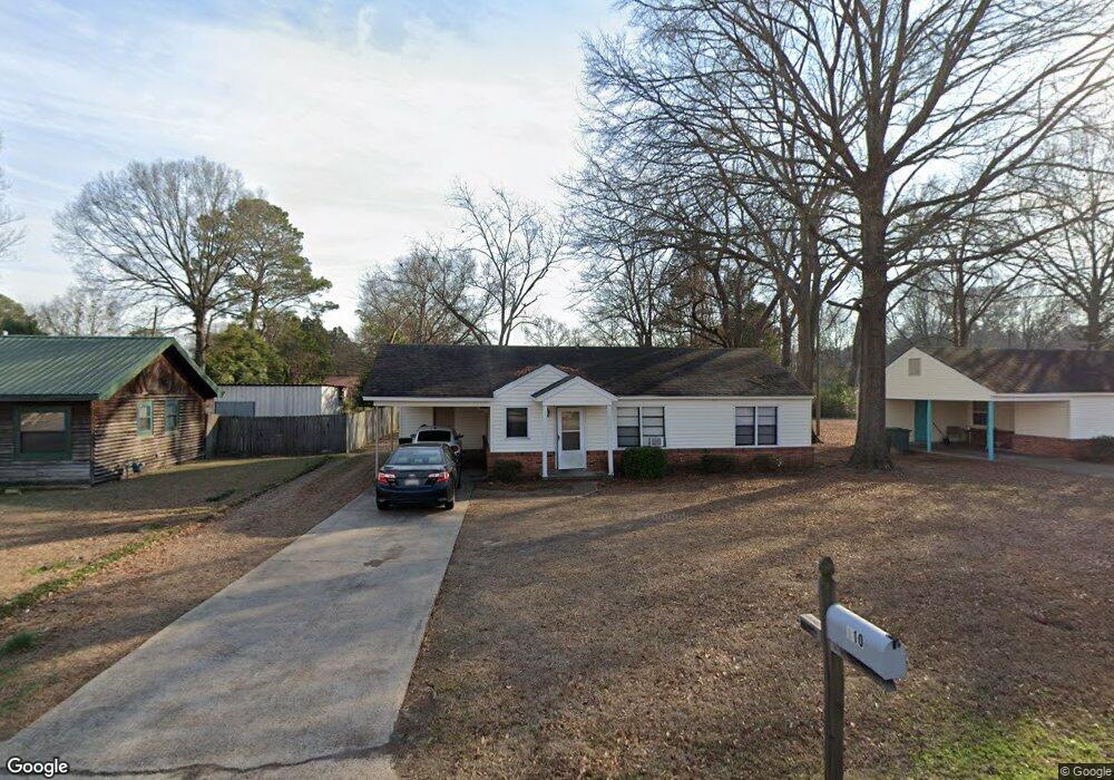
110 Airline Rd Columbus, MS 39702
Estimated Value: $77,000 - $101,849
Studio
--
Bath
1,315
Sq Ft
$66/Sq Ft
Est. Value
About This Home
This home is located at 110 Airline Rd, Columbus, MS 39702 and is currently estimated at $86,462, approximately $65 per square foot. 110 Airline Rd is a home with nearby schools including Columbus Middle School, Columbus High School, and Annunciation Catholic School.
Ownership History
Date
Name
Owned For
Owner Type
Purchase Details
Closed on
Jul 22, 2022
Sold by
Jb & B Investments Llc
Bought by
Fisher Real Estate Llc
Current Estimated Value
Home Financials for this Owner
Home Financials are based on the most recent Mortgage that was taken out on this home.
Original Mortgage
$52,000
Outstanding Balance
$47,072
Interest Rate
5.81%
Mortgage Type
New Conventional
Estimated Equity
$39,390
Purchase Details
Closed on
Oct 18, 2019
Sold by
Bell George W and Bell Inez D
Bought by
Jb & B Unvestments Llc
Home Financials for this Owner
Home Financials are based on the most recent Mortgage that was taken out on this home.
Original Mortgage
$1
Interest Rate
3.7%
Mortgage Type
Stand Alone Refi Refinance Of Original Loan
Purchase Details
Closed on
Oct 24, 2006
Sold by
Davis Dwayne
Bought by
Bell George W and Bell Inze D
Create a Home Valuation Report for This Property
The Home Valuation Report is an in-depth analysis detailing your home's value as well as a comparison with similar homes in the area
Purchase History
| Date | Buyer | Sale Price | Title Company |
|---|---|---|---|
| Fisher Real Estate Llc | -- | None Listed On Document | |
| Jb & B Unvestments Llc | -- | -- | |
| Bell George W | -- | -- |
Source: Public Records
Mortgage History
| Date | Status | Borrower | Loan Amount |
|---|---|---|---|
| Open | Fisher Real Estate Llc | $52,000 | |
| Previous Owner | Jb & B Unvestments Llc | $1 |
Source: Public Records
Tax History
| Year | Tax Paid | Tax Assessment Tax Assessment Total Assessment is a certain percentage of the fair market value that is determined by local assessors to be the total taxable value of land and additions on the property. | Land | Improvement |
|---|---|---|---|---|
| 2025 | $976 | $5,975 | $0 | $0 |
| 2024 | $964 | $5,975 | $0 | $0 |
| 2023 | $1,019 | $6,231 | $0 | $0 |
| 2022 | $1,024 | $6,231 | $0 | $0 |
| 2021 | $985 | $6,231 | $0 | $0 |
| 2020 | $962 | $6,231 | $0 | $0 |
| 2019 | $952 | $6,219 | $0 | $0 |
| 2018 | $952 | $6,287 | $0 | $0 |
| 2017 | $0 | $6,287 | $0 | $0 |
| 2016 | $899 | $6,287 | $0 | $0 |
| 2015 | -- | $6,384 | $0 | $0 |
| 2014 | -- | $6,335 | $0 | $0 |
Source: Public Records
Map
Nearby Homes
- 215 Robinwood Cir
- 201 Mccrary Dr
- 307 Vance St
- 0 Highway 182 E
- 225 Maple St
- 279 Pandora Dr
- 612 Sycamore St
- 405 Springdale Dr
- 111 Florence St
- 320 Florence St
- 630 22nd St S
- 112 Gaylane Dr
- 729 Cypress St
- 924 Waterworks Rd
- 232 Sylvan Rd
- 228 Sylvan Rd
- 230 Sylvan Rd
- 226 Sylvan Rd
- 320 Curtis Rd
- 302 19th St S
- 112 Airline Rd
- 108 Airline Rd
- 114 Airline Rd
- 106 Airline Rd
- 104 Airline Rd
- 116 Airline Rd
- 201 Robinwood Cir
- 205 Robinwood Cir
- 207 Robinwood Cir
- 125 Robinwood Cir
- 118 Airline Rd
- 405 Idlewild Rd
- 211 Robinwood Cir
- 102 Airline Rd
- 403 Idlewild Rd
- 121 Robinwood Cir
- 120 Airline Rd
- 120 Robinwood Cir
- 208 Robinwood Cir
- 407 Idlewild Rd
Your Personal Tour Guide
Ask me questions while you tour the home.