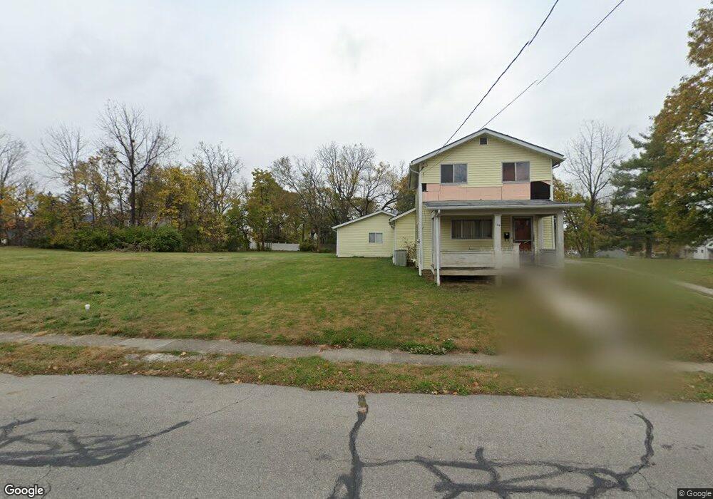
110 Bernard Ave Delaware, OH 43015
Estimated Value: $48,000 - $234,000
2
Beds
1
Bath
728
Sq Ft
$194/Sq Ft
Est. Value
About This Home
This home is located at 110 Bernard Ave, Delaware, OH 43015 and is currently estimated at $141,000, approximately $193 per square foot. 110 Bernard Ave is a home located in Delaware County with nearby schools including Laura Woodward Elementary School, John C. Dempsey Middle School, and Rutherford B. Hayes High School.
Ownership History
Date
Name
Owned For
Owner Type
Purchase Details
Closed on
Jun 27, 2008
Sold by
Thompson Mary L
Bought by
Whiteside Holdings
Current Estimated Value
Home Financials for this Owner
Home Financials are based on the most recent Mortgage that was taken out on this home.
Original Mortgage
$86,400
Outstanding Balance
$19,374
Interest Rate
6.05%
Mortgage Type
Purchase Money Mortgage
Estimated Equity
$121,626
Create a Home Valuation Report for This Property
The Home Valuation Report is an in-depth analysis detailing your home's value as well as a comparison with similar homes in the area
Home Values in the Area
Average Home Value in this Area
Purchase History
| Date | Buyer | Sale Price | Title Company |
|---|---|---|---|
| Whiteside Holdings | $108,000 | None Available |
Source: Public Records
Mortgage History
| Date | Status | Borrower | Loan Amount |
|---|---|---|---|
| Open | Whiteside Holdings | $86,400 |
Source: Public Records
Tax History
| Year | Tax Paid | Tax Assessment Tax Assessment Total Assessment is a certain percentage of the fair market value that is determined by local assessors to be the total taxable value of land and additions on the property. | Land | Improvement |
|---|---|---|---|---|
| 2024 | $469 | $9,700 | $9,700 | -- |
| 2023 | $470 | $9,700 | $9,700 | $0 |
| 2022 | $452 | $8,090 | $8,090 | $0 |
| 2021 | $461 | $8,090 | $8,090 | $0 |
Source: Public Records
Map
Nearby Homes
- 168 London Rd
- 103 Oak Hill Ave
- 63 Allenhurst Way
- 71 Allenhurst Way
- 73 Allenhurst Way
- 54 Allenhurst Way
- 53 Neil St
- 65 Neil St
- 63 Coldstone Ct
- 52 Aldersgate Dr
- 70 Aldersgate Dr
- 297 W William St
- 0 S Sandusky St Unit 224007383
- 351 W William St
- 27 Woodland Ave
- 3035 Brian Way
- 3173 Brian Way
- 3058 Brian Way
- 102 W Lincoln Ave
- 90 Richards Dr
- 104 Bernard Ave
- 86 Bernard Ave
- 137 S Liberty St
- 137 S Liberty St
- 145 S Liberty St
- 135 S Liberty St
- 146 S Washington St
- 0 S Liberty St
- 125 S Liberty St
- 709 S Liberty St
- 2106 S Liberty St
- 103 Bernard Ave
- 105 Park Ave
- 97 Park Ave
- 111 Park Ave
- 00 S Liberty St
- 117 S Liberty St
- 91 Park Ave
- 91 Park Ave Unit 3
- 117 Park Ave