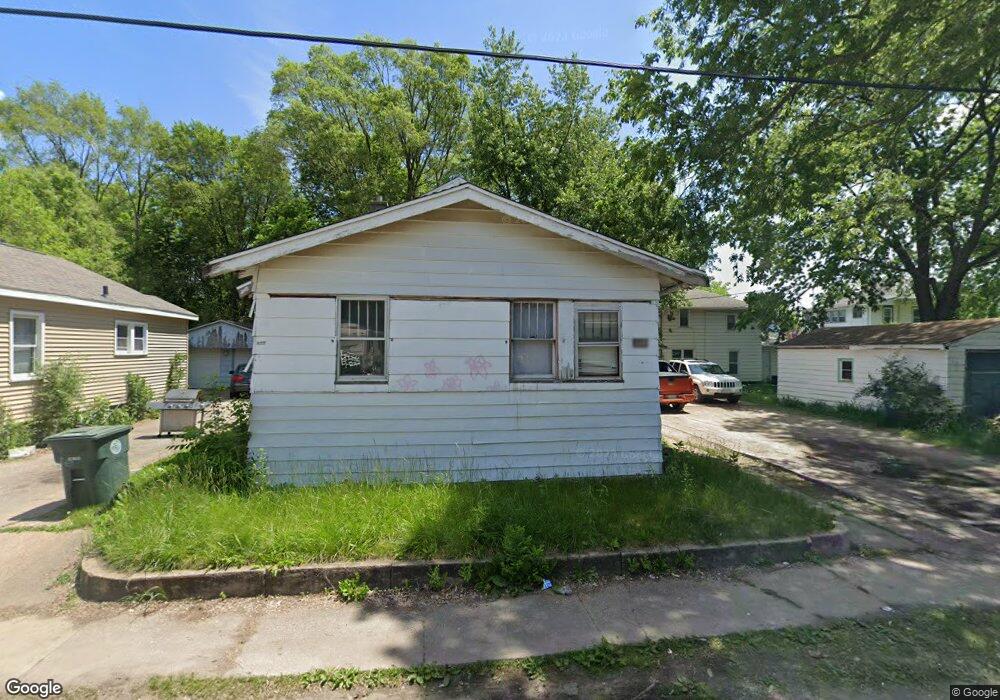
110 Block St Waterloo, IA 50703
Neighbors for Life NeighborhoodEstimated Value: $48,000 - $59,000
2
Beds
1
Bath
821
Sq Ft
$66/Sq Ft
Est. Value
About This Home
This home is located at 110 Block St, Waterloo, IA 50703 and is currently estimated at $54,333, approximately $66 per square foot. 110 Block St is a home located in Black Hawk County with nearby schools including Highland Elementary School, George Washington Carver Academy, and East High School.
Ownership History
Date
Name
Owned For
Owner Type
Purchase Details
Closed on
Dec 29, 2023
Sold by
Boland Properties Llc
Bought by
Fji-Ii-Ss Holdings Llc
Current Estimated Value
Purchase Details
Closed on
Jul 29, 2022
Sold by
Kaough Jacqueline F and Kaough Richard T
Bought by
Boland Properties Llc
Purchase Details
Closed on
Nov 1, 2020
Sold by
Kaough Richard T and Kaough Jacqueline M
Bought by
Boland Properties Llc
Home Financials for this Owner
Home Financials are based on the most recent Mortgage that was taken out on this home.
Original Mortgage
$23,000
Interest Rate
2.8%
Mortgage Type
New Conventional
Create a Home Valuation Report for This Property
The Home Valuation Report is an in-depth analysis detailing your home's value as well as a comparison with similar homes in the area
Home Values in the Area
Average Home Value in this Area
Purchase History
| Date | Buyer | Sale Price | Title Company |
|---|---|---|---|
| Fji-Ii-Ss Holdings Llc | $400,000 | None Listed On Document | |
| Boland Properties Llc | -- | None Listed On Document | |
| Boland Properties Llc | -- | None Listed On Document | |
| Boland Properties Llc | $23,500 | None Listed On Document | |
| Boland Properties Llc | $23,500 | None Listed On Document | |
| Boland Properties Llc | $23,000 | None Available |
Source: Public Records
Mortgage History
| Date | Status | Borrower | Loan Amount |
|---|---|---|---|
| Previous Owner | Boland Properties Llc | $23,000 |
Source: Public Records
Tax History
| Year | Tax Paid | Tax Assessment Tax Assessment Total Assessment is a certain percentage of the fair market value that is determined by local assessors to be the total taxable value of land and additions on the property. | Land | Improvement |
|---|---|---|---|---|
| 2025 | $744 | $38,660 | $6,200 | $32,460 |
| 2024 | $744 | $34,340 | $6,200 | $28,140 |
| 2023 | $648 | $34,340 | $6,200 | $28,140 |
| 2022 | $648 | $29,530 | $6,200 | $23,330 |
| 2021 | $616 | $29,530 | $6,200 | $23,330 |
| 2020 | $636 | $28,500 | $3,870 | $24,630 |
| 2019 | $636 | $28,500 | $3,870 | $24,630 |
| 2018 | $709 | $28,500 | $3,870 | $24,630 |
| 2017 | $654 | $28,500 | $3,870 | $24,630 |
| 2016 | $646 | $28,500 | $3,870 | $24,630 |
| 2015 | $646 | $28,500 | $3,870 | $24,630 |
| 2014 | $612 | $26,450 | $3,870 | $22,580 |
Source: Public Records
Map
Nearby Homes
- 1912 Sycamore St
- 822 Colorado St
- 520 Linden Ave
- 1612 Franklin St
- 1421 Mulberry St
- 0 Monroe St Unit Parcel 891230129032
- 0 Monroe St Unit Parcel 891230129033
- 0 Madison St Unit Parcel 891230129029
- 0 Madison St Unit Parcel 891230129030
- 0 Madison St Unit Parcel 891230129028
- 211 Madison St
- 215 Lamont St
- 1127 Independence Ave
- 1235 Independence Ave
- 406-408 Gladys St
- 861 Grindstone Cir
- 0 Irving St
- 47 Zuma St
- 911 Lafayette St Unit 913
- 1437 Vine St
Your Personal Tour Guide
Ask me questions while you tour the home.