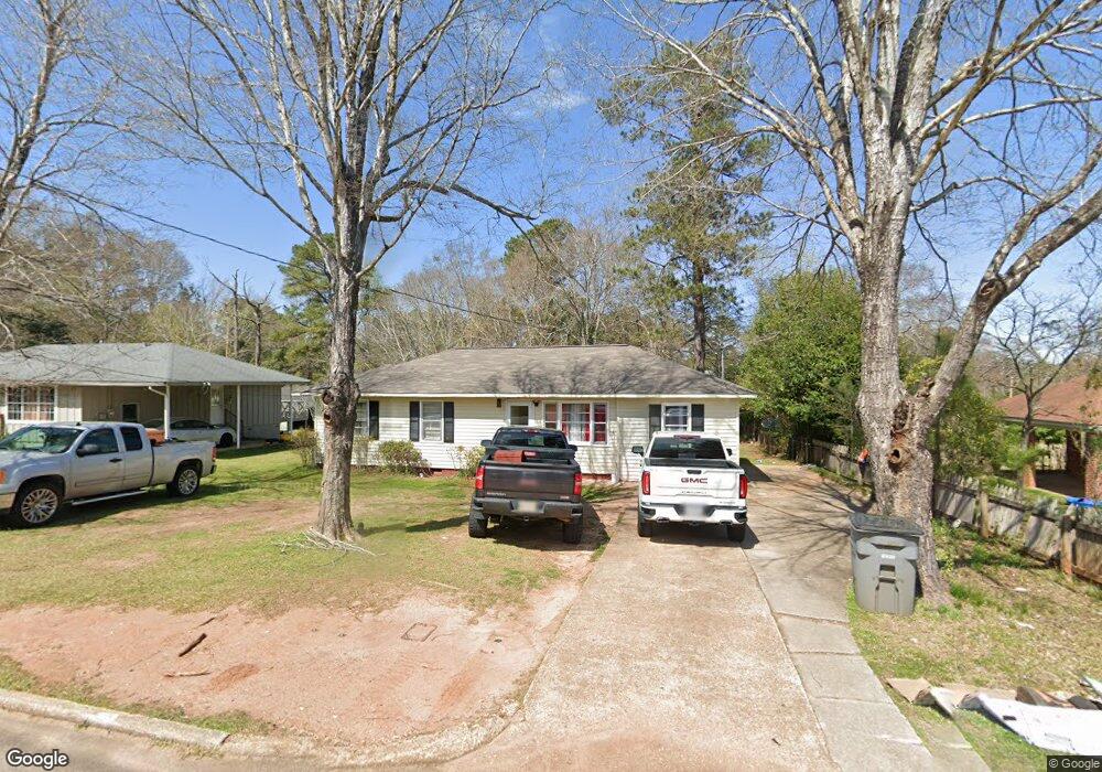
110 Bonaventure Dr Lagrange, GA 30241
Estimated Value: $120,000 - $170,000
3
Beds
1
Bath
1,152
Sq Ft
$123/Sq Ft
Est. Value
About This Home
This home is located at 110 Bonaventure Dr, Lagrange, GA 30241 and is currently estimated at $141,364, approximately $122 per square foot. 110 Bonaventure Dr is a home located in Troup County with nearby schools including Franklin Forest Elementary School, Hollis Hand Elementary School, and Ethel W. Kight Elementary School.
Ownership History
Date
Name
Owned For
Owner Type
Purchase Details
Closed on
Jul 29, 2011
Sold by
Bennett Kay F
Bought by
Kinney Brant David
Current Estimated Value
Home Financials for this Owner
Home Financials are based on the most recent Mortgage that was taken out on this home.
Original Mortgage
$44,000
Interest Rate
4.53%
Mortgage Type
New Conventional
Purchase Details
Closed on
Jun 7, 2001
Sold by
Kay Sue F and Kay Bennett
Bought by
Ford Henry and Kay Bennett
Purchase Details
Closed on
Apr 21, 1994
Sold by
Henry C Ford
Bought by
Kay Sue F and Kay Bennett
Purchase Details
Closed on
Apr 2, 1983
Sold by
Ford Henry C and Ford Sara H
Bought by
Henry C Ford
Purchase Details
Closed on
Apr 1, 1983
Sold by
Ford Henry C Jr Int
Bought by
Ford Henry C and Ford Sara H
Purchase Details
Closed on
Sep 1, 1960
Sold by
Jenkins Donald R
Bought by
Ford Henry C Jr Int
Create a Home Valuation Report for This Property
The Home Valuation Report is an in-depth analysis detailing your home's value as well as a comparison with similar homes in the area
Purchase History
| Date | Buyer | Sale Price | Title Company |
|---|---|---|---|
| Kinney Brant David | $55,000 | -- | |
| Ford Henry | -- | -- | |
| Kay Sue F | -- | -- | |
| Henry C Ford | -- | -- | |
| Ford Henry C | -- | -- | |
| Ford Henry C Jr Int | -- | -- |
Source: Public Records
Mortgage History
| Date | Status | Borrower | Loan Amount |
|---|---|---|---|
| Closed | Kinney Brant David | $44,000 |
Source: Public Records
Tax History
| Year | Tax Paid | Tax Assessment Tax Assessment Total Assessment is a certain percentage of the fair market value that is determined by local assessors to be the total taxable value of land and additions on the property. | Land | Improvement |
|---|---|---|---|---|
| 2025 | $1,020 | $38,880 | $8,000 | $30,880 |
| 2024 | $1,020 | $37,400 | $8,000 | $29,400 |
| 2023 | $1,054 | $38,640 | $7,400 | $31,240 |
| 2022 | $1,010 | $36,200 | $7,400 | $28,800 |
| 2021 | $797 | $26,440 | $7,400 | $19,040 |
| 2020 | $797 | $26,440 | $7,400 | $19,040 |
| 2019 | $644 | $21,360 | $6,640 | $14,720 |
| 2018 | $634 | $21,020 | $6,300 | $14,720 |
| 2017 | $634 | $21,020 | $6,300 | $14,720 |
| 2016 | $620 | $20,550 | $6,300 | $14,250 |
| 2015 | $632 | $20,928 | $6,678 | $14,250 |
| 2014 | $611 | $20,178 | $6,678 | $13,500 |
| 2013 | -- | $21,407 | $6,678 | $14,729 |
Source: Public Records
Map
Nearby Homes
- 212 Cleveland Dr
- 130 Clara Jean Ct
- 204 Cleveland Dr
- 210 Hearthstone Dr
- 110 Lenox Cir
- 121 Ct
- 305 Lenox Cir
- 107 N Barnard Ave
- 0 N Barnard Ave
- 5 Curran Ave
- 104 Sheila St
- 101 Sarah Ln
- 227 River Meadow Dr Unit H14
- 227 River Meadow Dr
- 412 Sweetwood Ct Unit A36
- 618 S Harlem Cir
- 616 S Harlem Cir
- 304 Bridgette Blvd
- 706 N Harlem Cir
- 608 S Harlem Cir
- 112 Bonaventure Dr
- 106 Bonaventure Dr
- 114 Bonaventure Dr
- 104 Bonaventure Dr
- 109 Bonaventure Dr
- 116 Bonaventure Dr
- 107 Bonaventure Dr
- 111 Bonaventure Dr
- 113 Bonaventure Dr
- 103 Bonaventure Dr
- 179 Youngs Mill Rd
- 183 Youngs Mill Rd
- 115 Bonaventure Dr
- 120 Bonaventure Dr
- 171 Youngs Mill Rd
- 117 Bonaventure Dr
- 261 Rutland Cir
- 157 Youngs Mill Rd
- 259 Rutland Cir
- 257 Rutland Cir