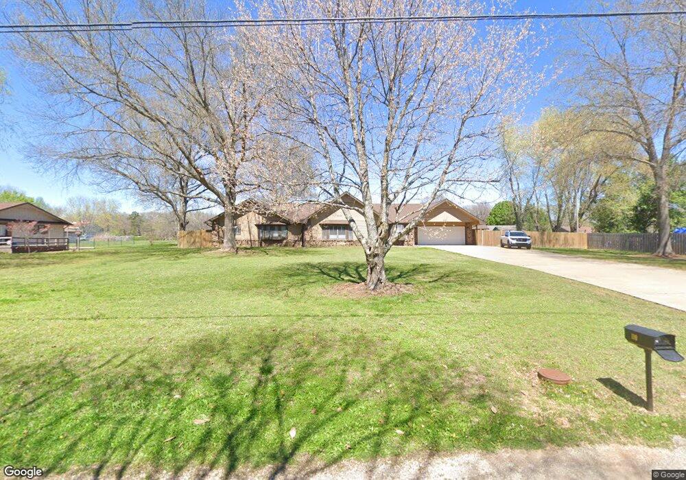
110 Cardin Rd Pea Ridge, AR 72751
Estimated Value: $474,000 - $633,000
3
Beds
3
Baths
2,587
Sq Ft
$203/Sq Ft
Est. Value
About This Home
This home is located at 110 Cardin Rd, Pea Ridge, AR 72751 and is currently estimated at $525,282, approximately $203 per square foot. 110 Cardin Rd is a home located in Benton County with nearby schools including Pea Ridge Intermediate School, Pea Ridge Primary School, and Pea Ridge Middle School.
Ownership History
Date
Name
Owned For
Owner Type
Purchase Details
Closed on
Mar 25, 2022
Sold by
Lane Anthony D
Bought by
Dezalia Family Trust and Dezalia
Current Estimated Value
Purchase Details
Closed on
Dec 11, 2010
Sold by
Blackwell Floyd A and Blackwell Nancy A
Bought by
Lane Anthony D
Home Financials for this Owner
Home Financials are based on the most recent Mortgage that was taken out on this home.
Original Mortgage
$189,082
Interest Rate
4.25%
Mortgage Type
FHA
Purchase Details
Closed on
Apr 15, 2010
Sold by
Blackwell Floyd A and Blackwell Nancy A
Bought by
Blackwell Floyd A
Purchase Details
Closed on
Jun 21, 1988
Bought by
Blackwell
Purchase Details
Closed on
May 8, 1987
Bought by
Blackwell
Purchase Details
Closed on
Feb 28, 1980
Bought by
Odle
Create a Home Valuation Report for This Property
The Home Valuation Report is an in-depth analysis detailing your home's value as well as a comparison with similar homes in the area
Home Values in the Area
Average Home Value in this Area
Purchase History
| Date | Buyer | Sale Price | Title Company |
|---|---|---|---|
| Dezalia Family Trust | $420,000 | Waco Title | |
| Lane Anthony D | $194,000 | None Available | |
| Blackwell Floyd A | -- | None Available | |
| Blackwell | -- | -- | |
| Blackwell | $10,000 | -- | |
| Odle | $5,000 | -- |
Source: Public Records
Mortgage History
| Date | Status | Borrower | Loan Amount |
|---|---|---|---|
| Previous Owner | Lane Anthony D | $189,082 |
Source: Public Records
Tax History Compared to Growth
Tax History
| Year | Tax Paid | Tax Assessment Tax Assessment Total Assessment is a certain percentage of the fair market value that is determined by local assessors to be the total taxable value of land and additions on the property. | Land | Improvement |
|---|---|---|---|---|
| 2025 | $3,151 | $76,869 | $10,000 | $66,869 |
| 2024 | $3,232 | $76,869 | $10,000 | $66,869 |
| 2023 | $3,232 | $56,800 | $3,800 | $53,000 |
| 2022 | $2,299 | $56,800 | $3,800 | $53,000 |
| 2021 | $2,153 | $56,800 | $3,800 | $53,000 |
| 2020 | $2,112 | $41,340 | $1,500 | $39,840 |
| 2019 | $2,013 | $41,340 | $1,500 | $39,840 |
| 2018 | $1,938 | $41,340 | $1,500 | $39,840 |
| 2017 | $1,605 | $41,340 | $1,500 | $39,840 |
| 2016 | $1,605 | $41,340 | $1,500 | $39,840 |
| 2015 | $1,861 | $32,710 | $3,200 | $29,510 |
| 2014 | $1,511 | $32,710 | $3,200 | $29,510 |
Source: Public Records
Map
Nearby Homes
- TBD Pace Ln
- 1616 S Curtis Ave
- 1272 Pace Ln
- 1330 S Curtis Ave
- 1660 Conrad St
- 1172 Nemett Dr
- 542 Oneida Cir
- 1306 Shepherd St
- 738 Cardin Spur
- 561 Oneida Cir
- 560 Forrest Dr
- 575 Sugar Creek Rd
- 499 S Davis St
- 0 S Davis St
- 21.4 AC Sugar Creek Rd
- 21 AC Sugar Creek Rd
- 215 Hunt St
- 0 Sugar Creek Rd
- 214 Hunt St
- 5AC Captain Miller Blvd