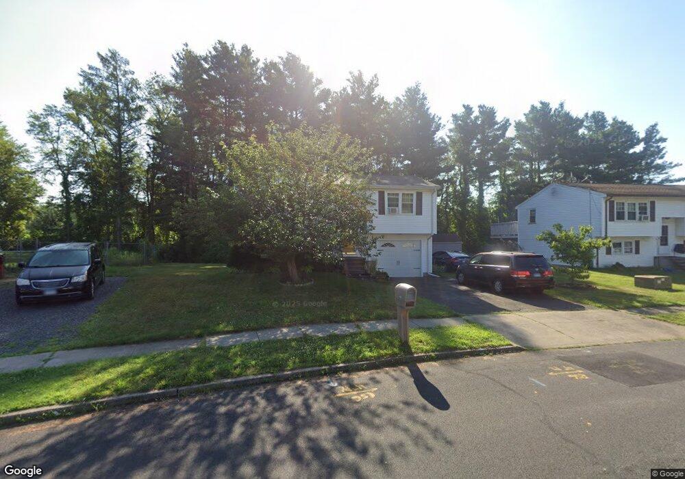
110 Cartpath Dr Meriden, CT 06450
Estimated Value: $342,000 - $390,000
3
Beds
2
Baths
1,244
Sq Ft
$290/Sq Ft
Est. Value
About This Home
This home is located at 110 Cartpath Dr, Meriden, CT 06450 and is currently estimated at $361,350, approximately $290 per square foot. 110 Cartpath Dr is a home located in New Haven County with nearby schools including Thomas Hooker School, Washington Middle School, and Francis T. Maloney High School.
Ownership History
Date
Name
Owned For
Owner Type
Purchase Details
Closed on
Nov 10, 1997
Sold by
Neri Margaret
Bought by
Tran Tuan Q
Current Estimated Value
Home Financials for this Owner
Home Financials are based on the most recent Mortgage that was taken out on this home.
Original Mortgage
$60,000
Interest Rate
7.19%
Mortgage Type
Unknown
Purchase Details
Closed on
Feb 22, 1990
Sold by
Satagaj Michael T
Bought by
Neri Joseph R
Purchase Details
Closed on
Jun 14, 1988
Sold by
Depaulo William D
Bought by
Satagaj Michael T
Home Financials for this Owner
Home Financials are based on the most recent Mortgage that was taken out on this home.
Original Mortgage
$126,000
Interest Rate
10.21%
Purchase Details
Closed on
Apr 20, 1987
Sold by
Barresi Joseph C
Bought by
Depaulo William D
Home Financials for this Owner
Home Financials are based on the most recent Mortgage that was taken out on this home.
Original Mortgage
$86,900
Interest Rate
8.97%
Create a Home Valuation Report for This Property
The Home Valuation Report is an in-depth analysis detailing your home's value as well as a comparison with similar homes in the area
Home Values in the Area
Average Home Value in this Area
Purchase History
| Date | Buyer | Sale Price | Title Company |
|---|---|---|---|
| Tran Tuan Q | $95,000 | -- | |
| Neri Joseph R | $5,000 | -- | |
| Satagaj Michael T | $140,000 | -- | |
| Depaulo William D | $136,900 | -- |
Source: Public Records
Mortgage History
| Date | Status | Borrower | Loan Amount |
|---|---|---|---|
| Closed | Depaulo William D | $60,000 | |
| Previous Owner | Depaulo William D | $126,000 | |
| Previous Owner | Depaulo William D | $86,900 |
Source: Public Records
Tax History
| Year | Tax Paid | Tax Assessment Tax Assessment Total Assessment is a certain percentage of the fair market value that is determined by local assessors to be the total taxable value of land and additions on the property. | Land | Improvement |
|---|---|---|---|---|
| 2025 | $6,086 | $151,760 | $63,490 | $88,270 |
| 2024 | $5,510 | $151,760 | $63,490 | $88,270 |
| 2023 | $5,280 | $151,760 | $63,490 | $88,270 |
| 2022 | $5,007 | $151,760 | $63,490 | $88,270 |
| 2021 | $4,811 | $117,740 | $50,190 | $67,550 |
| 2020 | $4,811 | $117,740 | $50,190 | $67,550 |
| 2019 | $4,811 | $117,740 | $50,190 | $67,550 |
| 2018 | $4,832 | $117,740 | $50,190 | $67,550 |
| 2017 | $4,700 | $117,740 | $50,190 | $67,550 |
| 2016 | $4,585 | $125,160 | $52,850 | $72,310 |
| 2015 | $4,585 | $125,160 | $52,850 | $72,310 |
| 2014 | $4,473 | $125,160 | $52,850 | $72,310 |
Source: Public Records
Map
Nearby Homes
- 291 Cartpath Dr
- 93 Overlook Rd
- 131 Oxbow Dr
- 190 Elmwood Dr
- 78 Kennedy Dr
- 29 Schwink Dr
- 774 Murdock Ave
- 198 Mildred Rd
- 67 Royal Oak Cir
- 1280 E Main St
- 1274 E Main St Unit D27
- 160 Bee St
- 55 Meetinghouse Village Unit 2
- 170 Bee St
- 180 Bee St
- 65 Brooklawn Dr
- 61 Meetinghouse Village Unit 5
- 108 Wayne Ln
- 129 Valley View Dr
- 80 Dryden Dr
Your Personal Tour Guide
Ask me questions while you tour the home.