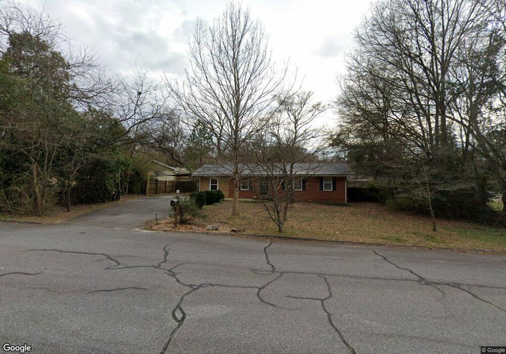
110 Clarke Dr Athens, GA 30605
Estimated Value: $271,000 - $289,000
3
Beds
2
Baths
1,378
Sq Ft
$204/Sq Ft
Est. Value
About This Home
This home is located at 110 Clarke Dr, Athens, GA 30605 and is currently estimated at $281,723, approximately $204 per square foot. 110 Clarke Dr is a home located in Clarke County with nearby schools including Barnett Shoals Elementary School, Hilsman Middle School, and Cedar Shoals High School.
Ownership History
Date
Name
Owned For
Owner Type
Purchase Details
Closed on
May 22, 2006
Sold by
Not Provided
Bought by
Sitler Heather M and Sitler David C Forker
Current Estimated Value
Home Financials for this Owner
Home Financials are based on the most recent Mortgage that was taken out on this home.
Original Mortgage
$103,000
Outstanding Balance
$59,463
Interest Rate
6.44%
Mortgage Type
New Conventional
Estimated Equity
$222,260
Purchase Details
Closed on
Feb 1, 1999
Sold by
Hendrix Frances C Mrs
Bought by
Hendrix Luther Andrew
Create a Home Valuation Report for This Property
The Home Valuation Report is an in-depth analysis detailing your home's value as well as a comparison with similar homes in the area
Home Values in the Area
Average Home Value in this Area
Purchase History
| Date | Buyer | Sale Price | Title Company |
|---|---|---|---|
| Sitler Heather M | $103,000 | -- | |
| Hendrix Luther Andrew | -- | -- |
Source: Public Records
Mortgage History
| Date | Status | Borrower | Loan Amount |
|---|---|---|---|
| Open | Sitler Heather M | $103,000 |
Source: Public Records
Tax History Compared to Growth
Tax History
| Year | Tax Paid | Tax Assessment Tax Assessment Total Assessment is a certain percentage of the fair market value that is determined by local assessors to be the total taxable value of land and additions on the property. | Land | Improvement |
|---|---|---|---|---|
| 2025 | $3,215 | $103,536 | $12,000 | $91,536 |
| 2024 | $3,215 | $97,481 | $12,000 | $85,481 |
| 2023 | $3,046 | $90,982 | $12,000 | $78,982 |
| 2022 | $2,344 | $73,472 | $10,400 | $63,072 |
| 2021 | $1,950 | $57,860 | $10,400 | $47,460 |
| 2020 | $1,862 | $55,256 | $10,400 | $44,856 |
| 2019 | $1,796 | $52,913 | $10,400 | $42,513 |
| 2018 | $1,608 | $47,357 | $10,400 | $36,957 |
| 2017 | $1,360 | $40,057 | $10,400 | $29,657 |
| 2016 | $1,275 | $37,568 | $10,400 | $27,168 |
| 2015 | $1,331 | $39,154 | $10,400 | $28,754 |
| 2014 | $1,005 | $39,501 | $10,400 | $29,101 |
Source: Public Records
Map
Nearby Homes
- 211 Stonecrest Ct
- 135 Wakefield Dr
- 171 Birch Valley Dr
- 140 Whitehall Rd
- 157 Wakefield Trace
- 148 Warren Way
- 170 Brookwood Dr
- 430 Forest Rd
- 119 Pine Ridge Trace
- 400 Ansley Dr
- 0 Barnett Shoals Rd Unit Lot 2
- 0 Barnett Shoals Rd Unit Lot 1
- 352 Greencrest Dr
- 354 Greencrest Dr
- 150 Greenwood Ln
- 325 Segrest Cir
- 310 Rumson Rd
- 2595 Barnett Shoals Rd
- 320 Rumson Rd
- 2655 Barnett Shoals Rd
- 330 Rumson Rd
- 2685 Barnett Shoals Rd
- 115 Clarke Dr
- 295 Rumson Rd
- 2575 Barnett Shoals Rd
- 2575 Barnett Shoals Rd Unit 7
- 200 Clarke Dr
- 325 Rumson Rd
- 2735 Barnett Shoals Rd
- 105 Brentwood Dr
- 285 Rumson Rd
- 2545 Barnett Shoals Rd
- 215 Clarke Dr
- 210 Clarke Dr
- 125 Brentwood Dr
- 2765 Barnett Shoals Rd