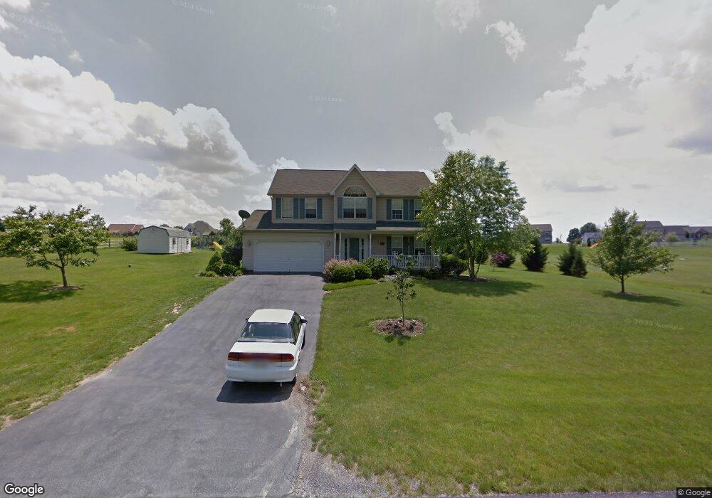
110 E Summit Dr Unit 53 Littlestown, PA 17340
Estimated Value: $456,996 - $540,000
4
Beds
3
Baths
2,204
Sq Ft
$232/Sq Ft
Est. Value
About This Home
This home is located at 110 E Summit Dr Unit 53, Littlestown, PA 17340 and is currently estimated at $511,499, approximately $232 per square foot. 110 E Summit Dr Unit 53 is a home located in Adams County with nearby schools including Rolling Acres El School, Maple Avenue Middle School, and Littlestown Senior High School.
Ownership History
Date
Name
Owned For
Owner Type
Purchase Details
Closed on
Aug 23, 2001
Bought by
Holden Scott R and Holden Kathy M
Current Estimated Value
Create a Home Valuation Report for This Property
The Home Valuation Report is an in-depth analysis detailing your home's value as well as a comparison with similar homes in the area
Home Values in the Area
Average Home Value in this Area
Purchase History
| Date | Buyer | Sale Price | Title Company |
|---|---|---|---|
| Holden Scott R | $191,900 | -- |
Source: Public Records
Tax History
| Year | Tax Paid | Tax Assessment Tax Assessment Total Assessment is a certain percentage of the fair market value that is determined by local assessors to be the total taxable value of land and additions on the property. | Land | Improvement |
|---|---|---|---|---|
| 2025 | $5,540 | $292,700 | $83,400 | $209,300 |
| 2024 | $5,325 | $292,700 | $83,400 | $209,300 |
| 2023 | $5,191 | $292,700 | $83,400 | $209,300 |
| 2022 | $5,153 | $292,700 | $83,400 | $209,300 |
| 2021 | $4,970 | $292,700 | $83,400 | $209,300 |
| 2020 | $4,898 | $292,700 | $83,400 | $209,300 |
| 2019 | $4,793 | $292,700 | $83,400 | $209,300 |
| 2018 | $4,651 | $292,700 | $83,400 | $209,300 |
| 2017 | $4,505 | $292,700 | $83,400 | $209,300 |
| 2016 | -- | $292,700 | $83,400 | $209,300 |
| 2015 | -- | $292,700 | $83,400 | $209,300 |
| 2014 | -- | $292,700 | $83,400 | $209,300 |
Source: Public Records
Map
Nearby Homes
- 484 S Columbus Ave Unit 19
- 17 Mason Dixon Dr Unit 84
- 230 M St
- LOT 9 Mehring Rd
- 535 Lumber St
- 559 Lumber St
- 567 Lumber St
- 311 S Columbus Ave Unit 128
- 161 Cemetery St
- 5130 Littlestown Pike
- 115 Charles St
- 117 Charles St
- 316 Mathias Rd Unit 4
- 15 Yorktowne Ct Unit 97
- 11 Yorktowne Ct Unit 96
- 50 Mummert Dr
- 2100 Blacks School House Rd
- 13 Fieldcrest Dr Unit 154
- 141 W King St
- 24 Ashfield Dr Unit 48
- 0 E Summit Dr Unit 17A ,17B 1000104844
- 100 E Summit Dr Unit 52
- 101 E Summit Dr Unit 16A
- 120 E Summit Dr Unit 54
- 109 E Summit Dr Unit 17A
- 109 E Summit Dr
- 90 E Summit Dr Unit 51
- 115 E Summit Dr Unit 17B
- 95 E Summit Dr Unit 16B
- 125 E Summit Dr Unit 18
- 135 E Summit Dr Unit 19
- 5 W Summit Dr Unit 44
- 15 W Summit Dr Unit 43
- 80 E Summit Dr Unit 50
- 140 E Summit Dr Unit 42
- 22 E Summit Dr Unit 46
- 91 E Summit Dr Unit 15
- 32 E Summit Dr Unit 47
- 141 W Summit Dr Unit 20
Your Personal Tour Guide
Ask me questions while you tour the home.