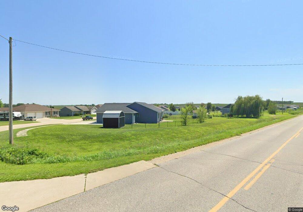
110 Elliot Ave Unit Lot 12 Willow Tree S Shell Rock, IA 50670
Estimated Value: $360,000 - $445,227
4
Beds
4
Baths
1,512
Sq Ft
$264/Sq Ft
Est. Value
About This Home
This home is located at 110 Elliot Ave Unit Lot 12 Willow Tree S, Shell Rock, IA 50670 and is currently estimated at $399,557, approximately $264 per square foot. 110 Elliot Ave Unit Lot 12 Willow Tree S is a home located in Butler County with nearby schools including Waverly-Shell Rock Senior High School.
Ownership History
Date
Name
Owned For
Owner Type
Purchase Details
Closed on
Oct 12, 2021
Sold by
J & M Willowtree Llc
Bought by
Shoultz Denise Ann
Current Estimated Value
Home Financials for this Owner
Home Financials are based on the most recent Mortgage that was taken out on this home.
Original Mortgage
$193,500
Outstanding Balance
$176,454
Interest Rate
2.8%
Mortgage Type
New Conventional
Estimated Equity
$223,103
Purchase Details
Closed on
Oct 1, 2021
Sold by
J & M Willowtree Llc
Bought by
Blc Inc
Home Financials for this Owner
Home Financials are based on the most recent Mortgage that was taken out on this home.
Original Mortgage
$193,500
Outstanding Balance
$176,454
Interest Rate
2.8%
Mortgage Type
New Conventional
Estimated Equity
$223,103
Create a Home Valuation Report for This Property
The Home Valuation Report is an in-depth analysis detailing your home's value as well as a comparison with similar homes in the area
Home Values in the Area
Average Home Value in this Area
Purchase History
| Date | Buyer | Sale Price | Title Company |
|---|---|---|---|
| Shoultz Denise Ann | $357,000 | None Listed On Document | |
| Blc Inc | $25,000 | None Listed On Document |
Source: Public Records
Mortgage History
| Date | Status | Borrower | Loan Amount |
|---|---|---|---|
| Open | Shoultz Denise Ann | $193,500 |
Source: Public Records
Tax History Compared to Growth
Tax History
| Year | Tax Paid | Tax Assessment Tax Assessment Total Assessment is a certain percentage of the fair market value that is determined by local assessors to be the total taxable value of land and additions on the property. | Land | Improvement |
|---|---|---|---|---|
| 2024 | $7,180 | $412,550 | $32,990 | $379,560 |
| 2023 | $6,348 | $412,550 | $32,990 | $379,560 |
| 2022 | $620 | $330,020 | $32,990 | $297,030 |
| 2021 | $550 | $32,990 | $32,990 | $0 |
| 2020 | $550 | $28,040 | $28,040 | $0 |
| 2019 | $2,564 | $0 | $0 | $0 |
| 2018 | $2,636 | $0 | $0 | $0 |
| 2017 | $2,726 | $0 | $0 | $0 |
| 2016 | $20 | $920 | $920 | $0 |
| 2015 | $20 | $0 | $0 | $0 |
Source: Public Records
Map
Nearby Homes
- 214 Elliot Ave
- 1125 Lozmar Ln
- 1124 Lozmar Ln
- 220 Elliot Ave
- 1130 Lozmar Ln
- 218 Harvest Ln
- 21164 Woodridge Ln
- 21250 Woodridge Ln
- 21146 Woodridge Ln
- 21161 Woodridge Ln
- 21273 Woodridge Ln
- 327 E Mindy Dr
- 403 E Jackson St
- 1065 230th St
- 21269 Woodridge Ln
- 21165 Woodridge Ln
- 21109 Woodridge Ln
- 2425 Bishop Ave
- TBD Cottage Ave
- 2412 W Bremer Ave
- 122 Elliot Ave
- 121 Elliot Ave
- 105 Elliot Ave
- 113 Elliot Ave
- 1100 S Cherry St
- 1108 S Cherry St Unit Lot 13 Willow Tree S
- 131 Elliot Ave
- 138 Elliot Ave
- 137 Elliot Ave
- 1109 Lozmar Ln Unit Lot 14 Willow Tree S
- 905 S Cherry St
- 914 S Cherry St
- 1009 S Cherry St
- 1115 Lozmar Ln
- 1110 Lozmar Ln
- 204 Elliot Ave Unit Lot 7 Willow Tree Su
- 1119 Lozmar Ln
- 1107 S Cherry St
- 1118 Lozmar Ln
- 829 S Cherry St