Estimated Value: $340,542 - $374,000
3
Beds
3
Baths
2,470
Sq Ft
$145/Sq Ft
Est. Value
About This Home
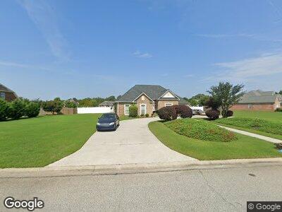
This home is located at 110 Elsa Way, Byron, GA 31008 and is currently estimated at $357,136, approximately $144 per square foot. 110 Elsa Way is a home located in Peach County with nearby schools including Kay Road Elementary School, Fort Valley Middle School, and Peach County High School.
Ownership History
Date
Name
Owned For
Owner Type
Purchase Details
Closed on
Dec 5, 2005
Sold by
Holcomb & Sons Constructio
Bought by
Bones Edgar C and Bones Juanita B
Current Estimated Value
Home Financials for this Owner
Home Financials are based on the most recent Mortgage that was taken out on this home.
Original Mortgage
$188,720
Interest Rate
7.88%
Mortgage Type
New Conventional
Purchase Details
Closed on
Nov 19, 2004
Sold by
H & H Land Development Corp
Bought by
Holcomb & Sons Construction Llc
Purchase Details
Closed on
Jun 15, 2004
Bought by
H & H Land Development Corp
Create a Home Valuation Report for This Property
The Home Valuation Report is an in-depth analysis detailing your home's value as well as a comparison with similar homes in the area
Home Values in the Area
Average Home Value in this Area
Purchase History
| Date | Buyer | Sale Price | Title Company |
|---|---|---|---|
| Bones Edgar C | $235,900 | -- | |
| Holcomb & Sons Construction Llc | $32,900 | -- | |
| H & H Land Development Corp | -- | -- |
Source: Public Records
Mortgage History
| Date | Status | Borrower | Loan Amount |
|---|---|---|---|
| Open | Bones Edgar C | $239,000 | |
| Closed | Bones Edgar C | $225,900 | |
| Closed | Bones Edgar C | $188,720 |
Source: Public Records
Tax History Compared to Growth
Tax History
| Year | Tax Paid | Tax Assessment Tax Assessment Total Assessment is a certain percentage of the fair market value that is determined by local assessors to be the total taxable value of land and additions on the property. | Land | Improvement |
|---|---|---|---|---|
| 2024 | $204 | $114,440 | $9,600 | $104,840 |
| 2023 | $247 | $111,600 | $9,600 | $102,000 |
| 2022 | $2,857 | $98,560 | $9,600 | $88,960 |
| 2021 | $2,797 | $83,040 | $9,600 | $73,440 |
| 2020 | $2,893 | $86,120 | $9,600 | $76,520 |
| 2019 | $2,836 | $83,880 | $9,600 | $74,280 |
| 2018 | $2,849 | $83,880 | $9,600 | $74,280 |
| 2017 | $2,862 | $83,880 | $9,600 | $74,280 |
| 2016 | $2,851 | $83,880 | $9,600 | $74,280 |
| 2015 | $2,855 | $83,880 | $9,600 | $74,280 |
| 2014 | $2,859 | $83,880 | $9,600 | $74,280 |
| 2013 | -- | $83,880 | $9,600 | $74,280 |
Source: Public Records
Map
Nearby Homes
- 109 Red Tail Cir
- 117 Red Tail Cir
- 183 Hawks Ridge Trace
- 85 Lakeview Rd
- 107 Red Tail Cir
- 24C Sterling Dr
- 19C Crown Ct
- lot 8 Mystic Cir
- 0 Barker Rd Unit 14258525
- 0 Barker Rd Unit 175053
- 0 Barker Rd Unit 243030
- 245 Sterling Dr
- 2050 Bible Camp Rd
- 118 Happy Ln
- 116 Champagne Dr
- 114 Champagne Dr
- 400 Jones Rd