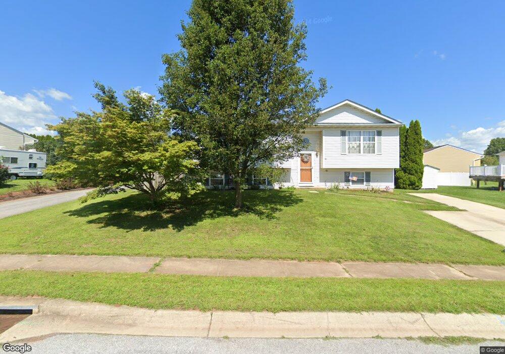
110 Flanagan Dr Taneytown, MD 21787
Estimated Value: $348,000 - $373,000
3
Beds
2
Baths
1,192
Sq Ft
$302/Sq Ft
Est. Value
About This Home
This home is located at 110 Flanagan Dr, Taneytown, MD 21787 and is currently estimated at $359,908, approximately $301 per square foot. 110 Flanagan Dr is a home located in Carroll County with nearby schools including Taneytown Elementary School, Northwest Middle School, and Francis Scott Key High School.
Ownership History
Date
Name
Owned For
Owner Type
Purchase Details
Closed on
Apr 16, 2018
Sold by
Conroy David Garfield and Conroy Sherry Louise
Bought by
Conroy David G
Current Estimated Value
Home Financials for this Owner
Home Financials are based on the most recent Mortgage that was taken out on this home.
Original Mortgage
$232,425
Outstanding Balance
$199,882
Interest Rate
4.44%
Mortgage Type
Construction
Estimated Equity
$160,026
Purchase Details
Closed on
Oct 8, 2008
Sold by
Mkpasi Chukwudi D
Bought by
Conroy David Garfield and Conroy Sherry Louise
Home Financials for this Owner
Home Financials are based on the most recent Mortgage that was taken out on this home.
Original Mortgage
$236,542
Interest Rate
6.41%
Mortgage Type
FHA
Purchase Details
Closed on
Sep 30, 2008
Sold by
Mkpasi Chukwudi D
Bought by
Conroy David Garfield and Conroy Sherry Louise
Home Financials for this Owner
Home Financials are based on the most recent Mortgage that was taken out on this home.
Original Mortgage
$236,542
Interest Rate
6.41%
Mortgage Type
FHA
Purchase Details
Closed on
Oct 5, 2006
Sold by
Mahlstedt John W
Bought by
Mkpasi Chukwudi D
Home Financials for this Owner
Home Financials are based on the most recent Mortgage that was taken out on this home.
Original Mortgage
$249,850
Interest Rate
9.5%
Mortgage Type
Purchase Money Mortgage
Purchase Details
Closed on
Sep 21, 2006
Sold by
Mahlstedt John W
Bought by
Mkpasi Chukwudi D
Home Financials for this Owner
Home Financials are based on the most recent Mortgage that was taken out on this home.
Original Mortgage
$249,850
Interest Rate
9.5%
Mortgage Type
Purchase Money Mortgage
Purchase Details
Closed on
Aug 20, 2001
Sold by
Knox Joseph E
Bought by
Mahlstedt John W and Mahlstedt Gina Marie
Purchase Details
Closed on
Jun 30, 1994
Sold by
Marsar Development Corp
Bought by
Knox Joseph E
Home Financials for this Owner
Home Financials are based on the most recent Mortgage that was taken out on this home.
Original Mortgage
$111,000
Interest Rate
8.55%
Create a Home Valuation Report for This Property
The Home Valuation Report is an in-depth analysis detailing your home's value as well as a comparison with similar homes in the area
Purchase History
| Date | Buyer | Sale Price | Title Company |
|---|---|---|---|
| Conroy David G | -- | Associates Title Svcs Inc | |
| Conroy David Garfield | $239,000 | -- | |
| Conroy David Garfield | $239,000 | -- | |
| Mkpasi Chukwudi D | $263,000 | -- | |
| Mkpasi Chukwudi D | $263,000 | -- | |
| Mahlstedt John W | $130,000 | -- | |
| Knox Joseph E | $111,150 | -- |
Source: Public Records
Mortgage History
| Date | Status | Borrower | Loan Amount |
|---|---|---|---|
| Open | Conroy David G | $232,425 | |
| Closed | Conroy David Garfield | $236,542 | |
| Closed | Conroy David Garfield | $236,542 | |
| Previous Owner | Mkpasi Chukwudi D | $249,850 | |
| Previous Owner | Mkpasi Chukwudi D | $249,850 | |
| Previous Owner | Knox Joseph E | $111,000 |
Source: Public Records
Tax History
| Year | Tax Paid | Tax Assessment Tax Assessment Total Assessment is a certain percentage of the fair market value that is determined by local assessors to be the total taxable value of land and additions on the property. | Land | Improvement |
|---|---|---|---|---|
| 2025 | $4,141 | $282,967 | $0 | $0 |
| 2024 | $3,929 | $266,433 | $0 | $0 |
| 2023 | $3,723 | $249,900 | $92,200 | $157,700 |
| 2022 | $3,588 | $240,833 | $0 | $0 |
| 2021 | $6,953 | $231,767 | $0 | $0 |
| 2020 | $3,340 | $222,700 | $82,200 | $140,500 |
| 2019 | $3,311 | $220,733 | $0 | $0 |
| 2018 | $3,259 | $218,767 | $0 | $0 |
| 2017 | $3,230 | $216,800 | $0 | $0 |
| 2016 | -- | $210,767 | $0 | $0 |
| 2015 | -- | $204,733 | $0 | $0 |
| 2014 | -- | $198,700 | $0 | $0 |
Source: Public Records
Map
Nearby Homes
- 404 Taney Dr
- 26 O Brien Ave
- 33 Musket Ct
- 3 Courtland St
- 316 Taney Dr
- 411 Clover Ct
- 125 Commerce St
- 547 Kenan St
- 105 Ridge Ave
- 545 Daisy Dr
- 428 E Baltimore St
- 430 E Baltimore St
- 205 Ridge Ave
- 525 Bull Run Rd
- 138 Crimson Ave
- 19 Fairground Ave
- 71 Fairground Ave
- 0 Carnival Dr
- 0 Harney Rd
- 4315 Stumptown Rd
- 109 Flanagan Dr
- 175 Blarney Ct
- 12 O Brien Ave
- 106 Flanagan Dr
- 506 Darby Dr
- 176 Blarney Ct
- 174 Blarney Ct
- 207 Carroll Heights Rd
- 508 Darby Dr
- 177 Blarney Ct
- 209 Carroll Heights Rd
- 101 O Hagan Dr
- 504 Darby Dr
- 178 Blarney Ct
- 203 Carroll Heights Rd
- 11 O Brien Ave
- 9 O Brien Ave
- 211 Carroll Heights Rd
- 179 Blarney Ct
- 100 George St
Your Personal Tour Guide
Ask me questions while you tour the home.