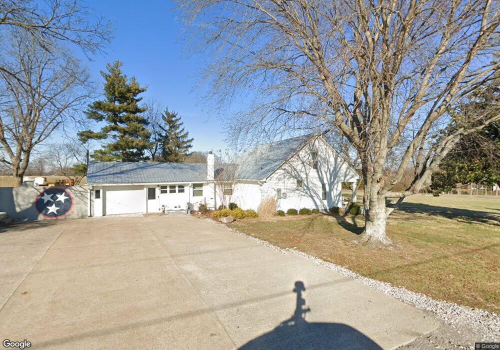
110 Jake Link Rd Cottontown, TN 37048
Estimated Value: $332,826 - $536,000
--
Bed
1
Bath
1,596
Sq Ft
$266/Sq Ft
Est. Value
About This Home
This home is located at 110 Jake Link Rd, Cottontown, TN 37048 and is currently estimated at $424,457, approximately $265 per square foot. 110 Jake Link Rd is a home located in Sumner County with nearby schools including Oakmont Elementary School, Portland East Middle School, and Portland High School.
Ownership History
Date
Name
Owned For
Owner Type
Purchase Details
Closed on
Mar 10, 2023
Sold by
Pearson Linda R
Bought by
Pearson Linda R and Eidson Tracy P
Current Estimated Value
Purchase Details
Closed on
Feb 13, 2018
Sold by
Cook Cole D and Cook Nettie A
Bought by
Pearson John H and Pearson Linda R
Purchase Details
Closed on
Sep 24, 2012
Sold by
Pearson John H and Pearson Linda R
Bought by
Cook Cole D and Cook Nellie A
Create a Home Valuation Report for This Property
The Home Valuation Report is an in-depth analysis detailing your home's value as well as a comparison with similar homes in the area
Home Values in the Area
Average Home Value in this Area
Purchase History
| Date | Buyer | Sale Price | Title Company |
|---|---|---|---|
| Pearson Linda R | -- | None Listed On Document | |
| Pearson John H | -- | Cbc Title & Escrow | |
| Cook Cole D | -- | Cbc Title & Escrow | |
| Cook Cole D | -- | None Available |
Source: Public Records
Tax History Compared to Growth
Tax History
| Year | Tax Paid | Tax Assessment Tax Assessment Total Assessment is a certain percentage of the fair market value that is determined by local assessors to be the total taxable value of land and additions on the property. | Land | Improvement |
|---|---|---|---|---|
| 2024 | $1,314 | $92,450 | $43,050 | $49,400 |
| 2023 | $943 | $41,875 | $13,175 | $28,700 |
| 2022 | $947 | $41,875 | $13,175 | $28,700 |
| 2021 | $926 | $40,925 | $12,225 | $28,700 |
| 2020 | $926 | $40,925 | $12,225 | $28,700 |
| 2019 | $715 | $0 | $0 | $0 |
| 2018 | $702 | $0 | $0 | $0 |
| 2017 | $702 | $0 | $0 | $0 |
| 2016 | $702 | $0 | $0 | $0 |
| 2015 | -- | $0 | $0 | $0 |
| 2014 | -- | $0 | $0 | $0 |
Source: Public Records
Map
Nearby Homes
- 721 New Deal Potts Rd
- 0 New Deal Pots Rd
- 3172 Highway 76
- 782 New Deal Potts Rd
- 0 Jake Link Rd
- 3011 Highway 76
- 155 S Ray Rd
- 290 Dink Rut Rd
- 199 Broaderick Ln
- 3371 Highway 76
- 686 Clearview Rd
- 286 S Ray Rd
- 268 S Ray Rd
- 101 Riggs Rd
- 105 Riggs Rd
- 1 Clearview Rd
- 120 Wilkerson Ln
- 512 N Happy Hollow Rd
- 541 Clearview Rd
- 300 N Happy Hollow Rd
- 389 New Deal Potts Rd
- 127 Jake Link Rd
- 127 Jake Link Rd Unit B
- 127 B Jake Link Rd
- 390 New Deal Potts Rd
- 109 Jake Link Rd
- 101 Belcher Hollow Rd
- 510 New Deal Potts Rd
- 372 New Deal Potts Rd
- 111 Belcher Hollow Rd
- 369 New Deal Potts Rd
- 370 New Deal Potts Rd
- 117 Belcher Hollow Rd
- 529 New Deal Potts Rd
- 358 New Deal Potts Rd
- 157 Jake Link Rd
- 158 Jake Link Rd
- 138 Belcher Hollow Rd
- 540 New Deal Potts Rd
- 537 New Deal Potts Rd