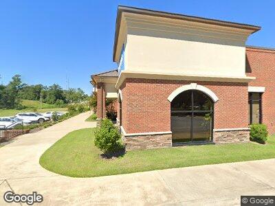
110 Kia Dr Lagrange, GA 30241
--
Bed
--
Bath
6,556
Sq Ft
5
Acres
About This Home
This home is located at 110 Kia Dr, Lagrange, GA 30241. 110 Kia Dr is a home located in Troup County with nearby schools including Hollis Hand Elementary School, Franklin Forest Elementary School, and Ethel W. Kight Elementary School.
Ownership History
Date
Name
Owned For
Owner Type
Purchase Details
Closed on
Feb 12, 2024
Sold by
Synovus Bank
Bought by
Humac Properties Llc
Purchase Details
Closed on
Dec 8, 2003
Sold by
Elizabeth Stewart and Mark Burn
Bought by
Linda Dixon
Purchase Details
Closed on
Dec 16, 2002
Sold by
Maynard Burnham
Bought by
Elizabeth Stewart and Mark Burn
Purchase Details
Closed on
Jul 12, 2002
Sold by
Maynard L Burnham
Bought by
Maynard Burnham
Purchase Details
Closed on
Jan 1, 1953
Sold by
Burnham J T
Bought by
Maynard L Burnham
Create a Home Valuation Report for This Property
The Home Valuation Report is an in-depth analysis detailing your home's value as well as a comparison with similar homes in the area
Home Values in the Area
Average Home Value in this Area
Purchase History
| Date | Buyer | Sale Price | Title Company |
|---|---|---|---|
| Humac Properties Llc | -- | -- | |
| Pkch Llc | $250,000 | -- | |
| Linda Dixon | $80,000 | -- | |
| Elizabeth Stewart | -- | -- | |
| Maynard Burnham | -- | -- | |
| Maynard L Burnham | -- | -- |
Source: Public Records
Mortgage History
| Date | Status | Borrower | Loan Amount |
|---|---|---|---|
| Previous Owner | Humac Properties Llc | $300,000 | |
| Previous Owner | Humac Properties Llc | $132,000 |
Source: Public Records
Tax History Compared to Growth
Tax History
| Year | Tax Paid | Tax Assessment Tax Assessment Total Assessment is a certain percentage of the fair market value that is determined by local assessors to be the total taxable value of land and additions on the property. | Land | Improvement |
|---|---|---|---|---|
| 2024 | $16,502 | $605,080 | $182,560 | $422,520 |
| 2023 | $15,566 | $570,760 | $182,560 | $388,200 |
| 2022 | $15,930 | $570,760 | $182,560 | $388,200 |
| 2021 | $15,955 | $529,000 | $161,080 | $367,920 |
| 2020 | $15,955 | $529,000 | $161,080 | $367,920 |
| 2019 | $16,037 | $531,720 | $161,080 | $370,640 |
| 2018 | $16,036 | $531,720 | $161,080 | $370,640 |
| 2017 | $15,015 | $497,840 | $161,080 | $336,760 |
| 2016 | $15,019 | $497,985 | $161,100 | $336,885 |
| 2015 | $15,044 | $497,985 | $161,100 | $336,885 |
| 2014 | $5,901 | $195,000 | $195,000 | $0 |
| 2013 | -- | $46,800 | $46,800 | $0 |
Source: Public Records
Map
Nearby Homes
- 4 Louise St
- 13 Fulton St
- 21 Barnard Ave
- 5 Curran Ave
- 1206 Pool Mill St
- 914 Greenville St
- 902 Georgia Ave
- 106 Shenandoah Ln Unit E26
- 114 Shenandoah Ln Unit E30
- 124 Shenandoah Ln
- 122 Shenandoah Ln
- 122 Shenandoah Ln Unit 64
- 713 Windstream Dr Unit B-58
- 205 Freshwater Ct
- 203 Freshwater Ct Unit E32
- 205 Freshwater Ct Unit E33
- 202 River Meadow Dr Unit G46
- 214 River Meadow Dr Unit G40
- 45 N Cary St
- 722 Windstream Dr Unit A-12
- 110 Kia Dr
- 110 & 112 Kia Dr
- 1306 Greenville St
- 1308 Greenville St
- 1320 Greenville St
- 16 Ragland St
- 1322 Greenville St
- 1324 Greenville St
- 0 Greenville and Ragland Unit 115 7163265
- 1300 Greenville St Unit 115
- 1212 Paxton St
- 15 Louise St
- 1103 Lafayette Pkwy
- 16 Louise St
- 13 Louise St
- 1201 Lafayette Pkwy
- 11 Louise St
- 14 Louise St
- 1208 Paxton St
- 12 Louise St
