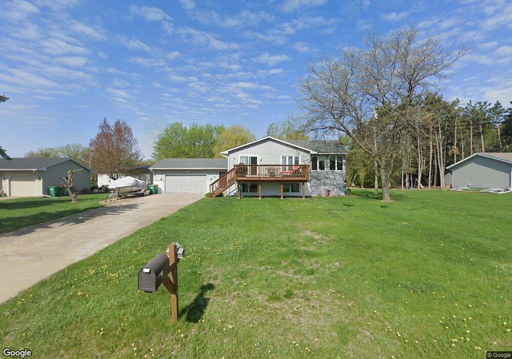
110 Lakeshore Dr Big Lake, MN 55309
Estimated Value: $382,000 - $412,000
4
Beds
2
Baths
1,335
Sq Ft
$293/Sq Ft
Est. Value
About This Home
This home is located at 110 Lakeshore Dr, Big Lake, MN 55309 and is currently estimated at $391,059, approximately $292 per square foot. 110 Lakeshore Dr is a home located in Sherburne County with nearby schools including Liberty Elementary School, Independence Elementary School, and Big Lake Middle School.
Ownership History
Date
Name
Owned For
Owner Type
Purchase Details
Closed on
Jun 1, 2017
Sold by
Ogara Patrick Dewey and Ogara Linda
Bought by
Larson James E and Larson Luann
Current Estimated Value
Home Financials for this Owner
Home Financials are based on the most recent Mortgage that was taken out on this home.
Original Mortgage
$180,000
Outstanding Balance
$149,722
Interest Rate
4.02%
Mortgage Type
New Conventional
Estimated Equity
$241,337
Create a Home Valuation Report for This Property
The Home Valuation Report is an in-depth analysis detailing your home's value as well as a comparison with similar homes in the area
Home Values in the Area
Average Home Value in this Area
Purchase History
| Date | Buyer | Sale Price | Title Company |
|---|---|---|---|
| Larson James E | $225,000 | Liberty Title |
Source: Public Records
Mortgage History
| Date | Status | Borrower | Loan Amount |
|---|---|---|---|
| Open | Larson James E | $180,000 |
Source: Public Records
Tax History Compared to Growth
Tax History
| Year | Tax Paid | Tax Assessment Tax Assessment Total Assessment is a certain percentage of the fair market value that is determined by local assessors to be the total taxable value of land and additions on the property. | Land | Improvement |
|---|---|---|---|---|
| 2025 | $4,626 | $384,000 | $115,400 | $268,600 |
| 2024 | $4,610 | $380,700 | $115,400 | $265,300 |
| 2023 | $4,436 | $380,900 | $116,900 | $264,000 |
| 2022 | $3,844 | $354,700 | $101,800 | $252,900 |
| 2020 | $3,608 | $256,200 | $46,800 | $209,400 |
| 2019 | $3,336 | $241,200 | $41,300 | $199,900 |
| 2018 | $3,020 | $222,100 | $37,800 | $184,300 |
| 2017 | $4,028 | $196,400 | $34,400 | $162,000 |
| 2016 | $3,886 | $183,100 | $31,000 | $152,100 |
| 2015 | $3,316 | $176,000 | $30,400 | $145,600 |
| 2014 | $2,074 | $148,800 | $26,500 | $122,300 |
| 2013 | -- | $129,000 | $25,500 | $103,500 |
Source: Public Records
Map
Nearby Homes
- TBD Highway 10 NW
- 241 Leighton Dr
- 491 Highland Ave
- 679 Lakeshore Dr
- 240 Wyoming Ave
- 637 Norwood Ln
- 20050 County Road 81 NW
- 20311 Gordon Ln
- TBD Manitou St
- 3300 Lake View Ln
- 874 Independence Dr NW
- 541 William St
- 110 Powell Cir E
- 5008 Bluff Rd
- 585 Glenwood Ave
- 3250 Lake Ridge Dr
- 18585 Arctic Ave
- 4637 Pond View Cir
- 4265 Lake Ridge Dr
- 20189 Esther Pkwy
- 100 Lakeshore Dr
- 111 Lakeshore Dr
- 20 Sherburne Ave
- XXXX Sherburne Ave
- 117 Lakeshore Dr
- 30 Sherburne Ave
- 150 Leighton Cir
- 90 Lakeshore Dr
- 130 Sherburne Ave
- 140 Leighton Cir
- 108 Leighton Cir
- 121 Lakeshore Dr
- 140 Sherburne Ave
- 104 Leighton Cir
- 121 Us Highway 10
- 121 Us Highway 10
- 121 Us Highway 10
- 121 Us Highway 10
- 121 Us Highway 10
- 131 Lakeshore Dr