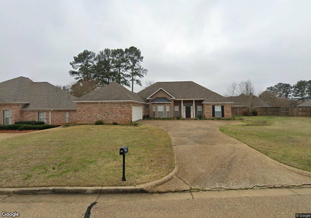
110 Linwood Dr Brandon, MS 39042
Estimated Value: $316,000 - $336,168
3
Beds
3
Baths
2,041
Sq Ft
$160/Sq Ft
Est. Value
About This Home
This home is located at 110 Linwood Dr, Brandon, MS 39042 and is currently estimated at $326,292, approximately $159 per square foot. 110 Linwood Dr is a home located in Rankin County with nearby schools including Rouse Elementary School, Brandon Elementary School, and Stonebridge Elementary School.
Ownership History
Date
Name
Owned For
Owner Type
Purchase Details
Closed on
Jun 30, 2021
Sold by
Mcdill Joyce S
Bought by
Mcdill Robert Gerald
Current Estimated Value
Purchase Details
Closed on
Sep 26, 2017
Sold by
Sartin Brendan C and Sartin Mary K
Bought by
Mcdill Robert G and Mcdill Joyce S
Home Financials for this Owner
Home Financials are based on the most recent Mortgage that was taken out on this home.
Original Mortgage
$192,850
Interest Rate
3.82%
Mortgage Type
New Conventional
Purchase Details
Closed on
Oct 31, 2013
Sold by
Linda M Linda M and Frenz John
Bought by
Sartin Brenden C and Sartin Mary K
Home Financials for this Owner
Home Financials are based on the most recent Mortgage that was taken out on this home.
Original Mortgage
$60,000
Interest Rate
4.33%
Create a Home Valuation Report for This Property
The Home Valuation Report is an in-depth analysis detailing your home's value as well as a comparison with similar homes in the area
Home Values in the Area
Average Home Value in this Area
Purchase History
| Date | Buyer | Sale Price | Title Company |
|---|---|---|---|
| Mcdill Robert Gerald | -- | None Listed On Document | |
| Mcdill Robert G | -- | None Available | |
| Sartin Brenden C | -- | -- |
Source: Public Records
Mortgage History
| Date | Status | Borrower | Loan Amount |
|---|---|---|---|
| Previous Owner | Mcdill Robert G | $192,850 | |
| Previous Owner | Sartin Brenden C | $60,000 |
Source: Public Records
Tax History
| Year | Tax Paid | Tax Assessment Tax Assessment Total Assessment is a certain percentage of the fair market value that is determined by local assessors to be the total taxable value of land and additions on the property. | Land | Improvement |
|---|---|---|---|---|
| 2024 | $2,792 | $23,690 | $0 | $0 |
| 2023 | $1,775 | $22,581 | $0 | $0 |
| 2022 | $1,754 | $22,581 | $0 | $0 |
| 2021 | $1,754 | $22,581 | $0 | $0 |
| 2020 | $1,754 | $22,581 | $0 | $0 |
| 2019 | $1,792 | $21,098 | $0 | $0 |
| 2018 | $1,765 | $21,098 | $0 | $0 |
| 2017 | $2,438 | $21,098 | $0 | $0 |
| 2016 | $2,201 | $20,702 | $0 | $0 |
| 2015 | $2,201 | $20,702 | $0 | $0 |
| 2014 | $2,157 | $20,702 | $0 | $0 |
| 2013 | -- | $20,702 | $0 | $0 |
Source: Public Records
Map
Nearby Homes
- 73 Eastgate Dr
- 402 Treeline Dr
- 135 Fawnwood Dr
- 0 Mississippi 471 Unit 4129332
- 0 Mississippi 471 Unit 4120443
- 0 Thorngate Dr
- 550 Pecan Blvd
- 0 Luckney Rd Unit 4087485
- 0001 Old Highway 471
- 102 Sunline Dr
- 48 Sandlewood Dr
- 22 Pebble Hill Dr
- 36 Pebble Hill Dr
- 637 Wild Horse Ln
- 2017 Rolling Hill Dr
- 119 Fern Valley Rd
- 213 Iron Horse Station
- 705 Heartwood Ln
- 104 Shelby Mae Cir
- 5095 Warner Dr
- 112 Linwood Dr
- 103 Glenside Dr
- 101 Glenside Dr
- 2004 Walden Place
- 105 Glenside Dr
- 111 Linwood Dr
- 109 Linwood Dr
- 114 Linwood Dr
- 113 Linwood Dr
- 107 Linwood Dr
- 107 Glenside Dr
- 115 Linwood Dr
- 102 Glenside Dr
- 104 Glenside Dr
- 321 Eastridge Dr
- 105 Linwood Dr
- 100 Glenside Dr
- 109 Glenside Dr
- 325 Eastridge Dr
- 319 Eastridge Dr
Your Personal Tour Guide
Ask me questions while you tour the home.