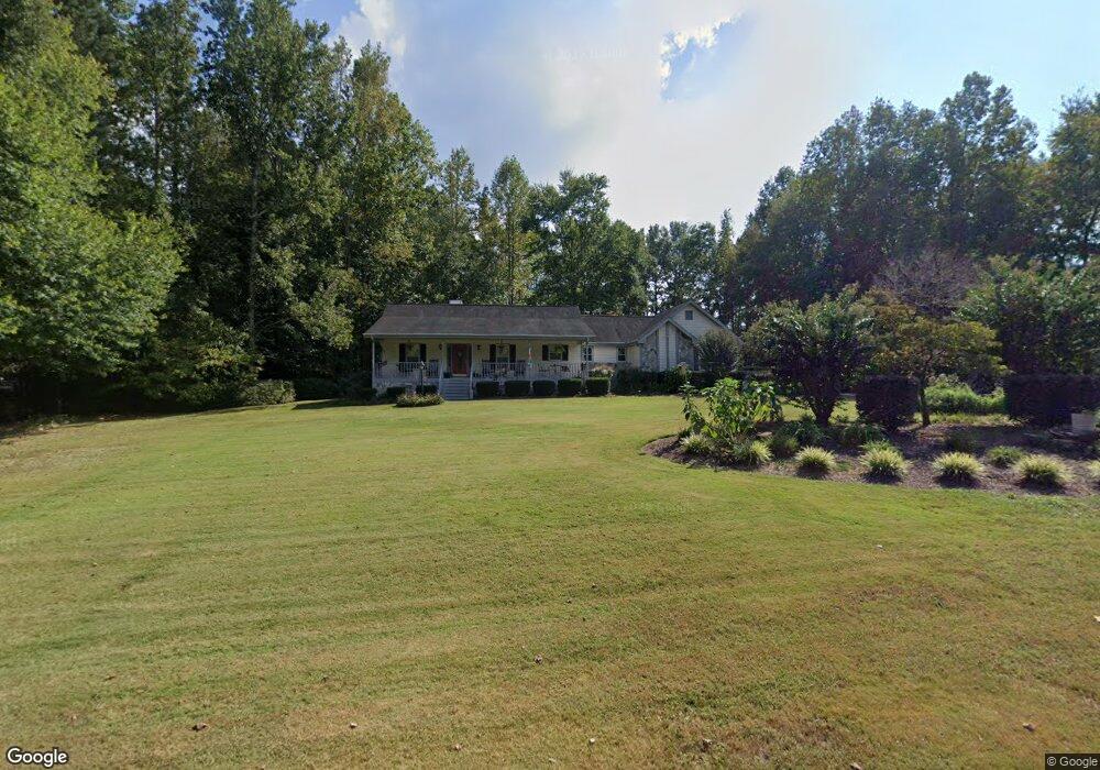
110 Long Point Dr Carrollton, GA 30117
Estimated Value: $360,931 - $431,000
3
Beds
3
Baths
2,429
Sq Ft
$165/Sq Ft
Est. Value
About This Home
This home is located at 110 Long Point Dr, Carrollton, GA 30117 and is currently estimated at $401,983, approximately $165 per square foot. 110 Long Point Dr is a home located in Carroll County with nearby schools including Central Elementary School, Central Middle School, and Central High School.
Ownership History
Date
Name
Owned For
Owner Type
Purchase Details
Closed on
Jul 23, 1999
Sold by
Ragsdale Marie J
Bought by
Dockery Charles D
Current Estimated Value
Purchase Details
Closed on
May 2, 1996
Sold by
Ragsdale
Bought by
Ragsdale Marie J
Purchase Details
Closed on
Mar 26, 1992
Sold by
Carrollton Federal
Bought by
Ragsdale
Purchase Details
Closed on
Feb 11, 1992
Bought by
Carrollton Federal
Create a Home Valuation Report for This Property
The Home Valuation Report is an in-depth analysis detailing your home's value as well as a comparison with similar homes in the area
Home Values in the Area
Average Home Value in this Area
Purchase History
| Date | Buyer | Sale Price | Title Company |
|---|---|---|---|
| Dockery Charles D | $118,900 | -- | |
| Ragsdale Marie J | -- | -- | |
| Ragsdale | $92,500 | -- | |
| Carrollton Federal | $89,000 | -- |
Source: Public Records
Tax History Compared to Growth
Tax History
| Year | Tax Paid | Tax Assessment Tax Assessment Total Assessment is a certain percentage of the fair market value that is determined by local assessors to be the total taxable value of land and additions on the property. | Land | Improvement |
|---|---|---|---|---|
| 2024 | $288 | $148,807 | $12,000 | $136,807 |
| 2023 | $288 | $136,261 | $12,000 | $124,261 |
| 2022 | $343 | $111,630 | $12,000 | $99,630 |
| 2021 | $345 | $97,316 | $12,000 | $85,316 |
| 2020 | $1,892 | $88,174 | $12,000 | $76,174 |
| 2019 | $1,554 | $68,782 | $12,000 | $56,782 |
| 2018 | $1,456 | $62,297 | $12,000 | $50,297 |
| 2017 | $1,460 | $62,297 | $12,000 | $50,297 |
| 2016 | $1,460 | $62,297 | $12,000 | $50,297 |
| 2015 | $1,372 | $53,070 | $5,000 | $48,070 |
| 2014 | $1,378 | $53,070 | $5,000 | $48,070 |
Source: Public Records
Map
Nearby Homes
- 1531 Tyus Carrollton Rd
- 20 Camp Ct
- 95 Camp Ln
- 399 Old Camp Church Rd
- 105 Woodbine Dr
- 345 Piney Grove Rd
- 3680 W Highway 166
- 0 Bonner Rd Unit 10635754
- 21 Crabapple Place
- The Coleman Plan at Summerfield Place
- The Pearson Plan at Summerfield Place
- The Piedmont Plan at Summerfield Place
- The Harrington Plan at Summerfield Place
- The McGinnis Plan at Summerfield Place
- The Telfair Plan at Summerfield Place
- 40 Red Holly Gap
- 0 Buffalo Creek Rd Unit 10624169
- 102 Red Oak Dr
- 533 Buffalo Creek Rd
- 86 Long Point Dr
- 120 Long Point Dr
- 105 Long Point Dr
- 89 Long Point Dr
- 121 Long Point Dr
- 73 Long Point Dr
- 135 Long Point Dr Unit 1
- 135 Long Point Dr
- 129 Long Point Dr
- 0 Long Point Dr Unit 8042365
- 64 Long Point Dr
- 57 Long Point Dr
- 1431 Tyus Carrollton Rd
- 1475 Tyus Carrollton Rd
- 1475B Tyus Carrollton Rd
- 42 Long Point Dr
- 39 Long Point Dr
- 1501 Tyus Carrollton Rd
- 20 Long Point Dr
- 21 Long Point Dr