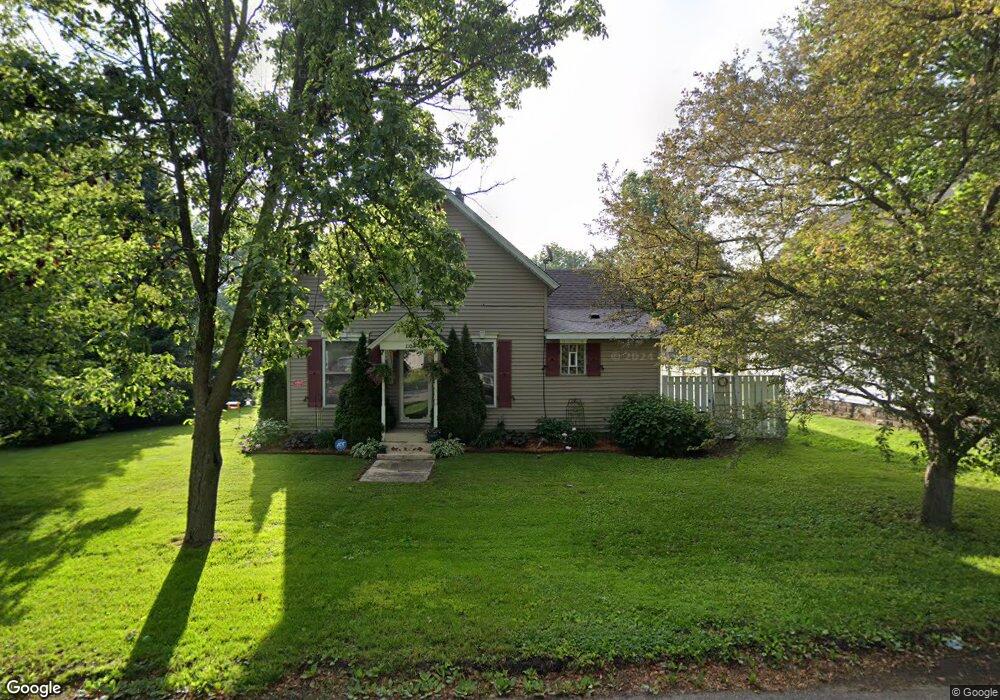
110 N Lincoln St Wanatah, IN 46390
Estimated Value: $183,687 - $250,000
3
Beds
1
Bath
1,472
Sq Ft
$148/Sq Ft
Est. Value
About This Home
This home is located at 110 N Lincoln St, Wanatah, IN 46390 and is currently estimated at $218,172, approximately $148 per square foot. 110 N Lincoln St is a home located in LaPorte County.
Ownership History
Date
Name
Owned For
Owner Type
Purchase Details
Closed on
Aug 1, 2006
Sold by
Mcardle Theresa L and Mattox Theresa L
Bought by
Mcardle Michael B and Mcardle Theresa L
Current Estimated Value
Home Financials for this Owner
Home Financials are based on the most recent Mortgage that was taken out on this home.
Original Mortgage
$48,500
Outstanding Balance
$29,229
Interest Rate
6.83%
Mortgage Type
New Conventional
Estimated Equity
$188,943
Purchase Details
Closed on
Oct 4, 2005
Sold by
Handzlik Glenn A and Handzlik Kristina M
Bought by
Lugo Jesse L
Home Financials for this Owner
Home Financials are based on the most recent Mortgage that was taken out on this home.
Original Mortgage
$71,920
Outstanding Balance
$41,213
Interest Rate
6.9%
Mortgage Type
Fannie Mae Freddie Mac
Estimated Equity
$176,959
Create a Home Valuation Report for This Property
The Home Valuation Report is an in-depth analysis detailing your home's value as well as a comparison with similar homes in the area
Home Values in the Area
Average Home Value in this Area
Purchase History
| Date | Buyer | Sale Price | Title Company |
|---|---|---|---|
| Mcardle Michael B | -- | Meridian Title Corp | |
| Lugo Jesse L | -- | Multiple |
Source: Public Records
Mortgage History
| Date | Status | Borrower | Loan Amount |
|---|---|---|---|
| Open | Mcardle Michael B | $48,500 | |
| Open | Lugo Jesse L | $71,920 |
Source: Public Records
Tax History Compared to Growth
Tax History
| Year | Tax Paid | Tax Assessment Tax Assessment Total Assessment is a certain percentage of the fair market value that is determined by local assessors to be the total taxable value of land and additions on the property. | Land | Improvement |
|---|---|---|---|---|
| 2024 | $1,101 | $126,800 | $15,800 | $111,000 |
| 2022 | $1,015 | $114,100 | $13,200 | $100,900 |
| 2021 | $960 | $108,600 | $10,600 | $98,000 |
| 2020 | $904 | $108,600 | $10,600 | $98,000 |
| 2019 | $940 | $108,600 | $10,600 | $98,000 |
| 2018 | $934 | $110,300 | $10,600 | $99,700 |
| 2017 | $858 | $107,700 | $10,600 | $97,100 |
| 2016 | $802 | $107,200 | $10,600 | $96,600 |
| 2014 | $747 | $106,300 | $10,600 | $95,700 |
Source: Public Records
Map
Nearby Homes
- 207 N Washington St
- 106 N Illinois St Unit 266
- 104 W Cross St
- 305 N Ohio St
- 116 Sprunger Dr
- 105 Earl St
- 627 Fieldcrest Cir
- 0 W Hwy 30 Unit GNR545374
- 9552 S Bigelow Mill Rd
- 627 E 300 S
- 6465 W 1100 S
- 421 Amy Rose Ln
- 83 Kaper Ln
- 87 Kaper Ln
- W 800 S V L
- 0 Porters Vale Blvd Unit GNR544918
- 0 St Road 2 Unit GNR544911
- 168 Jamestown Ave
- 0 Parcel B 325 E
- 0 Parcel A 325 E
- 108 N Lincoln St
- 210 N Lincoln St
- 504 W Cross St
- 109 N Washington St
- 106 N Lincoln St
- 218 N Lincoln St
- 414 W Cross St
- 107 N Washington St
- 119 N Washington St
- 106 S Washington St
- 109 N Lincoln St
- 201 N Washington St
- 209 N Lincoln St
- 204 N Lincoln St
- 107 N Lincoln St
- 201 N Lincoln St
- 203 N Washington St
- 102 N Lincoln St
- 203 N Lincoln St
- 206 N Lincoln St