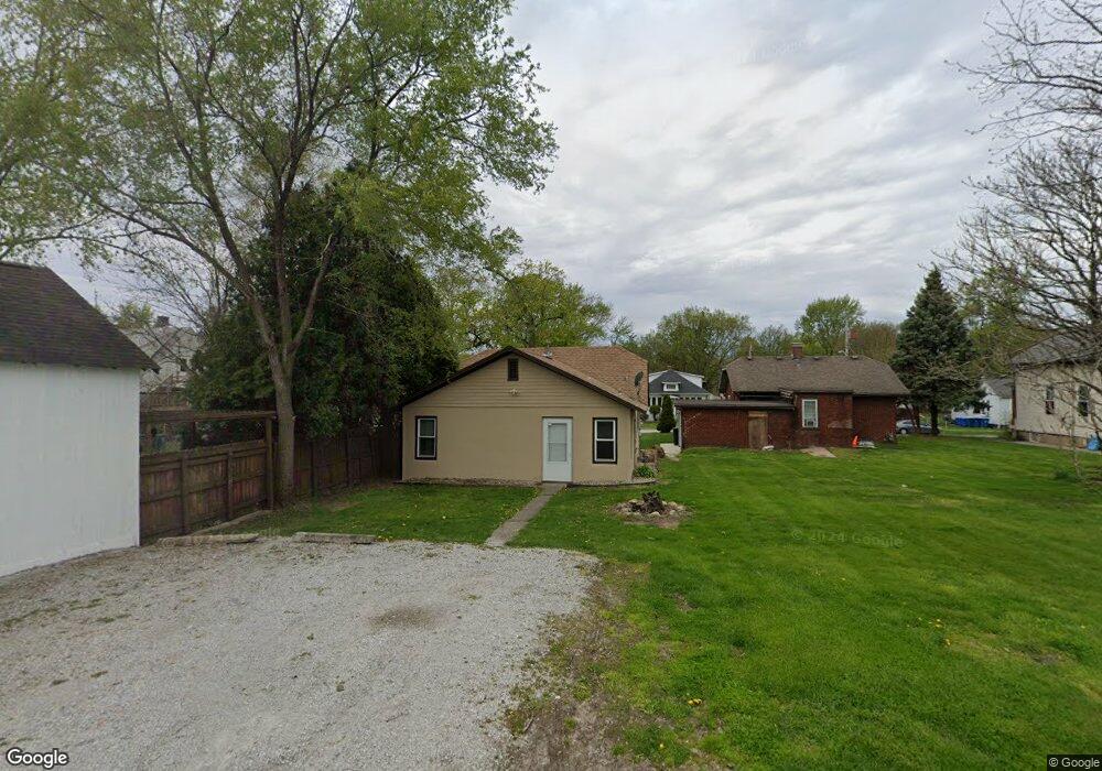
110 N Union St Crown Point, IN 46307
Estimated Value: $145,217 - $193,000
1
Bed
1
Bath
825
Sq Ft
$209/Sq Ft
Est. Value
About This Home
This home is located at 110 N Union St, Crown Point, IN 46307 and is currently estimated at $172,804, approximately $209 per square foot. 110 N Union St is a home located in Lake County with nearby schools including Timothy Ball Elementary School, Robert Taft Middle School, and Crown Point High School.
Ownership History
Date
Name
Owned For
Owner Type
Purchase Details
Closed on
Oct 1, 2020
Sold by
Amcr Llc
Bought by
Cain Ann M
Current Estimated Value
Home Financials for this Owner
Home Financials are based on the most recent Mortgage that was taken out on this home.
Original Mortgage
$66,000
Outstanding Balance
$47,437
Interest Rate
2.9%
Mortgage Type
New Conventional
Estimated Equity
$125,367
Purchase Details
Closed on
Jun 12, 2007
Sold by
Pace Roger D and Pace Brian J
Bought by
Amcr Llc
Home Financials for this Owner
Home Financials are based on the most recent Mortgage that was taken out on this home.
Original Mortgage
$128,000
Interest Rate
6.2%
Mortgage Type
Purchase Money Mortgage
Create a Home Valuation Report for This Property
The Home Valuation Report is an in-depth analysis detailing your home's value as well as a comparison with similar homes in the area
Home Values in the Area
Average Home Value in this Area
Purchase History
| Date | Buyer | Sale Price | Title Company |
|---|---|---|---|
| Cain Ann M | -- | Greater Indiana Title Co | |
| Amcr Llc | -- | Chicago Title Insurance Co |
Source: Public Records
Mortgage History
| Date | Status | Borrower | Loan Amount |
|---|---|---|---|
| Open | Cain Ann M | $66,000 | |
| Previous Owner | Amcr Llc | $128,000 |
Source: Public Records
Tax History Compared to Growth
Tax History
| Year | Tax Paid | Tax Assessment Tax Assessment Total Assessment is a certain percentage of the fair market value that is determined by local assessors to be the total taxable value of land and additions on the property. | Land | Improvement |
|---|---|---|---|---|
| 2024 | $2,133 | $88,000 | $27,600 | $60,400 |
| 2023 | $1,712 | $77,600 | $24,000 | $53,600 |
| 2022 | $1,644 | $74,400 | $24,000 | $50,400 |
| 2021 | $1,525 | $69,000 | $20,000 | $49,000 |
| 2020 | $1,472 | $66,600 | $20,000 | $46,600 |
| 2019 | $1,477 | $64,800 | $20,000 | $44,800 |
| 2018 | $1,640 | $62,600 | $20,000 | $42,600 |
| 2017 | $1,652 | $62,300 | $20,000 | $42,300 |
| 2016 | $1,665 | $61,700 | $20,000 | $41,700 |
| 2014 | $1,513 | $60,900 | $20,000 | $40,900 |
| 2013 | $1,486 | $59,100 | $20,000 | $39,100 |
Source: Public Records
Map
Nearby Homes
- 150 N Ridge St
- 310 N Indiana Ave
- 360 N Indiana Ave
- 380 N Indiana Ave
- 138 N Grant St
- 531 E Joliet St
- 407 Prairie St
- 411 Prairie St
- 266 Maxwell St
- 269 Maxwell St
- 221 N West St
- 123 Henderlong Pkwy
- 0 W Joliet St
- 306 Holton Ridge
- 901 Iroquois Dr
- 511 N West St
- 1710 Beech Dr
- 1639 Fir Ave
- 1714 Evergreen Ave
- 316 W South St