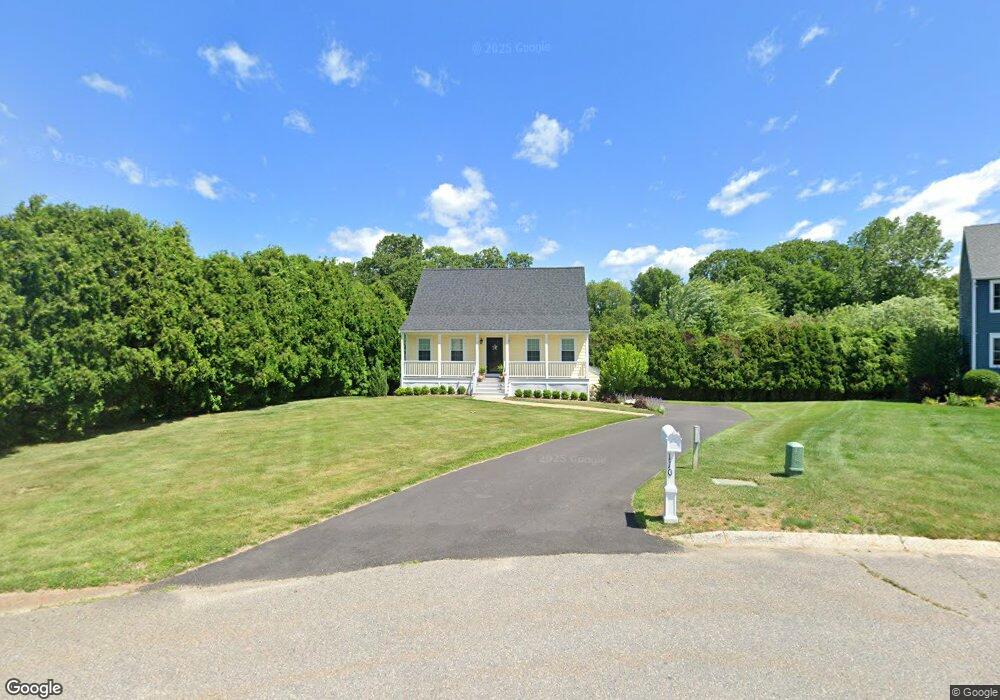
110 Pheasant Ln Bridgewater, MA 02324
Estimated Value: $576,000 - $669,000
3
Beds
2
Baths
1,547
Sq Ft
$395/Sq Ft
Est. Value
About This Home
This home is located at 110 Pheasant Ln, Bridgewater, MA 02324 and is currently estimated at $610,745, approximately $394 per square foot. 110 Pheasant Ln is a home located in Plymouth County with nearby schools including Mitchell Elementary School, Williams Intermediate School, and Bridgewater Middle School.
Ownership History
Date
Name
Owned For
Owner Type
Purchase Details
Closed on
Sep 22, 1994
Sold by
Genoa Inc
Bought by
Gallo Robert J and Gallo Clare T
Current Estimated Value
Create a Home Valuation Report for This Property
The Home Valuation Report is an in-depth analysis detailing your home's value as well as a comparison with similar homes in the area
Home Values in the Area
Average Home Value in this Area
Purchase History
| Date | Buyer | Sale Price | Title Company |
|---|---|---|---|
| Gallo Robert J | $161,800 | -- |
Source: Public Records
Mortgage History
| Date | Status | Borrower | Loan Amount |
|---|---|---|---|
| Open | Gallo Robert J | $250,000 | |
| Closed | Gallo Robert J | $150,000 | |
| Closed | Gallo Robert J | $30,000 |
Source: Public Records
Tax History
| Year | Tax Paid | Tax Assessment Tax Assessment Total Assessment is a certain percentage of the fair market value that is determined by local assessors to be the total taxable value of land and additions on the property. | Land | Improvement |
|---|---|---|---|---|
| 2025 | $5,812 | $491,300 | $193,400 | $297,900 |
| 2024 | $5,728 | $471,800 | $184,200 | $287,600 |
| 2023 | $5,664 | $441,100 | $172,100 | $269,000 |
| 2022 | $5,549 | $387,500 | $151,000 | $236,500 |
| 2021 | $4,971 | $343,300 | $134,800 | $208,500 |
| 2020 | $4,854 | $329,500 | $129,600 | $199,900 |
| 2019 | $4,749 | $320,200 | $129,600 | $190,600 |
| 2018 | $4,467 | $294,100 | $119,900 | $174,200 |
| 2017 | $4,301 | $275,500 | $119,900 | $155,600 |
| 2016 | $4,120 | $265,100 | $117,600 | $147,500 |
| 2015 | $4,144 | $255,200 | $114,100 | $141,100 |
| 2014 | $4,054 | $249,500 | $110,700 | $138,800 |
Source: Public Records
Map
Nearby Homes
- 215 Whitman St
- 81 Arrowhead Dr
- 150 Prattown Ln
- 0 Three Rivers Dr
- 845 Plymouth St
- 398 Plymouth St
- Lot 1 Mill St
- 30 Cesidio Ct
- 114 Plain St
- 11 Satucket Trail
- 3 Caswell Way
- 30 Sanger St
- 167 Spring St
- 580 Broad St Unit 2
- 580 Broad St Unit 1
- 30 Edgestone Dr Unit 30
- 5 Country Dr
- 55 Oldfield Rd
- 47 Hale St
- 20 Church Ave
- 120 Pheasant Ln
- 100 Pheasant Ln
- 130 Pheasant Ln
- 90 Pheasant Ln
- 135 Pheasant Ln
- 105 Pheasant Ln
- 80 Pheasant Ln
- 95 Pheasant Ln
- 85 Pheasant Ln
- 115 Pheasant Ln
- 125 Pheasant Ln
- 70 Pheasant Ln
- 60 Pheasant Ln
- 75 Pheasant Ln
- 50 Pheasant Ln
- 65 Pheasant Ln
- 235 Whitman St
- 55 Pheasant Ln
- 40 Pheasant Ln
- 233 Whitman St
Your Personal Tour Guide
Ask me questions while you tour the home.