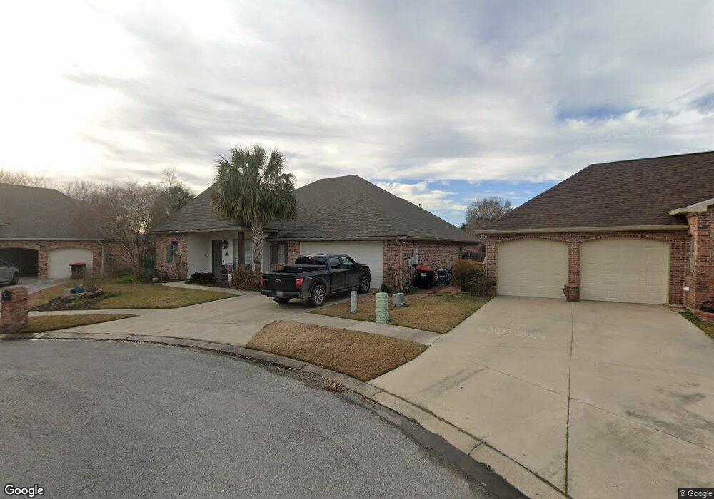
110 Port Royal Cir Lafayette, LA 70508
Kaliste Saloom NeighborhoodEstimated Value: $384,000 - $420,000
3
Beds
3
Baths
2,365
Sq Ft
$172/Sq Ft
Est. Value
About This Home
This home is located at 110 Port Royal Cir, Lafayette, LA 70508 and is currently estimated at $405,659, approximately $171 per square foot. 110 Port Royal Cir is a home located in Lafayette Parish with nearby schools including Corporal Michael Middlebrook Elementary School, Katharine Drexel Elementary School, and Tilton Upper Middle School.
Ownership History
Date
Name
Owned For
Owner Type
Purchase Details
Closed on
Oct 27, 2015
Sold by
Gachassin Nicholas and Gachassin Johnnie Leah Click
Bought by
Cox Frederick Ryan Anthony and Cox Frederick Kimberly
Current Estimated Value
Home Financials for this Owner
Home Financials are based on the most recent Mortgage that was taken out on this home.
Original Mortgage
$175,000
Outstanding Balance
$138,343
Interest Rate
3.94%
Mortgage Type
New Conventional
Estimated Equity
$267,316
Purchase Details
Closed on
Mar 22, 2007
Sold by
Bacon Cheryl Demis
Bought by
Gachassin Nicholas and Gachassin Johnnie Leah Click
Home Financials for this Owner
Home Financials are based on the most recent Mortgage that was taken out on this home.
Original Mortgage
$200,000
Interest Rate
6.26%
Mortgage Type
New Conventional
Create a Home Valuation Report for This Property
The Home Valuation Report is an in-depth analysis detailing your home's value as well as a comparison with similar homes in the area
Home Values in the Area
Average Home Value in this Area
Purchase History
| Date | Buyer | Sale Price | Title Company |
|---|---|---|---|
| Cox Frederick Ryan Anthony | $325,000 | None Available | |
| Gachassin Nicholas | $312,600 | None Available |
Source: Public Records
Mortgage History
| Date | Status | Borrower | Loan Amount |
|---|---|---|---|
| Open | Cox Frederick Ryan Anthony | $175,000 | |
| Previous Owner | Gachassin Nicholas | $200,000 |
Source: Public Records
Tax History Compared to Growth
Tax History
| Year | Tax Paid | Tax Assessment Tax Assessment Total Assessment is a certain percentage of the fair market value that is determined by local assessors to be the total taxable value of land and additions on the property. | Land | Improvement |
|---|---|---|---|---|
| 2024 | $2,794 | $32,734 | $5,135 | $27,599 |
| 2023 | $2,794 | $31,899 | $5,135 | $26,764 |
| 2022 | $3,338 | $31,899 | $5,135 | $26,764 |
| 2021 | $3,349 | $31,899 | $5,135 | $26,764 |
| 2020 | $3,338 | $31,899 | $5,135 | $26,764 |
| 2019 | $2,011 | $31,899 | $5,135 | $26,764 |
| 2018 | $2,623 | $31,899 | $5,135 | $26,764 |
| 2017 | $2,621 | $31,900 | $3,850 | $28,050 |
| 2015 | $2,633 | $32,040 | $3,850 | $28,190 |
| 2013 | -- | $32,040 | $3,850 | $28,190 |
Source: Public Records
Map
Nearby Homes
- 111 Port Royal Cir
- 112 Port Royal Cir
- 102 Lockeport Cir
- 106 Towne Rd
- 102 Towne Rd
- 108 Hamlet Ln
- 111 Hamlet Ln
- 109 Hamlet Ln
- 107 Hamlet Ln
- 100 Hollow Green Dr
- 209 Stoney Shadow Dr
- 2221 Verot School Rd
- 101 Blue Cove Dr
- 100 Blue Cove Dr
- 109 Blue Cove Dr
- 201 Blue Cove Dr
- 104 Blue Cove Dr
- 207 Leaning Oak Dr
- 1501 La Neuville Rd Unit 1-A
- 206 Leaning Oak Dr
- 111 Kentville Cir
- 108 Port Royal Cir
- 109 Kentville Cir
- 106 Port Royal Cir
- 107 Kentville Cir
- 109 Port Royal Cir
- 112 Kentville Cir
- 107 Port Royal Cir
- 104 Port Royal Cir
- 110 Lockeport Cir
- 108 Kentville Cir
- 105 Kentville Cir
- 108 Lockeport Cir
- 106 Kentville Cir
- 105 Port Royal Cir
- 112 Lockeport Cir
- 106 Lockeport Cir
- 102 Port Royal Cir
- 111 Hantsport Square
- 103 Kentville Cir