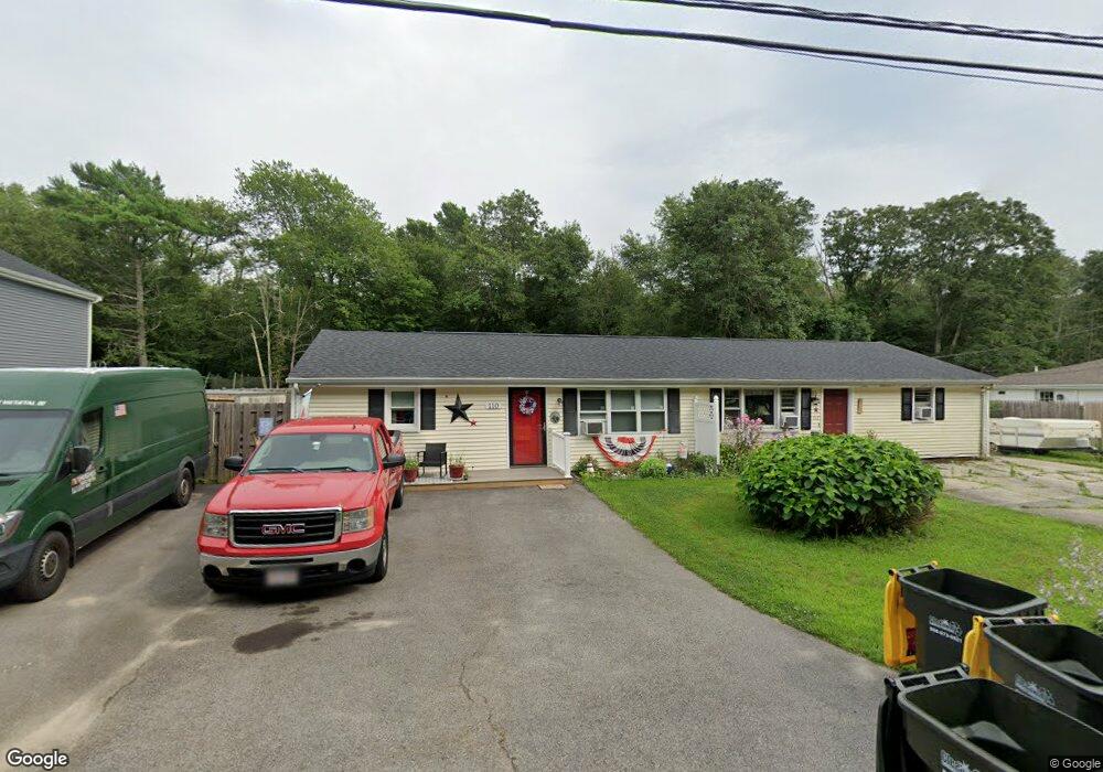
110 Robert St Unit A 110 Westport, MA 02790
Sawdy Pond/Woods Corner NeighborhoodEstimated Value: $283,574 - $427,000
2
Beds
1
Bath
845
Sq Ft
$423/Sq Ft
Est. Value
About This Home
This home is located at 110 Robert St Unit A 110, Westport, MA 02790 and is currently estimated at $357,144, approximately $422 per square foot. 110 Robert St Unit A 110 is a home located in Bristol County with nearby schools including Alice A. Macomber Primary School, Westport Elementary School, and Westport Middle-High School.
Ownership History
Date
Name
Owned For
Owner Type
Purchase Details
Closed on
Jun 30, 2010
Sold by
Fnma
Bought by
Mello Paula G
Current Estimated Value
Home Financials for this Owner
Home Financials are based on the most recent Mortgage that was taken out on this home.
Original Mortgage
$30,000
Outstanding Balance
$20,094
Interest Rate
4.88%
Mortgage Type
Purchase Money Mortgage
Estimated Equity
$337,050
Purchase Details
Closed on
Feb 25, 2010
Sold by
Dufresne Kim
Bought by
Federal National Mortgage Association
Purchase Details
Closed on
Nov 30, 2005
Sold by
Delgigante Brenda M and Delgigante James A
Bought by
Dufresne Kim
Home Financials for this Owner
Home Financials are based on the most recent Mortgage that was taken out on this home.
Original Mortgage
$199,900
Interest Rate
6.14%
Mortgage Type
Purchase Money Mortgage
Create a Home Valuation Report for This Property
The Home Valuation Report is an in-depth analysis detailing your home's value as well as a comparison with similar homes in the area
Home Values in the Area
Average Home Value in this Area
Purchase History
| Date | Buyer | Sale Price | Title Company |
|---|---|---|---|
| Mello Paula G | $44,900 | -- | |
| Federal National Mortgage Association | $182,158 | -- | |
| Dufresne Kim | $199,900 | -- |
Source: Public Records
Mortgage History
| Date | Status | Borrower | Loan Amount |
|---|---|---|---|
| Open | Dufresne Kim | $30,000 | |
| Previous Owner | Dufresne Kim | $199,900 | |
| Previous Owner | Dufresne Kim | $57,000 |
Source: Public Records
Tax History
| Year | Tax Paid | Tax Assessment Tax Assessment Total Assessment is a certain percentage of the fair market value that is determined by local assessors to be the total taxable value of land and additions on the property. | Land | Improvement |
|---|---|---|---|---|
| 2025 | $1,719 | $230,800 | $0 | $230,800 |
| 2024 | $1,761 | $227,800 | $0 | $227,800 |
| 2023 | $1,474 | $180,600 | $0 | $180,600 |
| 2022 | $1,130 | $133,300 | $0 | $133,300 |
| 2021 | $972 | $112,800 | $0 | $112,800 |
| 2020 | $951 | $112,800 | $0 | $112,800 |
| 2019 | $975 | $117,900 | $0 | $117,900 |
| 2018 | $905 | $110,800 | $0 | $110,800 |
| 2017 | $896 | $112,400 | $0 | $112,400 |
| 2016 | $889 | $112,400 | $0 | $112,400 |
| 2015 | $893 | $112,600 | $0 | $112,600 |
Source: Public Records
Map
Nearby Homes
- 179 Robert St
- 47 Robert St
- 40 Sycamore Ln
- 2 Magnolia Ln
- 33 Moniz Dr
- 218 American Legion Hwy
- 329 Tickle Rd
- 8 Campion Ave
- 24 Greenfield Rd
- 214 Sawdy Dr
- 45 Greenfield Rd
- 24 Cala Ave
- 6 Angel Ct
- 374 Crandall Rd
- 259 Tickle Rd
- 10 Elise Michelle Way
- 47 Devol Ave
- 1023 Old Stafford Rd
- 0 Tickle Rd Unit 73453134
- 330 Sodom Rd
- 110 Robert St
- 112 Robert St
- 112 Robert St Unit B
- 118 Robert St Unit B
- 106 Robert St Unit 108
- 116 Robert St Unit 118
- 116-118 Robert St
- 100 Robert St
- 100 Robert St Unit 1
- 100 Robert St Unit 2
- 102 Robert St
- 102 Robert St Unit 2
- 122 Robert St Unit 124
- 94 Robert St Unit 96
- 134 Robert St
- 93 Robert St
- 3 Keith Dr
- 138 Robert St Unit 140
- 87 Robert St
- 0 Keith Dr
Your Personal Tour Guide
Ask me questions while you tour the home.