Estimated Value: $115,209 - $177,000
Studio
1
Bath
1,478
Sq Ft
$92/Sq Ft
Est. Value
About This Home
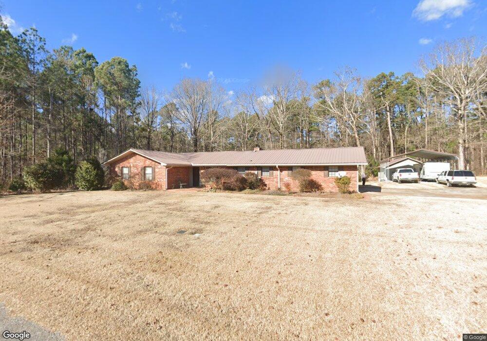
This home is located at 110 Robin Ln, Union, MS 39365 and is currently estimated at $135,802, approximately $91 per square foot. 110 Robin Ln is a home located in Neshoba County with nearby schools including Union Elementary School, Union Middle School, and Union High School.
Ownership History
Date
Name
Owned For
Owner Type
Purchase Details
Closed on
Jan 22, 2019
Sold by
Campbell Carter Yumecka C
Bought by
Barnes Cole Preston
Current Estimated Value
Home Financials for this Owner
Home Financials are based on the most recent Mortgage that was taken out on this home.
Original Mortgage
$50,431
Interest Rate
4.5%
Mortgage Type
FHA
Purchase Details
Closed on
Mar 8, 2007
Sold by
Mcnair Cedera Brown and Mcnair Ralph
Bought by
Campbell Yumecka C
Home Financials for this Owner
Home Financials are based on the most recent Mortgage that was taken out on this home.
Original Mortgage
$43,900
Interest Rate
6.17%
Mortgage Type
Purchase Money Mortgage
Create a Home Valuation Report for This Property
The Home Valuation Report is an in-depth analysis detailing your home's value as well as a comparison with similar homes in the area
Purchase History
| Date | Buyer | Sale Price | Title Company |
|---|---|---|---|
| Barnes Cole Preston | -- | -- | |
| Campbell Yumecka C | -- | -- |
Source: Public Records
Mortgage History
| Date | Status | Borrower | Loan Amount |
|---|---|---|---|
| Closed | Barnes Cole Preston | $50,431 | |
| Previous Owner | Campbell Yumecka C | $43,900 |
Source: Public Records
Tax History
| Year | Tax Paid | Tax Assessment Tax Assessment Total Assessment is a certain percentage of the fair market value that is determined by local assessors to be the total taxable value of land and additions on the property. | Land | Improvement |
|---|---|---|---|---|
| 2025 | $873 | $7,995 | $0 | $0 |
| 2024 | $880 | $7,995 | $0 | $0 |
| 2023 | $806 | $7,337 | $0 | $0 |
| 2022 | $821 | $7,337 | $0 | $0 |
| 2021 | $804 | $7,337 | $0 | $0 |
| 2020 | $796 | $7,337 | $0 | $0 |
| 2019 | $774 | $7,049 | $0 | $0 |
| 2018 | $758 | $7,049 | $0 | $0 |
| 2017 | $751 | $7,049 | $0 | $0 |
| 2016 | $753 | $7,049 | $0 | $0 |
| 2015 | -- | $6,991 | $0 | $0 |
| 2014 | -- | $6,991 | $0 | $0 |
Source: Public Records
Map
Nearby Homes
- 408 North St
- 0 North St
- 201 5th St
- 702 E Jackson Rd
- 704 E Jackson Rd
- 0 Mississippi 15
- 0 Lakeview Dr
- 26 Lakeview Dr
- 309 Conehatta Rd
- 12061 Highway 21 S
- Hwy 15 Union Unit MS 39365
- 327 Stamper Pond Rd
- 365 Stamper Pond Rd
- 10300 Road 286
- 4188 Greenland Rd
- 000 Greenland Rd
- 66 Pete Freeman Rd
- 3 County Road 347
- 2 County Road 347
- 19763 Mississippi 15
Your Personal Tour Guide
Ask me questions while you tour the home.