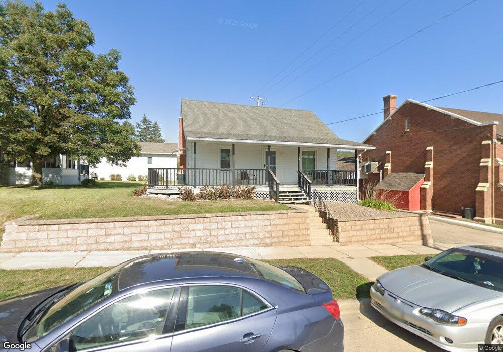
110 Spruce St NW Elkader, IA 52043
Estimated Value: $80,000 - $106,000
2
Beds
1
Bath
720
Sq Ft
$130/Sq Ft
Est. Value
About This Home
This home is located at 110 Spruce St NW, Elkader, IA 52043 and is currently estimated at $93,477, approximately $129 per square foot. 110 Spruce St NW is a home with nearby schools including Central Elementary School and Central Middle School/High School.
Ownership History
Date
Name
Owned For
Owner Type
Purchase Details
Closed on
Apr 6, 2016
Sold by
Hendrickson Robert A and Hendrickson Angela S
Bought by
Schroeder Christopher S and Schroeder Jody L
Current Estimated Value
Purchase Details
Closed on
Oct 27, 2011
Sold by
Siebrecht Jed J and Siebrecht Lori A
Bought by
Hendrickson Robert A
Home Financials for this Owner
Home Financials are based on the most recent Mortgage that was taken out on this home.
Original Mortgage
$35,200
Interest Rate
4.09%
Mortgage Type
New Conventional
Create a Home Valuation Report for This Property
The Home Valuation Report is an in-depth analysis detailing your home's value as well as a comparison with similar homes in the area
Home Values in the Area
Average Home Value in this Area
Purchase History
| Date | Buyer | Sale Price | Title Company |
|---|---|---|---|
| Schroeder Christopher S | $68,000 | None Available | |
| Hendrickson Robert A | $44,000 | None Available |
Source: Public Records
Mortgage History
| Date | Status | Borrower | Loan Amount |
|---|---|---|---|
| Previous Owner | Hendrickson Robert A | $35,200 |
Source: Public Records
Tax History Compared to Growth
Tax History
| Year | Tax Paid | Tax Assessment Tax Assessment Total Assessment is a certain percentage of the fair market value that is determined by local assessors to be the total taxable value of land and additions on the property. | Land | Improvement |
|---|---|---|---|---|
| 2025 | $1,548 | $72,835 | $8,354 | $64,481 |
| 2024 | $1,408 | $61,940 | $7,264 | $54,676 |
| 2023 | $1,300 | $61,940 | $7,264 | $54,676 |
| 2022 | $1,204 | $49,807 | $6,580 | $43,227 |
| 2021 | $1,086 | $49,807 | $6,580 | $43,227 |
| 2020 | $1,086 | $46,957 | $6,580 | $40,377 |
| 2019 | $1,022 | $46,957 | $6,580 | $40,377 |
| 2018 | $1,022 | $45,172 | $6,580 | $38,592 |
| 2017 | $1,006 | $45,172 | $6,580 | $38,592 |
| 2015 | $694 | $42,312 | $6,875 | $35,437 |
| 2014 | $694 | $42,312 | $6,875 | $35,437 |
Source: Public Records
Map
Nearby Homes
- 301 N 1st St
- 117 S Main St
- 209 2nd St SW
- 702 N Main St
- 302 N 3rd St
- 707 N Main St
- 0 E Bridge St
- 710 Woodland Dr NW
- 26642 Iowa 13
- 247 Franzen Ridge Rd
- 249 Franzen Ridge Rd
- 27766 Highway 13
- 0 13 Hwy Unit NBR20255145
- 27455 Harbor Rd
- 14149 Iowa 56
- 0 Grandview Rd
- TBD Country Rd
- 305 S Russell St
- TBD Birch Rd
- 108 Adams Ct