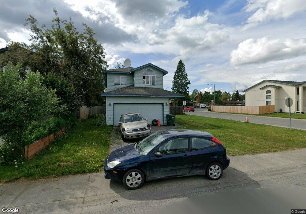
1100 Bentree Cir Anchorage, AK 99504
Northeast Anchorage NeighborhoodEstimated Value: $165,000 - $430,424
3
Beds
3
Baths
1,527
Sq Ft
$226/Sq Ft
Est. Value
About This Home
This home is located at 1100 Bentree Cir, Anchorage, AK 99504 and is currently estimated at $344,356, approximately $225 per square foot. 1100 Bentree Cir is a home located in Anchorage Municipality with nearby schools including Ptarmigan Elementary School, Clark Middle School, and Bartlett High School.
Ownership History
Date
Name
Owned For
Owner Type
Purchase Details
Closed on
Jan 1, 2001
Sold by
Lawson Paul
Bought by
Derek J Peterson Irrevocable Trust and National Bank Of Alaska
Current Estimated Value
Purchase Details
Closed on
Dec 29, 2000
Sold by
Lawson Paul
Bought by
National Bank Of Alaska and Derek J Peterson Irrevocable Trust
Create a Home Valuation Report for This Property
The Home Valuation Report is an in-depth analysis detailing your home's value as well as a comparison with similar homes in the area
Home Values in the Area
Average Home Value in this Area
Purchase History
| Date | Buyer | Sale Price | Title Company |
|---|---|---|---|
| Derek J Peterson Irrevocable Trust | -- | -- | |
| Derek J Peterson Irrevocable Trust | -- | -- | |
| National Bank Of Alaska | -- | Land Title |
Source: Public Records
Tax History Compared to Growth
Tax History
| Year | Tax Paid | Tax Assessment Tax Assessment Total Assessment is a certain percentage of the fair market value that is determined by local assessors to be the total taxable value of land and additions on the property. | Land | Improvement |
|---|---|---|---|---|
| 2025 | $4,532 | $378,200 | $89,500 | $288,700 |
| 2024 | $4,532 | $355,700 | $89,500 | $266,200 |
| 2023 | $4,351 | $330,500 | $89,500 | $241,000 |
| 2022 | $4,567 | $321,200 | $89,500 | $231,700 |
| 2021 | $5,208 | $289,000 | $89,500 | $199,500 |
| 2020 | $3,910 | $280,300 | $89,500 | $190,800 |
| 2019 | $3,742 | $278,700 | $89,500 | $189,200 |
| 2018 | $3,667 | $273,600 | $82,400 | $191,200 |
| 2017 | $4,145 | $284,700 | $82,400 | $202,300 |
| 2016 | $3,569 | $278,200 | $77,700 | $200,500 |
| 2015 | $3,569 | $272,400 | $77,700 | $194,700 |
| 2014 | $3,569 | $264,900 | $77,700 | $187,200 |
Source: Public Records
Map
Nearby Homes
- 6422 E 10th Ave Unit 16422
- 6229 Winding Way Unit 6
- 6124 E 12th Ave Unit D7
- 6119 E 12th Ave
- 6017 E 12th Ave
- 6615 E 11th Ave
- 910 Bench Ct
- 6811 E 11th Ave
- 6030 Staedem Dr
- 1406 Otter St
- Tr E Debarr Rd
- 6501 Donna Dr
- 1507 Elmendorf Dr
- 1410 Richardson Dr
- 1414 Marten St
- 1120 Ermine St
- 1601 Elmendorf Dr
- 6911 Mink Ave
- 706 Winter Haven St
- 305 Donna Dr Unit 38
- 1110 Bentree Cir
- L5 B2 Bentree Cir
- 1030 Bentree Cir
- 1120 Bentree Cir
- 6239 E 12th Ave
- 6239 E 12th Ave Unit 18
- 1101 Bentree Cir
- 1020 Bentree Cir
- 1111 Bentree Cir
- 1041 Bentree Cir
- 1145 Mila St
- 1130 Bentree Cir
- 1129 Mila St
- 1121 Bentree Cir
- L7 Bentree Cir
- L20 Bentree Cir
- L18 Bentree Cir
- L9 Bentree Cir
- 1131 Mila St
- 6237 E 12th Ave Unit 17