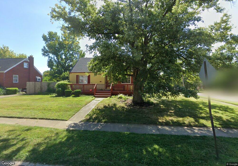
1100 Dalbren Ln Cincinnati, OH 45231
Finneytown NeighborhoodEstimated Value: $207,000 - $245,000
4
Beds
2
Baths
1,473
Sq Ft
$156/Sq Ft
Est. Value
About This Home
This home is located at 1100 Dalbren Ln, Cincinnati, OH 45231 and is currently estimated at $229,296, approximately $155 per square foot. 1100 Dalbren Ln is a home located in Hamilton County with nearby schools including Finneytown Elementary School, Finneytown Secondary Campus, and John Paul II Catholic School.
Ownership History
Date
Name
Owned For
Owner Type
Purchase Details
Closed on
Jul 23, 1999
Sold by
Grove Darroll D
Bought by
Grove Cathy S
Current Estimated Value
Purchase Details
Closed on
Aug 4, 1995
Sold by
Schroeder Rita L Sorge and Schroeder Michael
Bought by
Grove Darroll D and Grove Cathy S
Home Financials for this Owner
Home Financials are based on the most recent Mortgage that was taken out on this home.
Original Mortgage
$68,000
Interest Rate
7.56%
Purchase Details
Closed on
Sep 30, 1993
Sold by
Sorge Daniel E
Bought by
Sorge Rita L
Create a Home Valuation Report for This Property
The Home Valuation Report is an in-depth analysis detailing your home's value as well as a comparison with similar homes in the area
Home Values in the Area
Average Home Value in this Area
Purchase History
| Date | Buyer | Sale Price | Title Company |
|---|---|---|---|
| Grove Cathy S | -- | -- | |
| Grove Darroll D | -- | -- | |
| Sorge Rita L | -- | -- |
Source: Public Records
Mortgage History
| Date | Status | Borrower | Loan Amount |
|---|---|---|---|
| Closed | Grove Darroll D | $68,000 |
Source: Public Records
Tax History Compared to Growth
Tax History
| Year | Tax Paid | Tax Assessment Tax Assessment Total Assessment is a certain percentage of the fair market value that is determined by local assessors to be the total taxable value of land and additions on the property. | Land | Improvement |
|---|---|---|---|---|
| 2024 | $3,958 | $58,009 | $11,837 | $46,172 |
| 2023 | $3,892 | $58,009 | $11,837 | $46,172 |
| 2022 | $3,343 | $36,134 | $11,683 | $24,451 |
| 2021 | $3,280 | $36,134 | $11,683 | $24,451 |
| 2020 | $3,333 | $36,134 | $11,683 | $24,451 |
| 2019 | $3,061 | $30,622 | $9,902 | $20,720 |
| 2018 | $2,827 | $30,622 | $9,902 | $20,720 |
| 2017 | $2,694 | $30,622 | $9,902 | $20,720 |
| 2016 | $2,801 | $31,291 | $10,224 | $21,067 |
| 2015 | $2,818 | $31,291 | $10,224 | $21,067 |
| 2014 | $2,820 | $31,291 | $10,224 | $21,067 |
| 2013 | $2,872 | $32,939 | $10,763 | $22,176 |
Source: Public Records
Map
Nearby Homes
- 8925 Monsanto Dr
- 1100 Gracewind Ct
- 8950 Daly Rd
- 1190 Sugartree Ct
- 8831 Daly Rd
- 8772 Balboa Dr
- 8627 Mockingbird Ln
- 8622 Mockingbird Ln
- 8840 Grenada Dr
- 1013 Vacationland Dr
- 1151 Hempstead Dr
- 8734 Grenada Dr
- 958 Hollytree Dr
- 954 Hollytree Dr
- 1029 Bluejay Dr
- 8491 Daly Rd
- 8433 Jonfred Ct
- 8681 Desoto Dr
- 1031 Lost Crossing
- 1277 Prospect Place
- 1102 Dalbren Ln
- 1156 Madeleine Cir
- 1101 Dalbren Ln
- 1154 Madeleine Cir
- 1157 Tassie Ln
- 1159 Madeleine Cir
- 1157 Madeleine Cir
- 1149 Tassie Ln
- 1161 Madeleine Cir
- 1103 Dalbren Ln
- 1155 Madeleine Cir
- 1145 Tassie Ln
- 1161 Tassie Ln
- 1152 Madeleine Cir
- 1165 Madeleine Cir
- 1168 Madeleine Cir
- 1151 Madeleine Cir
- 1139 Tassie Ln
- 1167 Madeleine Cir
- 1167 Tassie Ln