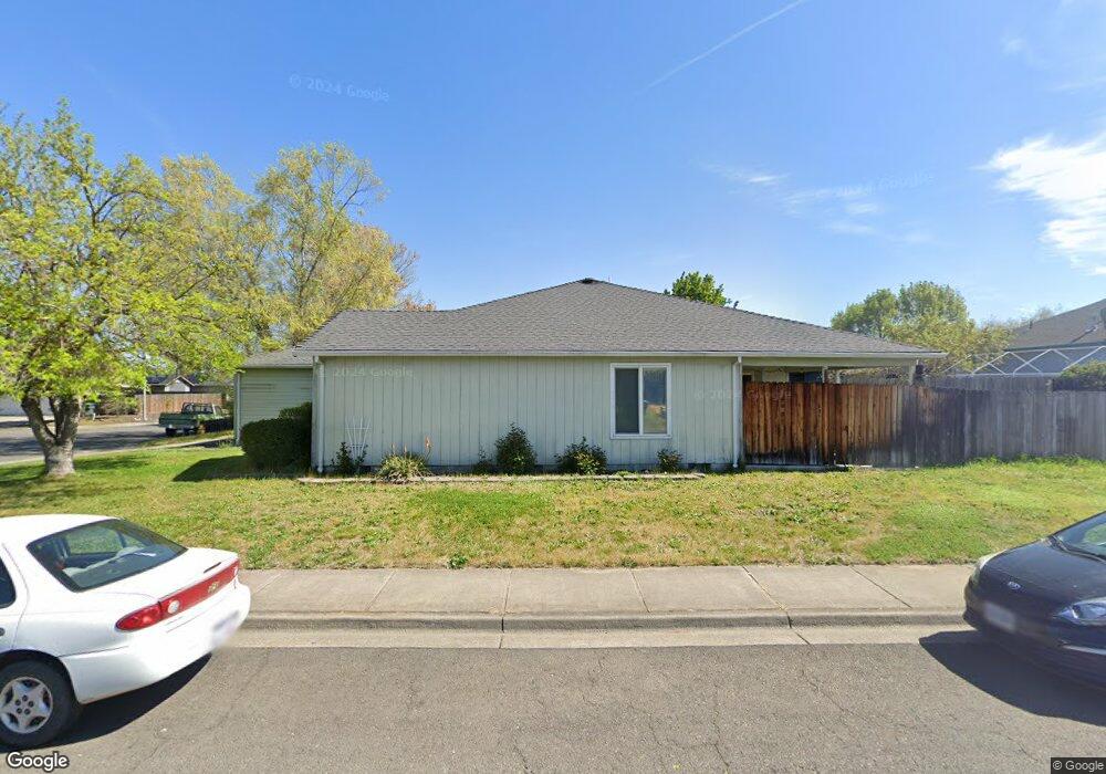
1100 Lathrop Dr Central Point, OR 97502
Estimated Value: $381,000 - $396,000
3
Beds
2
Baths
1,512
Sq Ft
$257/Sq Ft
Est. Value
About This Home
This home is located at 1100 Lathrop Dr, Central Point, OR 97502 and is currently estimated at $388,872, approximately $257 per square foot. 1100 Lathrop Dr is a home located in Jackson County with nearby schools including Jewett Elementary School, Scenic Middle School, and Crater High School.
Ownership History
Date
Name
Owned For
Owner Type
Purchase Details
Closed on
Dec 27, 2000
Sold by
Arana John A and Arana Jeanne L
Bought by
Arana Hazel M
Current Estimated Value
Purchase Details
Closed on
Apr 30, 1999
Sold by
Gifford Gale and Gifford Greg
Bought by
Arana John A and Arana Jeanne L
Home Financials for this Owner
Home Financials are based on the most recent Mortgage that was taken out on this home.
Original Mortgage
$106,450
Outstanding Balance
$27,323
Interest Rate
6.96%
Estimated Equity
$361,549
Create a Home Valuation Report for This Property
The Home Valuation Report is an in-depth analysis detailing your home's value as well as a comparison with similar homes in the area
Home Values in the Area
Average Home Value in this Area
Purchase History
| Date | Buyer | Sale Price | Title Company |
|---|---|---|---|
| Arana Hazel M | -- | -- | |
| Arana John A | $118,300 | Jackson County Title |
Source: Public Records
Mortgage History
| Date | Status | Borrower | Loan Amount |
|---|---|---|---|
| Open | Arana John A | $106,450 |
Source: Public Records
Tax History Compared to Growth
Tax History
| Year | Tax Paid | Tax Assessment Tax Assessment Total Assessment is a certain percentage of the fair market value that is determined by local assessors to be the total taxable value of land and additions on the property. | Land | Improvement |
|---|---|---|---|---|
| 2025 | $3,554 | $213,730 | $65,850 | $147,880 |
| 2024 | $3,554 | $207,510 | $63,930 | $143,580 |
| 2023 | $3,439 | $201,470 | $62,070 | $139,400 |
| 2022 | $3,359 | $201,470 | $62,070 | $139,400 |
| 2021 | $3,263 | $195,610 | $60,260 | $135,350 |
| 2020 | $3,168 | $189,920 | $58,510 | $131,410 |
| 2019 | $3,090 | $179,020 | $55,150 | $123,870 |
| 2018 | $2,996 | $173,810 | $53,540 | $120,270 |
| 2017 | $2,920 | $173,810 | $53,540 | $120,270 |
| 2016 | $2,835 | $163,840 | $50,470 | $113,370 |
| 2015 | $2,716 | $163,840 | $50,470 | $113,370 |
| 2014 | $2,647 | $154,440 | $47,570 | $106,870 |
Source: Public Records
Map
Nearby Homes
- 920 N 10th St
- 1010 N 3rd St
- 4035 Rock Way
- 0 Peninger Rd
- 4626 N Pacific Hwy
- 741 Hazel St
- 833 Hazel St
- 905 Comet Ave
- 55 Crater Ln
- 356 Marian Ave Unit 40
- 405 N 9th St
- 327 Brookhaven Dr
- 335 Applewood Dr
- 431 N 5th St
- 342 Hazel St
- 1167 Boulder Ridge St
- 426 Bridge Creek Dr
- 546 Laurel St
- 144 N 5th St
- 845 Manzanita St
- 1110 Lathrop Dr
- 1040 Lathrop Dr
- 1039 Iris Cir
- 1120 Lathrop Dr Unit 49
- 1120 Lathrop Dr
- 1045 Lathrop Dr
- 1043 Lathrop Dr
- 1101 Lathrop Dr
- 1047 Lathrop Dr
- 1037 Iris Cir
- 1041 Lathrop Dr
- 1130 Lathrop Dr Unit 50
- 1130 Lathrop Dr
- 1210 Daisy Cir
- 1051 Lathrop Dr Unit 26
- 1051 Lathrop Dr
- 1049 Lathrop Dr Unit 27
- 1049 Lathrop Dr
- 1035 Iris Cir
- 1031 Lathrop Dr