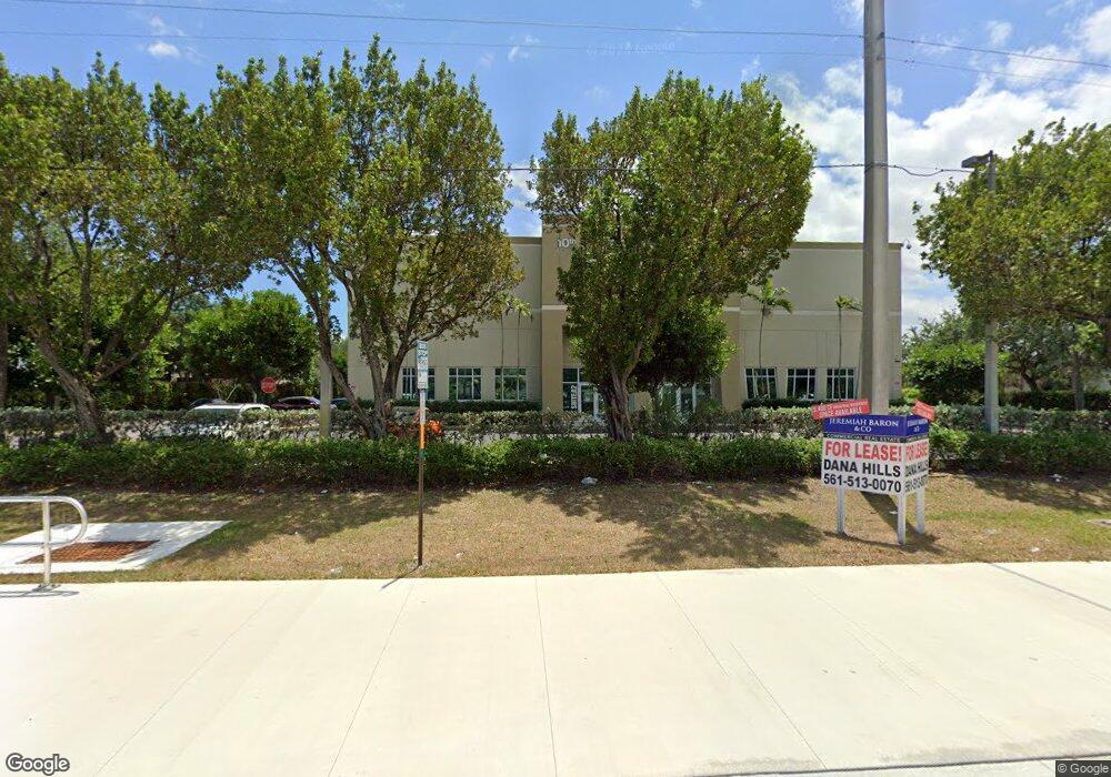
1100 SW 10th St Unit L Delray Beach, FL 33444
Downtown Delray Beach NeighborhoodEstimated Value: $1,232,950
--
Bed
--
Bath
3,714
Sq Ft
$332/Sq Ft
Est. Value
About This Home
This home is located at 1100 SW 10th St Unit L, Delray Beach, FL 33444 and is currently estimated at $1,232,950, approximately $331 per square foot. 1100 SW 10th St Unit L is a home located in Palm Beach County with nearby schools including Pine Grove Elementary School, Carver Middle School, and Atlantic High School.
Ownership History
Date
Name
Owned For
Owner Type
Purchase Details
Closed on
Mar 25, 2022
Sold by
H & S Development Group Inc
Bought by
Rbds Holdings Llc
Current Estimated Value
Home Financials for this Owner
Home Financials are based on the most recent Mortgage that was taken out on this home.
Original Mortgage
$562,500
Outstanding Balance
$528,430
Interest Rate
4.42%
Mortgage Type
Balloon
Estimated Equity
$704,520
Create a Home Valuation Report for This Property
The Home Valuation Report is an in-depth analysis detailing your home's value as well as a comparison with similar homes in the area
Home Values in the Area
Average Home Value in this Area
Purchase History
| Date | Buyer | Sale Price | Title Company |
|---|---|---|---|
| Rbds Holdings Llc | $1,125,000 | Ochoa & Rubio Pa |
Source: Public Records
Mortgage History
| Date | Status | Borrower | Loan Amount |
|---|---|---|---|
| Open | Rbds Holdings Llc | $562,500 | |
| Closed | Rbds Holdings Llc | $450,000 |
Source: Public Records
Tax History Compared to Growth
Tax History
| Year | Tax Paid | Tax Assessment Tax Assessment Total Assessment is a certain percentage of the fair market value that is determined by local assessors to be the total taxable value of land and additions on the property. | Land | Improvement |
|---|---|---|---|---|
| 2024 | $13,106 | $673,948 | -- | -- |
| 2023 | $13,527 | $672,518 | $322,599 | $349,919 |
| 2022 | $9,913 | $452,988 | $0 | $0 |
| 2021 | $9,111 | $411,807 | $144,543 | $267,264 |
| 2020 | $9,185 | $412,641 | $144,543 | $268,098 |
| 2019 | $8,880 | $391,994 | $137,671 | $254,323 |
| 2018 | $8,554 | $384,507 | $133,653 | $250,854 |
| 2017 | $8,592 | $377,909 | $133,653 | $244,256 |
| 2016 | $8,371 | $357,721 | $0 | $0 |
| 2015 | $8,075 | $331,871 | $0 | $0 |
| 2014 | -- | $304,265 | $0 | $0 |
Source: Public Records
Map
Nearby Homes
- 1022 SW 9th Ave
- 1111 SW 8th St
- 619 SW 10th St
- 713 SW 9th Ct
- 2470 Douglas Ave
- 15764 SW 8th Ave
- 517 SW 10th St
- 702 SW 7th St
- 509 SW 10th St
- 2484 Southridge Rd
- 524 Southridge Rd
- 520 SW 15th Terrace
- 937 SW 20th Ct Unit 5
- 2315 Zeder Ave
- 2311 Zeder Ave
- 821 SW 4th Ave
- 2291 Linton Ridge Cir Unit B4
- 645 SW 20th Ct Unit 8C
- 2339 Linton Ridge Cir Unit E6
- 417 SW 8th Ave
- 1100 SW 10th St Unit H
- 1100 SW 10th St Unit I
- 929 SW 11th Terrace
- 930 SW 11th Terrace
- 925 SW 11th Terrace
- 926 SW 11th Ave
- 1180 SW 10th St
- 926 SW 11th Terrace
- 955 SW 12th Ave
- 927 SW 11th Ave
- 921 SW 11th Terrace
- 922 SW 11th Ave
- 922 SW 11th Terrace
- 1015 SW 10th St
- 925 SW 11th Ave
- 925 SW 12th Ave
- 930 SW 10th Ave
- 917 SW 11th Terrace
- 921 SW 11th Ave
- 918 SW 11th Ave