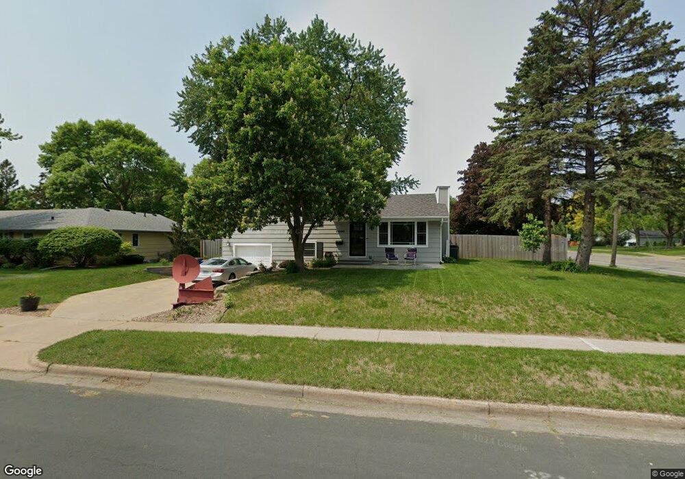
11000 Quinn Ave S Bloomington, MN 55437
West Bloomington NeighborhoodEstimated Value: $345,000 - $375,000
3
Beds
2
Baths
1,072
Sq Ft
$336/Sq Ft
Est. Value
About This Home
This home is located at 11000 Quinn Ave S, Bloomington, MN 55437 and is currently estimated at $360,204, approximately $336 per square foot. 11000 Quinn Ave S is a home located in Hennepin County with nearby schools including Westwood Elementary School, Oak Grove Middle School, and Jefferson Senior High School.
Ownership History
Date
Name
Owned For
Owner Type
Purchase Details
Closed on
Nov 12, 2008
Sold by
Hsbc Bank Usa
Bought by
Magoffin Lori A and Magoffin John A
Current Estimated Value
Purchase Details
Closed on
Jan 17, 2006
Sold by
Lonsbary John E
Bought by
Kikhamsouk Vivian and Keophothisane Venehay
Purchase Details
Closed on
Feb 28, 2005
Sold by
Pryor Kevin J
Bought by
Lonsbury John E
Purchase Details
Closed on
Jun 30, 1999
Sold by
Joneski Thomas A
Bought by
Pryor Kevin J and Pryor Michelle C
Create a Home Valuation Report for This Property
The Home Valuation Report is an in-depth analysis detailing your home's value as well as a comparison with similar homes in the area
Home Values in the Area
Average Home Value in this Area
Purchase History
| Date | Buyer | Sale Price | Title Company |
|---|---|---|---|
| Magoffin Lori A | $156,900 | -- | |
| Kikhamsouk Vivian | $244,900 | -- | |
| Lonsbury John E | $210,000 | -- | |
| Pryor Kevin J | $115,000 | -- |
Source: Public Records
Mortgage History
| Date | Status | Borrower | Loan Amount |
|---|---|---|---|
| Closed | Magoffin Lori A | -- |
Source: Public Records
Tax History Compared to Growth
Tax History
| Year | Tax Paid | Tax Assessment Tax Assessment Total Assessment is a certain percentage of the fair market value that is determined by local assessors to be the total taxable value of land and additions on the property. | Land | Improvement |
|---|---|---|---|---|
| 2024 | $3,866 | $314,000 | $142,600 | $171,400 |
| 2023 | $3,831 | $325,200 | $153,800 | $171,400 |
| 2022 | $3,204 | $320,700 | $151,000 | $169,700 |
| 2021 | $2,905 | $262,000 | $128,000 | $134,000 |
| 2020 | $3,089 | $242,200 | $124,400 | $117,800 |
| 2019 | $2,824 | $249,400 | $124,400 | $125,000 |
| 2018 | $2,743 | $226,700 | $124,200 | $102,500 |
| 2017 | $2,553 | $204,300 | $111,500 | $92,800 |
| 2016 | $2,582 | $197,100 | $103,200 | $93,900 |
| 2015 | $2,501 | $185,400 | $100,100 | $85,300 |
| 2014 | -- | $169,000 | $97,100 | $71,900 |
Source: Public Records
Map
Nearby Homes
- 4725 W 110th St
- 10916 Oxborough Ave S
- 4600 Morris Ln
- 5100 Balmoral Ln
- 11024 Little Ave S
- 11115 Vessey Cir
- 10726 Toledo Ct
- 5275 Balmoral Ln
- 11250 Vessey Ave S
- 5410 W Old Shakopee Cir
- 11252 Vessey Ave S
- 10616 Johnson Rd
- 5392 W Old Shakopee Cir
- 4816 Overlook Dr
- 11341 Kell Rd
- 11416 Kell Rd
- 11313 Xavier Rd
- 11509 Palmer Rd
- 10600 Normandale Blvd
- 4653 Heritage Hills Cir
- 11008 Quinn Ave S
- 5017 W 110th St
- 11016 Quinn Ave S
- 5025 W 110th St
- 11001 Quinn Ave S
- 11009 Quinn Ave S
- 5000 W 110th St
- 5008 W 110th St
- 11017 Quinn Ave S
- 5016 W 110th St
- 11024 Quinn Ave S
- 5024 W 110th St
- 11017 Stanley Curve
- 5101 W 110th St
- 11025 Quinn Ave S
- 4909 W 110th St
- 10940 Quinn Ave S
- 11100 Quinn Ave S
- 4920 W 110th St
- 11015 Stanley Curve