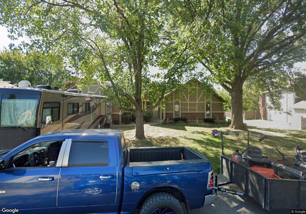
1101 Brookside Ct Raymore, MO 64083
Estimated Value: $261,000 - $339,000
3
Beds
2
Baths
1,539
Sq Ft
$199/Sq Ft
Est. Value
About This Home
This home is located at 1101 Brookside Ct, Raymore, MO 64083 and is currently estimated at $306,343, approximately $199 per square foot. 1101 Brookside Ct is a home located in Cass County with nearby schools including Eagle Glen Intermediate School, Raymore-Peculiar East Middle School, and Raymore-Peculiar Senior High School.
Ownership History
Date
Name
Owned For
Owner Type
Purchase Details
Closed on
May 29, 2015
Sold by
Riggert Joyce A
Bought by
Riggert Tad W and Riggert Teri S
Current Estimated Value
Home Financials for this Owner
Home Financials are based on the most recent Mortgage that was taken out on this home.
Original Mortgage
$148,500
Outstanding Balance
$114,068
Interest Rate
3.68%
Mortgage Type
New Conventional
Estimated Equity
$192,275
Create a Home Valuation Report for This Property
The Home Valuation Report is an in-depth analysis detailing your home's value as well as a comparison with similar homes in the area
Home Values in the Area
Average Home Value in this Area
Purchase History
| Date | Buyer | Sale Price | Title Company |
|---|---|---|---|
| Riggert Tad W | -- | None Available |
Source: Public Records
Mortgage History
| Date | Status | Borrower | Loan Amount |
|---|---|---|---|
| Open | Riggert Tad W | $148,500 |
Source: Public Records
Tax History
| Year | Tax Paid | Tax Assessment Tax Assessment Total Assessment is a certain percentage of the fair market value that is determined by local assessors to be the total taxable value of land and additions on the property. | Land | Improvement |
|---|---|---|---|---|
| 2025 | $2,572 | $35,570 | $3,460 | $32,110 |
| 2024 | $2,572 | $31,600 | $3,150 | $28,450 |
| 2023 | $2,568 | $31,600 | $3,150 | $28,450 |
| 2022 | $2,288 | $27,970 | $3,150 | $24,820 |
| 2021 | $2,289 | $27,970 | $3,150 | $24,820 |
| 2020 | $2,245 | $26,950 | $3,150 | $23,800 |
| 2019 | $2,167 | $26,950 | $3,150 | $23,800 |
| 2018 | $1,991 | $23,910 | $2,520 | $21,390 |
| 2017 | $1,712 | $23,910 | $2,520 | $21,390 |
| 2016 | $1,712 | $21,340 | $2,520 | $18,820 |
| 2015 | $1,713 | $21,340 | $2,520 | $18,820 |
| 2014 | $1,714 | $21,340 | $2,520 | $18,820 |
| 2013 | -- | $21,340 | $2,520 | $18,820 |
Source: Public Records
Map
Nearby Homes
- 113 N Eastglen Dr
- 1105 Brookside Place
- 1206 Johnston Dr
- 105 N Landcaster Dr
- 201 Johnston Dr
- 110 S Westglen Dr
- 205 Johnston Pkwy
- 108 Rainbow Cir
- 208 N Pacific Ct
- 205 N Pacific Ct
- 701 Hampstead Dr
- 411 Eagle Glen Dr
- 1206 W Lucy Webb Rd
- 1601 Stasi Ave
- 1108 Yokley Dr
- 1608 Cody Dr
- 615 N Conway St
- 215 Scott Dr
- 0 Scott Dr
- 1412 W Stone Blvd
- 1024 Brookside Dr
- 1103 Brookside Ct
- 1113 Brookside Ct
- 1026 Brookside Dr
- 1102 Johnston Dr
- 1018 Johnston Dr
- 1102 Brookside Ct
- 1105 Brookside Ct
- 1104 Johnston Dr
- 1025 Brookside Dr
- 1023 Brookside Dr
- 1028 Brookside Dr
- 1020 Brookside Dr
- 1016 Johnston Dr
- 1106 Brookside Ct
- 1027 Brookside Dr
- 1104 Brookside Ct
- 1021 Brookside Dr
- 101 S Silver Top Ln
- 107 N Eastglen Dr
Your Personal Tour Guide
Ask me questions while you tour the home.