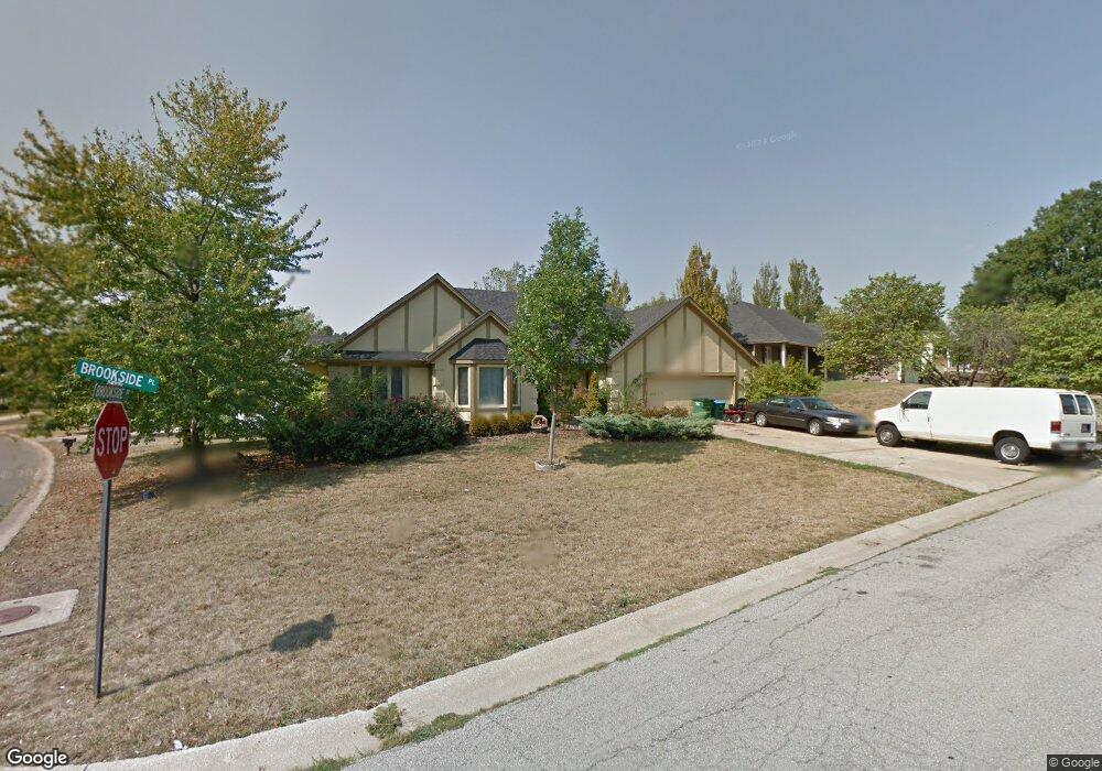
1101 Brookside Place Raymore, MO 64083
Estimated Value: $307,000 - $454,000
4
Beds
3
Baths
1,797
Sq Ft
$206/Sq Ft
Est. Value
About This Home
This home is located at 1101 Brookside Place, Raymore, MO 64083 and is currently estimated at $370,717, approximately $206 per square foot. 1101 Brookside Place is a home located in Cass County with nearby schools including Eagle Glen Intermediate School, Raymore-Peculiar East Middle School, and Raymore-Peculiar Senior High School.
Ownership History
Date
Name
Owned For
Owner Type
Purchase Details
Closed on
Jan 3, 2018
Sold by
Morin Paulette S and Morin Reid
Bought by
Smith Paula A and Smith Albert P
Current Estimated Value
Home Financials for this Owner
Home Financials are based on the most recent Mortgage that was taken out on this home.
Original Mortgage
$184,000
Interest Rate
3.32%
Mortgage Type
New Conventional
Purchase Details
Closed on
Nov 18, 2010
Sold by
Ehrich Suzette E
Bought by
Smith Paulette S
Home Financials for this Owner
Home Financials are based on the most recent Mortgage that was taken out on this home.
Original Mortgage
$181,528
Interest Rate
4.22%
Mortgage Type
FHA
Create a Home Valuation Report for This Property
The Home Valuation Report is an in-depth analysis detailing your home's value as well as a comparison with similar homes in the area
Home Values in the Area
Average Home Value in this Area
Purchase History
| Date | Buyer | Sale Price | Title Company |
|---|---|---|---|
| Smith Paula A | -- | None Available | |
| Smith Paulette S | -- | -- |
Source: Public Records
Mortgage History
| Date | Status | Borrower | Loan Amount |
|---|---|---|---|
| Previous Owner | Smith Paula A | $184,000 | |
| Previous Owner | Smith Paulette S | $181,528 |
Source: Public Records
Tax History
| Year | Tax Paid | Tax Assessment Tax Assessment Total Assessment is a certain percentage of the fair market value that is determined by local assessors to be the total taxable value of land and additions on the property. | Land | Improvement |
|---|---|---|---|---|
| 2025 | $3,081 | $43,250 | $3,870 | $39,380 |
| 2024 | $3,081 | $37,860 | $3,520 | $34,340 |
| 2023 | $3,077 | $37,860 | $3,520 | $34,340 |
| 2022 | $2,737 | $33,450 | $3,520 | $29,930 |
| 2021 | $2,737 | $33,450 | $3,520 | $29,930 |
| 2020 | $2,674 | $32,100 | $3,520 | $28,580 |
| 2019 | $2,581 | $32,100 | $3,520 | $28,580 |
| 2018 | $2,373 | $28,500 | $2,820 | $25,680 |
| 2017 | $2,176 | $28,500 | $2,820 | $25,680 |
| 2016 | $2,176 | $27,120 | $2,820 | $24,300 |
| 2015 | $2,177 | $27,120 | $2,820 | $24,300 |
| 2014 | $2,178 | $27,120 | $2,820 | $24,300 |
| 2013 | -- | $27,120 | $2,820 | $24,300 |
Source: Public Records
Map
Nearby Homes
- 1105 Brookside Place
- 113 N Eastglen Dr
- 105 N Landcaster Dr
- 205 Johnston Pkwy
- 208 N Pacific Ct
- 701 Hampstead Dr
- 205 N Pacific Ct
- 809 Stratford Dr
- 108 Rainbow Cir
- 110 S Westglen Dr
- 112 S Westglen Dr
- 615 N Conway St
- 1601 Stasi Ave
- 411 Eagle Glen Dr
- 1412 W Stone Blvd
- 503 N Jenkins Blvd
- 215 Scott Dr
- 1010 Wiltshire Blvd
- 0 Scott Dr
- 308 N Woodson Dr
- 1103 Brookside Place
- 1016 Brookside Dr
- 1010 Brookside Dr
- 1013 Brookside Dr
- 1015 Brookside Dr
- 1102 W Glendale Dr
- 1011 Brookside Dr
- 1102 Brookside Place
- 1017 Brookside Dr
- 1107 Brookside Place
- 1008 Brookside Dr
- 1104 W Glendale Dr
- 1104 Brookside Place
- 1009 Brookside Dr
- 1019 Brookside Dr
- 1101 W Glendale Dr
- 1008 Silver Lake Dr
- 1103 W Glendale Dr
- 1106 Brookside Place
- 1010 Silver Lake Dr
Your Personal Tour Guide
Ask me questions while you tour the home.