Estimated Value: $232,457 - $676,000
Studio
--
Bath
2,018
Sq Ft
$254/Sq Ft
Est. Value
About This Home
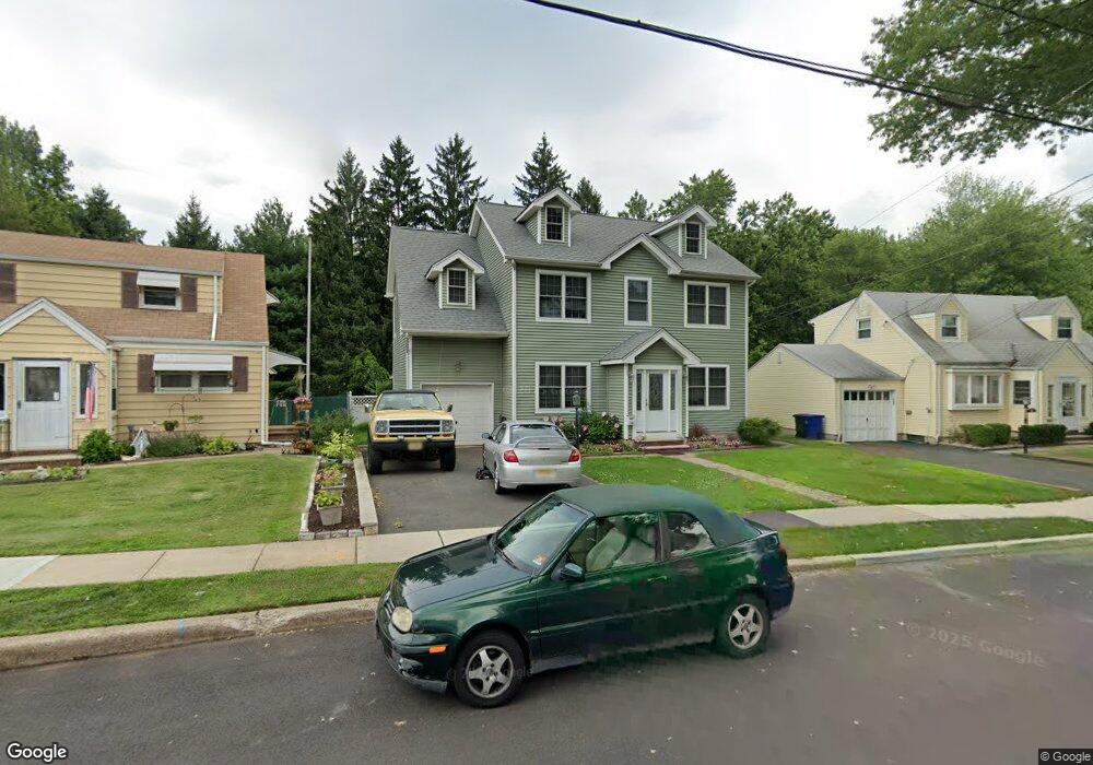
This home is located at 1101 Cranbrook Rd, Union, NJ 07083 and is currently estimated at $512,364, approximately $253 per square foot. 1101 Cranbrook Rd is a home located in Union County with nearby schools including Livingston Elementary School, Union High School, and St Michael Parish School.
Ownership History
Date
Name
Owned For
Owner Type
Purchase Details
Closed on
Jan 31, 2020
Sold by
Deller Karen
Bought by
Seidof Frederick C
Current Estimated Value
Home Financials for this Owner
Home Financials are based on the most recent Mortgage that was taken out on this home.
Original Mortgage
$290,000
Interest Rate
3.4%
Mortgage Type
New Conventional
Purchase Details
Closed on
Jan 30, 2002
Sold by
Metzger Dorothy
Bought by
Seidof Frederick and Diller Karen
Home Financials for this Owner
Home Financials are based on the most recent Mortgage that was taken out on this home.
Original Mortgage
$106,550
Interest Rate
7.13%
Mortgage Type
FHA
Purchase Details
Closed on
Jun 26, 1997
Sold by
Kozlowsky Theodore P and Kozlowsky Joanne
Bought by
Metzger Dorothy and Deller Carol A
Create a Home Valuation Report for This Property
The Home Valuation Report is an in-depth analysis detailing your home's value as well as a comparison with similar homes in the area
Home Values in the Area
Average Home Value in this Area
Purchase History
| Date | Buyer | Sale Price | Title Company |
|---|---|---|---|
| Seidof Frederick C | $97,500 | Servcelink | |
| Seidof Frederick | $185,000 | -- | |
| Metzger Dorothy | $149,000 | -- |
Source: Public Records
Mortgage History
| Date | Status | Borrower | Loan Amount |
|---|---|---|---|
| Previous Owner | Seidof Frederick C | $290,000 | |
| Previous Owner | Seidof Frederick | $106,550 |
Source: Public Records
Tax History
| Year | Tax Paid | Tax Assessment Tax Assessment Total Assessment is a certain percentage of the fair market value that is determined by local assessors to be the total taxable value of land and additions on the property. | Land | Improvement |
|---|---|---|---|---|
| 2025 | $12,427 | $55,600 | $20,400 | $35,200 |
| 2024 | $12,048 | $55,600 | $20,400 | $35,200 |
| 2023 | $12,048 | $55,600 | $20,400 | $35,200 |
| 2022 | $11,629 | $55,600 | $20,400 | $35,200 |
| 2021 | $11,347 | $55,600 | $20,400 | $35,200 |
| 2020 | $11,121 | $55,600 | $20,400 | $35,200 |
| 2019 | $10,972 | $55,600 | $20,400 | $35,200 |
| 2018 | $10,785 | $55,600 | $20,400 | $35,200 |
| 2017 | $10,625 | $55,600 | $20,400 | $35,200 |
| 2016 | $10,366 | $55,600 | $20,400 | $35,200 |
| 2015 | $10,194 | $55,600 | $20,400 | $35,200 |
| 2014 | $9,966 | $55,600 | $20,400 | $35,200 |
Source: Public Records
Map
Nearby Homes
- 1250 Erhardt St
- 1453 Morris Ave
- 1611 N Sunset Place
- 1218 Schmidt Ave
- 1841 Cider Mill Rd
- 1393 Cornell Place
- 1801 Quaker Way
- 1239 Victor Ave
- 120 Parkside Dr
- 1779 Oak Hill Dr
- 1263 Coolidge Ave
- 950 Carteret Ave
- 987 Floyd Terrace
- 1011 Adams Ave
- 1272 Robinson Terrace
- 401 Burroughs Terrace
- 552 Paul St Unit 8
- 564 Chapman St
- 321 Sherwood Rd
- 1244 Grandview Ave
- 1105 Cranbrook Rd
- 1097 Cranbrook Rd
- 1109 Cranbrook Rd
- 1093 Cranbrook Rd
- 1050 Field Rd
- 1089 Cranbrook Rd
- 1113 Cranbrook Rd
- 1104 Cranbrook Rd
- 1086 Cranbrook Rd
- 1085 Cranbrook Rd
- 1117 Cranbrook Rd
- 1110 Cranbrook Rd
- 1043 Field Rd
- 1081 Cranbrook Rd
- 1121 Cranbrook Rd
- 1080 Cranbrook Rd
- 1116 Cranbrook Rd
- 1038 Field Rd
- 1039 Field Rd
- 1125 Cranbrook Rd
Your Personal Tour Guide
Ask me questions while you tour the home.