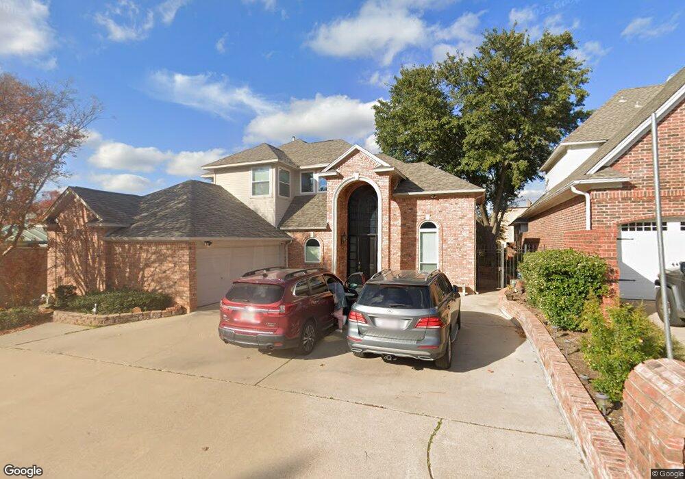
1101 Sandestin Dr Denton, TX 76205
South Denton NeighborhoodEstimated Value: $475,751 - $570,000
3
Beds
3
Baths
3,049
Sq Ft
$174/Sq Ft
Est. Value
About This Home
This home is located at 1101 Sandestin Dr, Denton, TX 76205 and is currently estimated at $531,188, approximately $174 per square foot. 1101 Sandestin Dr is a home located in Denton County with nearby schools including Houston Elementary School, McMath Middle School, and Denton High School.
Ownership History
Date
Name
Owned For
Owner Type
Purchase Details
Closed on
Oct 31, 2019
Sold by
Stucky Mellina G and Gassaway Turner F
Bought by
Ukhun Imeine and Ukhun Cynthia
Current Estimated Value
Home Financials for this Owner
Home Financials are based on the most recent Mortgage that was taken out on this home.
Original Mortgage
$318,250
Outstanding Balance
$280,533
Interest Rate
3.7%
Mortgage Type
New Conventional
Estimated Equity
$250,655
Purchase Details
Closed on
Dec 21, 2017
Sold by
Gassaway Ii Turner F and Gassaway Turner F
Bought by
Stucky Mellina G and Gassaway Turner F
Purchase Details
Closed on
Oct 28, 1999
Sold by
Lawrence Ben R and Carolyn Lawrence M
Bought by
Gassaway Ii Turner F
Create a Home Valuation Report for This Property
The Home Valuation Report is an in-depth analysis detailing your home's value as well as a comparison with similar homes in the area
Home Values in the Area
Average Home Value in this Area
Purchase History
| Date | Buyer | Sale Price | Title Company |
|---|---|---|---|
| Ukhun Imeine | -- | None Available | |
| Stucky Mellina G | -- | None Available | |
| Gassaway Ii Turner F | -- | -- |
Source: Public Records
Mortgage History
| Date | Status | Borrower | Loan Amount |
|---|---|---|---|
| Open | Ukhun Imeine | $318,250 |
Source: Public Records
Tax History Compared to Growth
Tax History
| Year | Tax Paid | Tax Assessment Tax Assessment Total Assessment is a certain percentage of the fair market value that is determined by local assessors to be the total taxable value of land and additions on the property. | Land | Improvement |
|---|---|---|---|---|
| 2025 | $4,641 | $441,496 | $110,250 | $331,246 |
| 2024 | $8,569 | $443,969 | $0 | $0 |
| 2023 | $4,647 | $403,608 | $110,250 | $399,456 |
| 2022 | $7,789 | $366,916 | $110,250 | $377,831 |
| 2021 | $7,415 | $337,740 | $63,000 | $274,740 |
| 2020 | $6,931 | $303,236 | $63,000 | $240,236 |
| 2019 | $7,369 | $308,834 | $63,000 | $245,834 |
| 2018 | $7,516 | $311,121 | $63,000 | $248,121 |
| 2017 | $6,831 | $276,356 | $56,700 | $243,896 |
| 2016 | $6,210 | $251,233 | $56,700 | $195,350 |
| 2015 | $3,698 | $228,394 | $56,700 | $171,694 |
| 2013 | -- | $212,423 | $50,400 | $162,023 |
Source: Public Records
Map
Nearby Homes
- 1108 Ellison Park Cir
- 1012 Indian Ridge Dr
- 720 Smokerise Cir
- 816 Chapel Dr
- 916 Smokerise Cir
- 2000 Lamprey Cir
- 824 Sandpiper Dr
- 821 Sandpiper Dr
- 2009 Lake Fork Ct
- 1000 Lynhurst Ln
- 829 Skylark Dr
- 2008 Moonsail Ln
- 3432 Sundown Blvd
- 2209 Loon Lake Rd
- 2226 Savannah Trail
- 2216 Jefferson Trail
- 2312 Caddo Cir
- 1313 Lorelei Ln
- 3601 Montecito Dr
- 3601 Monte Carlo Ln
- 1105 Sandestin Dr
- 2901 Pennsylvania Dr
- 1109 Sandestin Dr
- 1113 Sandestin Dr
- 2904 Destin Dr
- 2907 Pennsylvania Dr
- 1117 Sandestin Dr
- 1101 Southmont Dr
- 2904 Pennsylvania Dr
- 1115 Southmont Dr
- 1121 Sandestin Dr
- 2908 Pennsylvania Dr
- 2901 Destin Dr
- 2900 Pennsylvania Dr
- 2905 Destin Dr
- 2909 Destin Dr
- 1008 Southmont Dr
- 1108 Southmont Dr
- 1104 Southmont Dr
- 1100 Southmont Dr