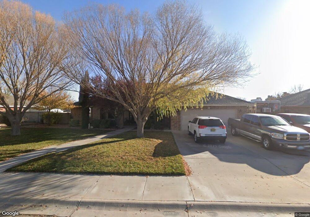
1101 Saunders Dr Roswell, NM 88201
Estimated Value: $345,364 - $388,000
3
Beds
2
Baths
2,371
Sq Ft
$156/Sq Ft
Est. Value
About This Home
This home is located at 1101 Saunders Dr, Roswell, NM 88201 and is currently estimated at $368,841, approximately $155 per square foot. 1101 Saunders Dr is a home located in Chaves County with nearby schools including Military Heights Elementary School, Berrendo Middle School, and Goddard High School.
Ownership History
Date
Name
Owned For
Owner Type
Purchase Details
Closed on
Mar 28, 2024
Sold by
Rico Barbara Ann
Bought by
Rico Tommy and Rico Barbara Ann
Current Estimated Value
Purchase Details
Closed on
Sep 2, 2015
Sold by
Rodriguez Rodney and Mcknight Sonya A
Bought by
Jpmorgan Chase Bank Na
Purchase Details
Closed on
May 31, 2008
Sold by
Rodgiguez Rodney
Bought by
Rodriguz Rodney and Mcknight Sonya A
Home Financials for this Owner
Home Financials are based on the most recent Mortgage that was taken out on this home.
Original Mortgage
$270,954
Interest Rate
6.07%
Mortgage Type
FHA
Purchase Details
Closed on
Sep 6, 2006
Sold by
Roswell Escrow Services Inc
Bought by
Dennnis William C and Dennnis Carol
Create a Home Valuation Report for This Property
The Home Valuation Report is an in-depth analysis detailing your home's value as well as a comparison with similar homes in the area
Home Values in the Area
Average Home Value in this Area
Purchase History
| Date | Buyer | Sale Price | Title Company |
|---|---|---|---|
| Rico Tommy | -- | None Listed On Document | |
| Jpmorgan Chase Bank Na | -- | None Available | |
| Rodriguz Rodney | -- | None Available | |
| Dennnis William C | -- | Landamerica Lawyers Title Of |
Source: Public Records
Mortgage History
| Date | Status | Borrower | Loan Amount |
|---|---|---|---|
| Previous Owner | Rodriguz Rodney | $270,954 |
Source: Public Records
Tax History Compared to Growth
Tax History
| Year | Tax Paid | Tax Assessment Tax Assessment Total Assessment is a certain percentage of the fair market value that is determined by local assessors to be the total taxable value of land and additions on the property. | Land | Improvement |
|---|---|---|---|---|
| 2025 | $2,764 | $104,754 | $10,333 | $94,421 |
| 2024 | $2,764 | $54,821 | $10,333 | $44,488 |
| 2023 | $2,817 | $100,348 | $10,306 | $90,042 |
| 2022 | $2,677 | $96,257 | $10,296 | $85,961 |
| 2021 | $2,657 | $93,454 | $10,288 | $83,166 |
| 2020 | $2,579 | $90,732 | $10,105 | $80,627 |
| 2019 | $2,500 | $88,090 | $9,674 | $78,416 |
| 2018 | $2,423 | $85,524 | $9,333 | $76,191 |
| 2017 | $2,383 | $84,892 | $9,333 | $75,559 |
| 2016 | $2,395 | $86,165 | $9,333 | $76,832 |
| 2015 | $2,590 | $84,698 | $9,333 | $75,365 |
| 2014 | $5,056 | $82,659 | $9,333 | $73,326 |
Source: Public Records
Map
Nearby Homes
- 1006 de Bremond Dr
- 1201 Saunders Dr
- 906 Pearson Dr
- 805 Mason Dr
- 3207 Dow Dr
- 3203 Highland Rd
- 3109 Riverside Dr
- 2803 W 8th St
- 708 N Sycamore Ave
- 2607 Riverside Dr
- 307 N Sycamore Ave
- 00002 N Sycamore Ave
- 00001 N Sycamore Ave
- 205 Pima Dr
- 00 S Balsam Ave
- 7 Oak Dr
- 4608 W 2nd St
- 2116 W 1st St
- 6399 W 2nd St
- 412 S Pine Ave
- 1005 Saunders Dr
- 1103 Saunders Dr
- 1008 Mullis St
- 1006 Mullis St
- 1008 Saunders Dr
- 1102 Saunders Dr
- 1003 Saunders Dr
- 1006 Saunders Dr
- 1104 Saunders Dr
- 3500 Bradley Dr
- 1004 Mullis St
- 1004 Mullis Ave
- 1001 Saunders Dr
- 1004 Saunders Dr
- 1202 Saunders Dr
- 1202 Mullis St
- 1101 Le Ann Dr
- 1005 Mullis St
- 1003 Mullis Ave