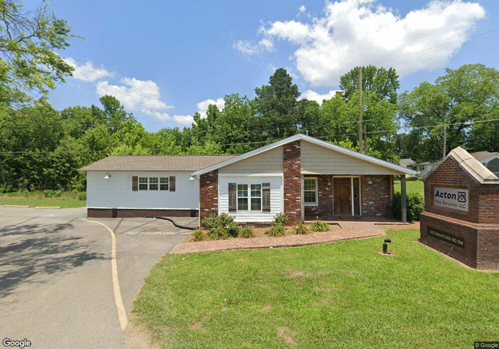
1101 Swafford Rd SW Cullman, AL 35055
Estimated Value: $310,335
--
Bed
1
Bath
1,634
Sq Ft
$190/Sq Ft
Est. Value
About This Home
This home is located at 1101 Swafford Rd SW, Cullman, AL 35055 and is currently estimated at $310,335, approximately $189 per square foot. 1101 Swafford Rd SW is a home located in Cullman County with nearby schools including Cullman City Primary School, Cullman Middle School, and Cullman High School.
Ownership History
Date
Name
Owned For
Owner Type
Purchase Details
Closed on
Jun 13, 2022
Sold by
Johnson and Jazmine
Bought by
Acton Title Services Llc
Current Estimated Value
Home Financials for this Owner
Home Financials are based on the most recent Mortgage that was taken out on this home.
Original Mortgage
$285,000
Outstanding Balance
$270,695
Interest Rate
5.23%
Mortgage Type
New Conventional
Estimated Equity
$39,640
Create a Home Valuation Report for This Property
The Home Valuation Report is an in-depth analysis detailing your home's value as well as a comparison with similar homes in the area
Home Values in the Area
Average Home Value in this Area
Purchase History
| Date | Buyer | Sale Price | Title Company |
|---|---|---|---|
| Acton Title Services Llc | $270,000 | Jackson & Williams |
Source: Public Records
Mortgage History
| Date | Status | Borrower | Loan Amount |
|---|---|---|---|
| Open | Acton Title Services Llc | $285,000 | |
| Previous Owner | Acton Title Services Llc | $83,244 |
Source: Public Records
Tax History Compared to Growth
Tax History
| Year | Tax Paid | Tax Assessment Tax Assessment Total Assessment is a certain percentage of the fair market value that is determined by local assessors to be the total taxable value of land and additions on the property. | Land | Improvement |
|---|---|---|---|---|
| 2025 | $2,238 | $58,120 | $0 | $0 |
| 2024 | $2,247 | $58,360 | $0 | $0 |
| 2023 | $2,247 | $58,420 | $0 | $0 |
| 2022 | $1,601 | $41,580 | $0 | $0 |
| 2021 | $1,364 | $35,420 | $0 | $0 |
| 2020 | $793 | $20,600 | $0 | $0 |
| 2019 | $873 | $22,680 | $0 | $0 |
| 2018 | $873 | $22,680 | $0 | $0 |
| 2017 | $1,018 | $26,440 | $0 | $0 |
| 2016 | $1,018 | $26,440 | $0 | $0 |
| 2014 | $1,018 | $26,440 | $0 | $0 |
Source: Public Records
Map
Nearby Homes
- 1109 Swafford Rd SW
- 0 Miller St SW
- 1113 James St SW
- 911 Olive St SW
- 4701 County Road 437 Unit Lot 3
- 4701 County Road 437 Unit Lot 2
- 4701 County Road 437
- 4701 County Road 437 Unit Lot 1
- 4701 County Road 437 Unit Lot 4
- .5 Acres County Road 437
- 2036 Larry Ave SW
- 1203 Morningside Dr SW
- The Freeport Plan at Ellsworth
- The Aldridge Plan at Ellsworth
- The Elston Plan at Ellsworth
- The Robie Plan at Ellsworth
- The Taylor Plan at Ellsworth
- 2122 Addison Way SW
- 2124 Addison Way SW
- 2126 Addison Way
- 0 Swafford Road&cherokee
- 1949 Main Ave SW
- 1945 Main Ave SW
- 0 Swafford Rd SW Unit 1 21387616
- 0 Swafford Rd SW Unit 513550
- 0 Swafford Rd SW Unit 1795263
- 0 Swafford Rd SW Unit 502241
- 0 Swafford Rd SW Unit 380959
- 0 Swafford Rd SW Unit 381477
- 0 Swafford Rd SW Unit 383759
- 0 Swafford Rd SW Unit 382398
- 0 Swafford Rd SW Unit 376765
- 0 Swafford Rd SW Unit 383025
- 0 Swafford Rd SW Unit 427156
- 0 Swafford Rd SW Unit 428151
- 0 Swafford Rd SW Unit 27010 1280608
- 0 Swafford Rd SW Unit 1 1277471
- 0 Swafford Rd SW
- 2000 Main Ave SW
- 1115 Swafford Rd SW