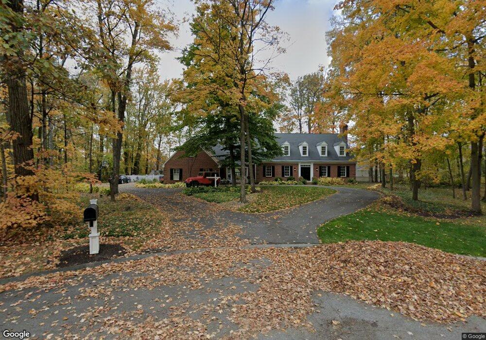
11017 Hickory Branch Ct Fort Wayne, IN 46845
Estimated Value: $509,000 - $543,000
4
Beds
3
Baths
4,009
Sq Ft
$131/Sq Ft
Est. Value
About This Home
This home is located at 11017 Hickory Branch Ct, Fort Wayne, IN 46845 and is currently estimated at $523,610, approximately $130 per square foot. 11017 Hickory Branch Ct is a home located in Allen County with nearby schools including Oak View Elementary School, Maple Creek Middle School, and Carroll High School.
Ownership History
Date
Name
Owned For
Owner Type
Purchase Details
Closed on
Dec 28, 2007
Sold by
Gross S Eugene and Gross Beth Ann
Bought by
Neal Joshua C and Neal Amber J
Current Estimated Value
Home Financials for this Owner
Home Financials are based on the most recent Mortgage that was taken out on this home.
Original Mortgage
$244,000
Outstanding Balance
$154,898
Interest Rate
6.27%
Mortgage Type
Purchase Money Mortgage
Estimated Equity
$368,712
Purchase Details
Closed on
Jan 27, 2003
Sold by
Laux Ronald L and Laux Pamela A
Bought by
Gross S Eugene and Gross Beth Ann
Create a Home Valuation Report for This Property
The Home Valuation Report is an in-depth analysis detailing your home's value as well as a comparison with similar homes in the area
Home Values in the Area
Average Home Value in this Area
Purchase History
| Date | Buyer | Sale Price | Title Company |
|---|---|---|---|
| Neal Joshua C | -- | Lawyers Title | |
| Gross S Eugene | -- | Three Rivers Title Company I |
Source: Public Records
Mortgage History
| Date | Status | Borrower | Loan Amount |
|---|---|---|---|
| Open | Neal Joshua C | $244,000 |
Source: Public Records
Tax History Compared to Growth
Tax History
| Year | Tax Paid | Tax Assessment Tax Assessment Total Assessment is a certain percentage of the fair market value that is determined by local assessors to be the total taxable value of land and additions on the property. | Land | Improvement |
|---|---|---|---|---|
| 2024 | $5,126 | $537,800 | $38,400 | $499,400 |
| 2023 | $5,121 | $494,900 | $38,400 | $456,500 |
| 2022 | $4,518 | $434,100 | $38,400 | $395,700 |
| 2021 | $4,006 | $382,700 | $38,400 | $344,300 |
| 2020 | $3,712 | $353,100 | $38,400 | $314,700 |
| 2019 | $3,727 | $354,500 | $38,400 | $316,100 |
| 2018 | $3,348 | $326,400 | $38,400 | $288,000 |
| 2017 | $3,143 | $314,300 | $38,400 | $275,900 |
| 2016 | $3,114 | $311,400 | $38,400 | $273,000 |
| 2014 | $2,779 | $277,900 | $38,400 | $239,500 |
| 2013 | $2,667 | $266,700 | $38,400 | $228,300 |
Source: Public Records
Map
Nearby Homes
- 704 Oaktree Ct
- 1228 Holly Ridge Run
- 10614 Alderwood Ln
- 11020 Windsor Woods Blvd
- 1326 Bluff Pointe Way
- 1421 Holly Ridge Run
- 10638 Lantern Bay Cove
- 10428 Maple Springs Cove
- 12060 Painted Peak Cove
- 12146 Firekat Cove
- 12012 Kimball Run
- 10832 Lone Eagle Way
- 10717 Wild Ridge Place
- 12202 Shearwater Run
- 9804 Oak Trail Rd
- 708 Perolla Dr
- 1923 Sweet Cider Rd
- 12331 Jacobas Place
- 11688 Talis Park Way
- 394 Carrara Cove
- 916 Rollingwood Ln
- 927 Hemingford Ct
- 915 Hemingford Ct
- 11025 Hickory Branch Ct
- 933 Hemingford Ct
- 909 Hemingford Ct
- 1008 Rollingwood Ln
- 939 Hemingford Ct
- 11010 Hickory Branch Ct
- 903 Hemingford Ct
- 920 Hemingford Ct
- 926 Hemingford Ct
- 1005 Hemingford Ct
- 914 Hemingford Ct
- 917 Rollingwood Ln
- 938 Hemingford Ct
- 908 Hemingford Ct
- 1020 Rollingwood Ln
- 1011 Hemingford Ct
- 828 Rollingwood Ln