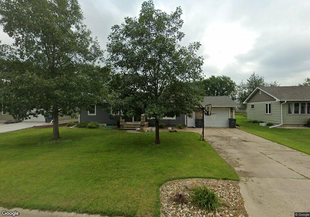
1102 9th Ave Rock Valley, IA 51247
Estimated Value: $158,000 - $241,000
--
Bed
1
Bath
1,144
Sq Ft
$182/Sq Ft
Est. Value
About This Home
This home is located at 1102 9th Ave, Rock Valley, IA 51247 and is currently estimated at $208,152, approximately $181 per square foot. 1102 9th Ave is a home located in Sioux County with nearby schools including Rock Valley Elementary School, Rock Valley Middle School, and Rock Valley Junior/Senior High School.
Ownership History
Date
Name
Owned For
Owner Type
Purchase Details
Closed on
Jan 14, 2022
Sold by
Molly Hengeveld
Bought by
Peoples Bank
Current Estimated Value
Home Financials for this Owner
Home Financials are based on the most recent Mortgage that was taken out on this home.
Original Mortgage
$151,725
Outstanding Balance
$139,834
Interest Rate
3.11%
Mortgage Type
New Conventional
Estimated Equity
$68,319
Create a Home Valuation Report for This Property
The Home Valuation Report is an in-depth analysis detailing your home's value as well as a comparison with similar homes in the area
Home Values in the Area
Average Home Value in this Area
Purchase History
| Date | Buyer | Sale Price | Title Company |
|---|---|---|---|
| Peoples Bank | -- | None Listed On Document | |
| Hengeveld Molly K | $178,500 | None Listed On Document | |
| Hengeveld Molly K | $178,500 | None Listed On Document |
Source: Public Records
Mortgage History
| Date | Status | Borrower | Loan Amount |
|---|---|---|---|
| Open | Hengeveld Molly K | $151,725 | |
| Closed | Hengeveld Molly K | $151,725 |
Source: Public Records
Tax History Compared to Growth
Tax History
| Year | Tax Paid | Tax Assessment Tax Assessment Total Assessment is a certain percentage of the fair market value that is determined by local assessors to be the total taxable value of land and additions on the property. | Land | Improvement |
|---|---|---|---|---|
| 2025 | $3,184 | $222,240 | $21,240 | $201,000 |
| 2024 | $3,184 | $192,050 | $21,240 | $170,810 |
| 2023 | $3,116 | $192,050 | $21,240 | $170,810 |
| 2022 | $2,278 | $161,510 | $21,240 | $140,270 |
| 2021 | $2,416 | $148,440 | $21,240 | $127,200 |
| 2020 | $2,416 | $141,240 | $21,240 | $120,000 |
| 2019 | $2,228 | $128,170 | $13,520 | $114,650 |
| 2018 | $2,178 | $128,170 | $13,520 | $114,650 |
| 2017 | $2,178 | $128,170 | $13,520 | $114,650 |
| 2014 | $1,770 | $105,540 | $0 | $0 |
Source: Public Records
Map
Nearby Homes