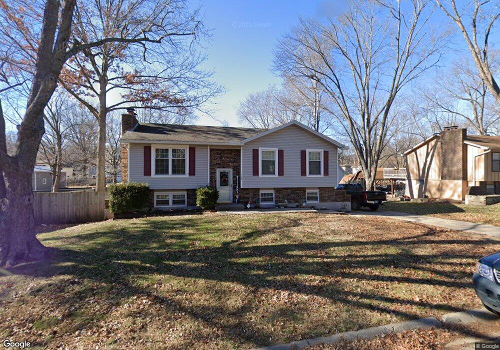
1102 Ada St Kearney, MO 64060
Estimated Value: $232,112 - $245,000
3
Beds
2
Baths
1,002
Sq Ft
$241/Sq Ft
Est. Value
About This Home
This home is located at 1102 Ada St, Kearney, MO 64060 and is currently estimated at $241,778, approximately $241 per square foot. 1102 Ada St is a home located in Clay County with nearby schools including Kearney Junior High School, Kearney High School, and Northern Hills Christian Academy.
Ownership History
Date
Name
Owned For
Owner Type
Purchase Details
Closed on
Nov 30, 2000
Sold by
Phillips John Michael
Bought by
Singh Gurdev and Singh Krista Deann
Current Estimated Value
Home Financials for this Owner
Home Financials are based on the most recent Mortgage that was taken out on this home.
Original Mortgage
$99,849
Outstanding Balance
$37,166
Interest Rate
7.84%
Mortgage Type
FHA
Estimated Equity
$204,612
Purchase Details
Closed on
Jun 17, 1998
Sold by
Porter Vernon L
Bought by
Phillips John Michael
Home Financials for this Owner
Home Financials are based on the most recent Mortgage that was taken out on this home.
Original Mortgage
$63,200
Interest Rate
7.17%
Create a Home Valuation Report for This Property
The Home Valuation Report is an in-depth analysis detailing your home's value as well as a comparison with similar homes in the area
Home Values in the Area
Average Home Value in this Area
Purchase History
| Date | Buyer | Sale Price | Title Company |
|---|---|---|---|
| Singh Gurdev | -- | First American Title Ins Co | |
| Phillips John Michael | -- | United Title Company |
Source: Public Records
Mortgage History
| Date | Status | Borrower | Loan Amount |
|---|---|---|---|
| Open | Singh Gurdev | $99,849 | |
| Previous Owner | Phillips John Michael | $63,200 |
Source: Public Records
Tax History
| Year | Tax Paid | Tax Assessment Tax Assessment Total Assessment is a certain percentage of the fair market value that is determined by local assessors to be the total taxable value of land and additions on the property. | Land | Improvement |
|---|---|---|---|---|
| 2025 | $1,871 | $29,720 | -- | -- |
| 2024 | $1,871 | $27,300 | -- | -- |
| 2023 | $1,865 | $27,300 | $0 | $0 |
| 2022 | $1,627 | $23,030 | $0 | $0 |
| 2021 | $1,594 | $23,028 | $3,800 | $19,228 |
| 2020 | $1,663 | $21,850 | $0 | $0 |
| 2019 | $1,654 | $21,850 | $0 | $0 |
Source: Public Records
Map
Nearby Homes
- 200 E 10th St
- 1304 S Jefferson St
- 1300 Robin Cir
- 1202 Noah Ln
- 1204 Noah's Ln
- 1209 Noah's Ln
- 623 E 13th St
- 1404 Colony Dr
- 901 Pine Crest Ave
- 905 Susan St
- Parcel C State Route 92
- 307 W 11th Terrace
- 1302 Regency Dr
- 819 Susan St
- 1104 Regency Dr
- 1307 Stonecrest Dr
- 1505 Emerald Cir
- 919 E 8th Cir
- 801 Southbrook Pkwy
- 201 S Marimack Dr
Your Personal Tour Guide
Ask me questions while you tour the home.