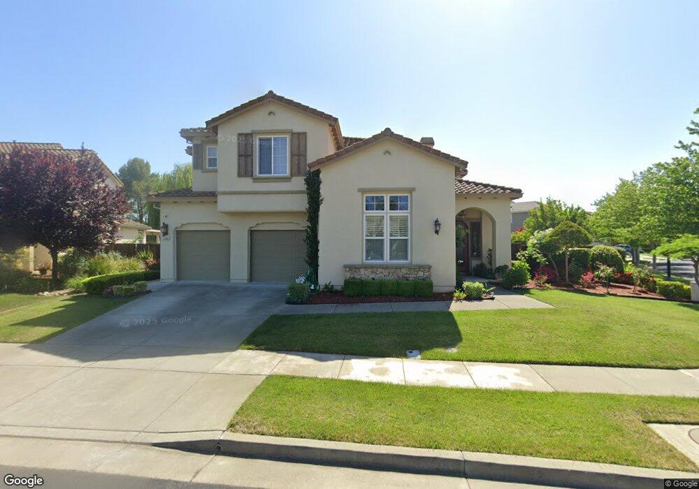
1102 Bunker Ct Fairfield, CA 94533
Estimated Value: $943,000 - $1,114,000
5
Beds
5
Baths
3,681
Sq Ft
$279/Sq Ft
Est. Value
About This Home
This home is located at 1102 Bunker Ct, Fairfield, CA 94533 and is currently estimated at $1,026,802, approximately $278 per square foot. 1102 Bunker Ct is a home located in Solano County with nearby schools including Rolling Hills Elementary School, Fairfield High School, and Fairfield Christian School.
Ownership History
Date
Name
Owned For
Owner Type
Purchase Details
Closed on
Apr 7, 2008
Sold by
Chaffee Ernest R and Chaffee Rose E
Bought by
Harrinauth Prakash and Harrinauth Denise
Current Estimated Value
Home Financials for this Owner
Home Financials are based on the most recent Mortgage that was taken out on this home.
Original Mortgage
$135,000
Interest Rate
5.7%
Mortgage Type
Unknown
Purchase Details
Closed on
Oct 19, 2006
Sold by
First American Title Co
Bought by
Chaffee Ernest R and Chaffee Rose S
Home Financials for this Owner
Home Financials are based on the most recent Mortgage that was taken out on this home.
Original Mortgage
$142,750
Interest Rate
6.16%
Mortgage Type
Stand Alone Second
Create a Home Valuation Report for This Property
The Home Valuation Report is an in-depth analysis detailing your home's value as well as a comparison with similar homes in the area
Home Values in the Area
Average Home Value in this Area
Purchase History
| Date | Buyer | Sale Price | Title Company |
|---|---|---|---|
| Harrinauth Prakash | $690,000 | Chicago Title Company | |
| Chaffee Ernest R | $952,000 | First American Title Co |
Source: Public Records
Mortgage History
| Date | Status | Borrower | Loan Amount |
|---|---|---|---|
| Closed | Harrinauth Prakash | $135,000 | |
| Open | Harrinauth Prakash | $417,000 | |
| Previous Owner | Chaffee Ernest R | $142,750 | |
| Previous Owner | Chaffee Ernest R | $761,450 |
Source: Public Records
Tax History
| Year | Tax Paid | Tax Assessment Tax Assessment Total Assessment is a certain percentage of the fair market value that is determined by local assessors to be the total taxable value of land and additions on the property. | Land | Improvement |
|---|---|---|---|---|
| 2025 | $10,733 | $906,318 | $275,833 | $630,485 |
| 2024 | $10,733 | $888,548 | $270,425 | $618,123 |
| 2023 | $10,420 | $871,126 | $265,123 | $606,003 |
| 2022 | $10,045 | $854,046 | $259,925 | $594,121 |
| 2021 | $8,921 | $747,000 | $171,000 | $576,000 |
| 2020 | $8,667 | $692,000 | $166,000 | $526,000 |
| 2019 | $8,715 | $700,000 | $168,000 | $532,000 |
| 2018 | $8,964 | $685,000 | $171,000 | $514,000 |
| 2017 | $8,970 | $676,000 | $175,000 | $501,000 |
| 2016 | $8,768 | $653,000 | $176,000 | $477,000 |
| 2015 | $8,258 | $643,000 | $174,000 | $469,000 |
| 2014 | $9,157 | $717,000 | $194,000 | $523,000 |
Source: Public Records
Map
Nearby Homes
- 4595 Avondale Cir
- 624 Emerald Hills Cir
- 4124 Singletree Way
- 3896 Doral Dr
- 4017 The Masters Dr Unit 1
- 702 Racoon Ct
- 738 Marsh Place
- 3280 Mustang Cir
- 2456 Shore Vista
- 3276 Arroyo Dr
- 3265 Arroyo Dr
- 3862 Clay Bank Rd
- 497 Americano Way
- 989 Suffolk Way
- 1031 Suffolk Way
- 445 Lakehurst Ct
- 2924 Redwood Dr
- 793 Marigold Dr
- 3005 Marigold Dr
- 1175 Hickory Ave
- 1106 Bunker Ct
- 4501 Avondale Cir
- 4497 Avondale Cir
- 1110 Bunker Ct
- 4500 Avondale Cir
- 4503 Avondale Cir
- 4496 Avondale Cir
- 4508 Avondale Cir
- 4493 Avondale Cir
- 4510 Avondale Cir
- 4481 Avondale Cir
- 1005 Almaden Ct
- 4514 Avondale Cir
- 1013 Almaden Ct
- 1009 Almaden Ct
- 4477 Avondale Cir
- 1050 Winterwood Dr
- 1042 Winterwood Dr
- 4518 Avondale Cir
Your Personal Tour Guide
Ask me questions while you tour the home.