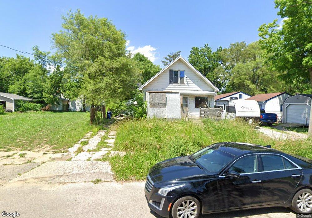
1102 Pinehurst Ave Flint, MI 48507
South Side NeighborhoodEstimated Value: $35,000 - $44,933
3
Beds
1
Bath
960
Sq Ft
$41/Sq Ft
Est. Value
About This Home
This home is located at 1102 Pinehurst Ave, Flint, MI 48507 and is currently estimated at $39,483, approximately $41 per square foot. 1102 Pinehurst Ave is a home located in Genesee County with nearby schools including Neithercut Elementary School, Flint Southwestern Classical Academy, and International Academy of Flint (K-12).
Ownership History
Date
Name
Owned For
Owner Type
Purchase Details
Closed on
Dec 16, 2025
Sold by
Chil Alyen
Bought by
Abreu Diego I Hernandez
Current Estimated Value
Purchase Details
Closed on
Dec 9, 2025
Sold by
Aagr Llc and Gomez Aniuska
Bought by
Chil Alyen
Purchase Details
Closed on
Dec 3, 2025
Sold by
Agle Tom and Agle Sandy
Bought by
Aagr Llc
Purchase Details
Closed on
Oct 27, 2004
Sold by
Agle Thomas and Agle Sandy
Bought by
Agle Tom and Agle Sandy
Create a Home Valuation Report for This Property
The Home Valuation Report is an in-depth analysis detailing your home's value as well as a comparison with similar homes in the area
Home Values in the Area
Average Home Value in this Area
Purchase History
| Date | Buyer | Sale Price | Title Company |
|---|---|---|---|
| Abreu Diego I Hernandez | $35,000 | None Listed On Document | |
| Chil Alyen | $30,000 | None Listed On Document | |
| Aagr Llc | $10,000 | Dream Title & Escrow | |
| Aagr Llc | $10,000 | Dream Title & Escrow | |
| Agle Tom | -- | Ati Title Company Agency |
Source: Public Records
Tax History
| Year | Tax Paid | Tax Assessment Tax Assessment Total Assessment is a certain percentage of the fair market value that is determined by local assessors to be the total taxable value of land and additions on the property. | Land | Improvement |
|---|---|---|---|---|
| 2025 | $1,042 | $17,600 | $0 | $0 |
| 2024 | $967 | $18,100 | $0 | $0 |
| 2023 | $947 | $14,500 | $0 | $0 |
| 2022 | $0 | $11,600 | $0 | $0 |
| 2021 | $959 | $10,400 | $0 | $0 |
| 2020 | $885 | $10,400 | $0 | $0 |
| 2019 | $867 | $10,600 | $0 | $0 |
| 2018 | $851 | $9,400 | $0 | $0 |
| 2017 | $830 | $0 | $0 | $0 |
| 2016 | $825 | $0 | $0 | $0 |
| 2015 | -- | $0 | $0 | $0 |
| 2014 | -- | $0 | $0 | $0 |
| 2012 | -- | $11,600 | $0 | $0 |
Source: Public Records
Map
Nearby Homes
- 1122 Markham St
- 1210 Pinehurst Ave
- 1318 Ingleside Ave
- 1234 Huron St
- 1310 Huron St
- 1310 Alvord Ave
- 912 Huron St
- 846 W Hemphill Rd
- 1627 Blackberry Ln
- 845 Alvord Ave
- 1028 Campbell St
- 1826 Greenbrook Ln
- 805 Alvord Ave
- 4502 Huckleberry Ln
- 1410 Berrywood Ln
- 806 Alvord Ave
- 1130 W Atherton Rd
- 1902 Crestbrook Ln
- 842 Leland St
- 717 Huron St
- 1046 Pinehurst Ave
- 1110 Pinehurst Ave
- 1042 Pinehurst Ave
- 1105 Ingleside Ave
- 1118 Pinehurst Ave
- 1043 Ingleside Ave
- 1109 Ingleside Ave
- 1036 Pinehurst Ave
- 1039 Ingleside Ave
- 1101 Pinehurst Ave
- 1105 Pinehurst Ave
- 1115 Ingleside Ave
- 1122 Pinehurst Ave
- 1113 Pinehurst Ave
- 1035 Ingleside Ave
- 1028 Pinehurst Ave
- 1123 Ingleside Ave
- 1117 Pinehurst Ave
- 1043 Pinehurst Ave
- 1035 Pinehurst Ave
Your Personal Tour Guide
Ask me questions while you tour the home.