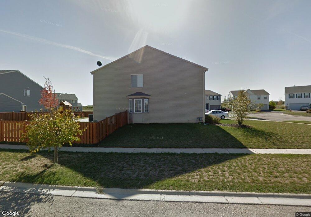
1102 Port Royal Rd Pingree Grove, IL 60140
Estimated Value: $450,781 - $468,000
--
Bed
1
Bath
3,075
Sq Ft
$149/Sq Ft
Est. Value
About This Home
This home is located at 1102 Port Royal Rd, Pingree Grove, IL 60140 and is currently estimated at $457,445, approximately $148 per square foot. 1102 Port Royal Rd is a home located in Kane County with nearby schools including Hampshire Middle School, Hampshire High School, and Cambridge Lakes Charter School.
Ownership History
Date
Name
Owned For
Owner Type
Purchase Details
Closed on
Sep 6, 2006
Sold by
Drh Cambridge Homes Inc
Bought by
Perez Juan J and Thorne Lourdes H
Current Estimated Value
Home Financials for this Owner
Home Financials are based on the most recent Mortgage that was taken out on this home.
Original Mortgage
$301,017
Outstanding Balance
$179,983
Interest Rate
6.59%
Mortgage Type
Purchase Money Mortgage
Estimated Equity
$277,462
Create a Home Valuation Report for This Property
The Home Valuation Report is an in-depth analysis detailing your home's value as well as a comparison with similar homes in the area
Home Values in the Area
Average Home Value in this Area
Purchase History
| Date | Buyer | Sale Price | Title Company |
|---|---|---|---|
| Perez Juan J | $317,000 | First American Title |
Source: Public Records
Mortgage History
| Date | Status | Borrower | Loan Amount |
|---|---|---|---|
| Open | Perez Juan J | $301,017 |
Source: Public Records
Tax History Compared to Growth
Tax History
| Year | Tax Paid | Tax Assessment Tax Assessment Total Assessment is a certain percentage of the fair market value that is determined by local assessors to be the total taxable value of land and additions on the property. | Land | Improvement |
|---|---|---|---|---|
| 2024 | $10,249 | $133,352 | $30,777 | $102,575 |
| 2023 | $9,948 | $120,593 | $27,832 | $92,761 |
| 2022 | $9,611 | $111,187 | $25,661 | $85,526 |
| 2021 | $9,370 | $104,578 | $24,136 | $80,442 |
| 2020 | $9,214 | $101,908 | $23,520 | $78,388 |
| 2019 | $9,033 | $97,810 | $22,574 | $75,236 |
| 2018 | $8,800 | $91,797 | $21,186 | $70,611 |
| 2017 | $8,615 | $87,417 | $20,175 | $67,242 |
| 2016 | $8,579 | $83,223 | $19,207 | $64,016 |
| 2015 | -- | $78,601 | $18,140 | $60,461 |
| 2014 | -- | $76,091 | $15,630 | $60,461 |
| 2013 | -- | $77,486 | $15,917 | $61,569 |
Source: Public Records
Map
Nearby Homes
- 1157 Clearwater Dr
- 1173 Sonoma Ct
- 1286 Newport Cir
- 1385 Broadland Dr
- 1641 Sandcastle Ln
- 1701 Windward Dr
- 1192 Alta Vista Dr
- 1740 Spinnaker St
- 955 Emerald Dr
- 898 Emerald Dr
- 932 Clover Ln
- 1840 Spinnaker St
- 1929 Diamond Head Trail
- 1482 Hollow Tree Ln
- 1731 Dempsey Cir
- 700 Brighton Dr
- 562 Lancaster Dr
- Lot 019 Old Stage Rd
- 560 Canterbury Ln
- 460 Lancaster Dr
- 1106 Port Royal Rd
- 1084 Port Royal Rd
- 1110 Port Royal Rd
- 1103 Port Royal Rd
- 1093 Port Royal Rd
- 1064 Port Royal Rd
- 1113 Port Royal Rd
- 1083 Port Royal Rd
- 1386 Padre Island Ln
- 1123 Port Royal Rd
- 1398 Padre Island Ln
- 1126 Port Royal Rd
- 1073 Port Royal Rd
- 1114 Port Royal Rd
- 1046 Port Royal Rd
- 1410 Padre Island Ln
- 1133 Port Royal Rd Unit 10
- 1122 Port Royal Rd
- 1422 Padre Island Ln