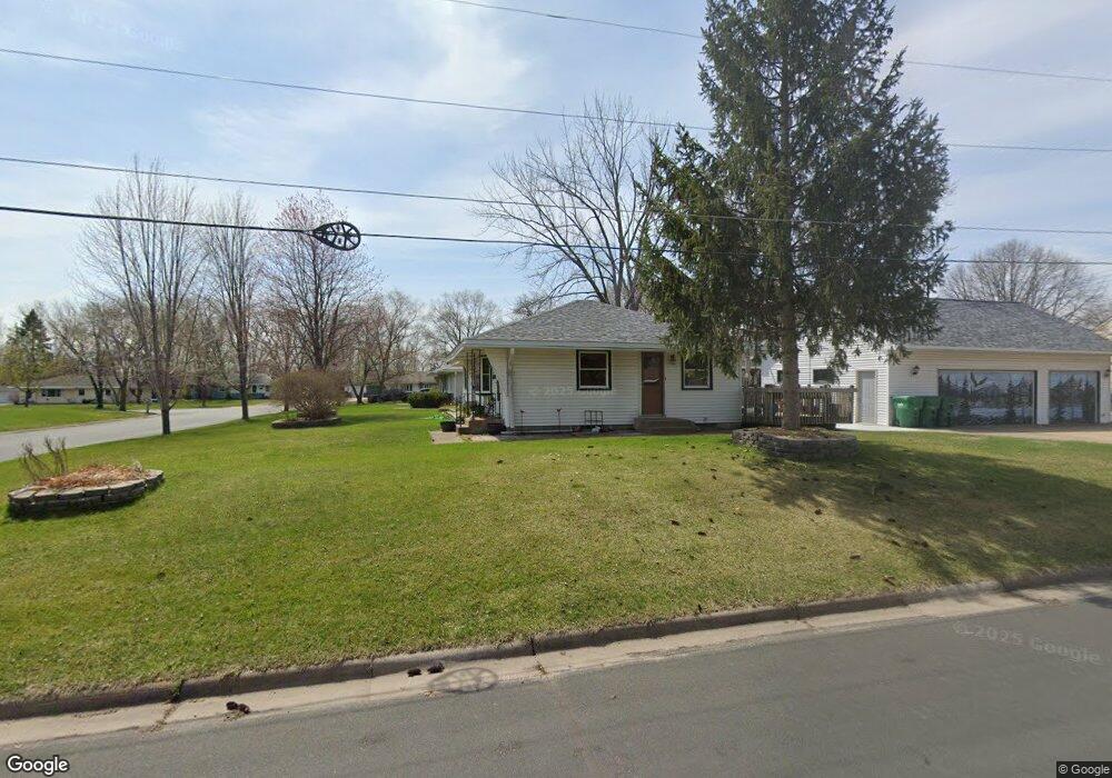
11020 Zion St NW Coon Rapids, MN 55433
Estimated Value: $350,000 - $379,000
4
Beds
3
Baths
1,248
Sq Ft
$290/Sq Ft
Est. Value
About This Home
This home is located at 11020 Zion St NW, Coon Rapids, MN 55433 and is currently estimated at $361,621, approximately $289 per square foot. 11020 Zion St NW is a home located in Anoka County with nearby schools including Lucile Bruner Elementary School, Hoover Elementary School, and Laughlin Junior/Senior High School.
Ownership History
Date
Name
Owned For
Owner Type
Purchase Details
Closed on
Oct 18, 2018
Sold by
Stanley Randy E
Bought by
Stanley Melissa A
Current Estimated Value
Home Financials for this Owner
Home Financials are based on the most recent Mortgage that was taken out on this home.
Original Mortgage
$165,000
Outstanding Balance
$144,196
Interest Rate
4.6%
Mortgage Type
New Conventional
Estimated Equity
$217,425
Purchase Details
Closed on
Apr 29, 1999
Sold by
Abraham Charles F
Bought by
Stanley Randy E and Stanley Melissa A
Create a Home Valuation Report for This Property
The Home Valuation Report is an in-depth analysis detailing your home's value as well as a comparison with similar homes in the area
Home Values in the Area
Average Home Value in this Area
Purchase History
| Date | Buyer | Sale Price | Title Company |
|---|---|---|---|
| Stanley Melissa A | -- | Land Title Inc | |
| Stanley Randy E | $110,000 | -- |
Source: Public Records
Mortgage History
| Date | Status | Borrower | Loan Amount |
|---|---|---|---|
| Open | Stanley Melissa A | $165,000 |
Source: Public Records
Tax History Compared to Growth
Tax History
| Year | Tax Paid | Tax Assessment Tax Assessment Total Assessment is a certain percentage of the fair market value that is determined by local assessors to be the total taxable value of land and additions on the property. | Land | Improvement |
|---|---|---|---|---|
| 2025 | $3,634 | $354,100 | $84,000 | $270,100 |
| 2024 | $3,634 | $347,100 | $87,000 | $260,100 |
| 2023 | $3,543 | $336,400 | $76,000 | $260,400 |
| 2022 | $3,320 | $342,600 | $67,000 | $275,600 |
| 2021 | $3,191 | $286,500 | $67,000 | $219,500 |
| 2020 | $2,999 | $269,500 | $62,000 | $207,500 |
| 2019 | $2,801 | $244,100 | $60,000 | $184,100 |
| 2018 | $2,711 | $222,200 | $0 | $0 |
| 2017 | $2,398 | $209,200 | $0 | $0 |
| 2016 | $2,405 | $180,400 | $0 | $0 |
| 2015 | $2,212 | $180,400 | $45,000 | $135,400 |
| 2014 | -- | $147,600 | $36,500 | $111,100 |
Source: Public Records
Map
Nearby Homes
- 2721 109th Ave NW
- 2728 109th Ln NW
- 2400 108th Ave NW
- 11000 Swallow St NW
- 10648 Wren St NW
- 2965 108th Ln NW
- 2851 113th Ave NW
- 10616 Arrowhead St NW
- 2201 108th Ave NW
- 11036 Hanson Blvd NW Unit 20
- 11409 Quinn St NW
- 2633 103rd Ave NW
- 10309 Yukon St NW
- 2862 116th Ave NW
- 11424 Hanson Blvd NW
- 11444 Hanson Blvd NW
- 10239 Raven St NW
- 11749 Crooked Lake Blvd NW
- 3020 117th Ave NW
- 11835 Crocus St NW
- 11010 Zion St NW
- 11030 Zion St NW
- 11000 Zion St NW
- 11011 Zion St NW
- 11021 Zion St NW
- 11001 Zion St NW
- 11040 Zion St NW
- 11031 Zion St NW
- 10950 Zion St NW
- 11041 Zion St NW
- 10942 Arrowhead Cir NW
- 10948 Arrowhead Cir NW
- 11050 Zion St NW
- 10940 Zion St NW
- 11000 Yukon St NW
- 11010 Yukon St NW
- 11020 Yukon St NW
- 2600 111th Ave NW
- 10930 Zion St NW
- 2610 111th Ave NW