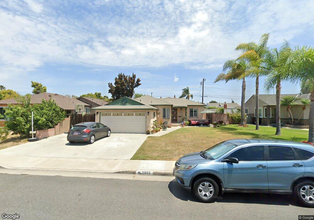
11022 Ranger Dr Los Alamitos, CA 90720
Estimated Value: $884,719 - $1,181,000
3
Beds
1
Bath
1,004
Sq Ft
$1,014/Sq Ft
Est. Value
About This Home
This home is located at 11022 Ranger Dr, Los Alamitos, CA 90720 and is currently estimated at $1,017,930, approximately $1,013 per square foot. 11022 Ranger Dr is a home located in Orange County with nearby schools including Los Alamitos Elementary School, Jack L. Weaver Elementary School, and Sharon Christa Mcauliffe Middle School.
Ownership History
Date
Name
Owned For
Owner Type
Purchase Details
Closed on
Jan 26, 1996
Sold by
Gould Ned J and Gould Joanne I
Bought by
Powers Timothy and Powers Angela
Current Estimated Value
Home Financials for this Owner
Home Financials are based on the most recent Mortgage that was taken out on this home.
Original Mortgage
$158,340
Interest Rate
7.01%
Mortgage Type
VA
Purchase Details
Closed on
Mar 21, 1995
Sold by
Gould Ned J
Bought by
Gould Ned J and Gould Joanne I
Create a Home Valuation Report for This Property
The Home Valuation Report is an in-depth analysis detailing your home's value as well as a comparison with similar homes in the area
Home Values in the Area
Average Home Value in this Area
Purchase History
| Date | Buyer | Sale Price | Title Company |
|---|---|---|---|
| Powers Timothy | $166,000 | Continental Lawyers Title Co | |
| Gould Ned J | -- | -- |
Source: Public Records
Mortgage History
| Date | Status | Borrower | Loan Amount |
|---|---|---|---|
| Previous Owner | Powers Timothy | $158,340 |
Source: Public Records
Tax History Compared to Growth
Tax History
| Year | Tax Paid | Tax Assessment Tax Assessment Total Assessment is a certain percentage of the fair market value that is determined by local assessors to be the total taxable value of land and additions on the property. | Land | Improvement |
|---|---|---|---|---|
| 2025 | $3,567 | $275,758 | $219,252 | $56,506 |
| 2024 | $3,567 | $270,351 | $214,952 | $55,399 |
| 2023 | $3,479 | $265,050 | $210,737 | $54,313 |
| 2022 | $3,451 | $259,853 | $206,604 | $53,249 |
| 2021 | $3,374 | $254,758 | $202,553 | $52,205 |
| 2020 | $3,373 | $252,146 | $200,476 | $51,670 |
| 2019 | $3,258 | $247,202 | $196,545 | $50,657 |
| 2018 | $3,097 | $242,355 | $192,691 | $49,664 |
| 2017 | $3,029 | $237,603 | $188,912 | $48,691 |
| 2016 | $2,968 | $232,945 | $185,208 | $47,737 |
| 2015 | $2,928 | $229,446 | $182,426 | $47,020 |
| 2014 | $2,827 | $224,952 | $178,853 | $46,099 |
Source: Public Records
Map
Nearby Homes
- 11051 Tarawa Dr
- 11091 Ranger Dr
- 11131 Ticonderoga Dr
- 10319 Triple Crown Ln
- 4411 Farquhar Ave
- 4311 Howard Ave
- 5092 Citation Ave
- 5041 Myra Ave
- 10424 Santa Rita St
- 5633 Lakia Dr
- 4777 Larwin Ave
- 4418 Larwin Ave
- 11676 Lakia Dr
- 4005 Bryant Ct
- 4481 Larwin Ave
- 3845 Farquhar Ave Unit 110
- 4286 Dina Ct
- 3802 Howard Ave
- 10202 Aqueduct Dr
- 3804 Howard Ave
- 11042 Ranger Dr
- 11012 Ranger Dr
- 11021 Tarawa Dr
- 11052 Ranger Dr
- 11041 Tarawa Dr
- 11011 Tarawa Dr
- 11011 Ranger Dr
- 11031 Ranger Dr
- 11062 Ranger Dr
- 11051 Ranger Dr
- 11061 Tarawa Dr
- 11010 Ticonderoga Dr
- 11032 Ticonderoga Dr
- 11072 Ranger Dr
- 11061 Ranger Dr
- 11042 Ticonderoga Dr
- 11071 Tarawa Dr
- 11022 Tarawa Dr
- 11042 Tarawa Dr
- 11012 Tarawa Dr