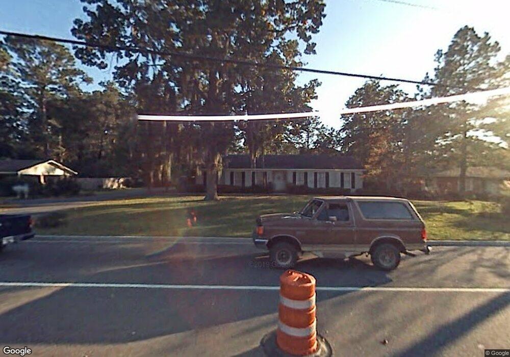
1103 Gornto Rd Valdosta, GA 31602
Estimated Value: $192,000 - $243,000
3
Beds
2
Baths
1,870
Sq Ft
$118/Sq Ft
Est. Value
About This Home
This home is located at 1103 Gornto Rd, Valdosta, GA 31602 and is currently estimated at $219,780, approximately $117 per square foot. 1103 Gornto Rd is a home located in Lowndes County with nearby schools including S.L. Mason Elementary School, Valdosta Middle School, and Valdosta High School.
Ownership History
Date
Name
Owned For
Owner Type
Purchase Details
Closed on
Apr 29, 2013
Sold by
Hickman Jamie M
Bought by
Wombats Llc
Current Estimated Value
Purchase Details
Closed on
Oct 18, 2012
Sold by
Hickman L Elbert
Bought by
Hickman Jamie M
Purchase Details
Closed on
Mar 24, 1977
Bought by
Hickman Hickman L and Hickman Jami
Purchase Details
Closed on
Jul 26, 1973
Bought by
Sutton Leonard C Etal
Purchase Details
Closed on
Apr 23, 1970
Bought by
Templeton Charles O
Create a Home Valuation Report for This Property
The Home Valuation Report is an in-depth analysis detailing your home's value as well as a comparison with similar homes in the area
Home Values in the Area
Average Home Value in this Area
Purchase History
| Date | Buyer | Sale Price | Title Company |
|---|---|---|---|
| Wombats Llc | $80,000 | -- | |
| Hickman Jamie M | -- | -- | |
| Hickman Hickman L | $15,500 | -- | |
| Sutton Leonard C Etal | $35,000 | -- | |
| Templeton Charles O | $27,000 | -- |
Source: Public Records
Mortgage History
| Date | Status | Borrower | Loan Amount |
|---|---|---|---|
| Closed | Wombats Llc | $0 |
Source: Public Records
Tax History Compared to Growth
Tax History
| Year | Tax Paid | Tax Assessment Tax Assessment Total Assessment is a certain percentage of the fair market value that is determined by local assessors to be the total taxable value of land and additions on the property. | Land | Improvement |
|---|---|---|---|---|
| 2024 | $1,824 | $65,308 | $13,200 | $52,108 |
| 2023 | $1,824 | $65,308 | $13,200 | $52,108 |
| 2022 | $1,523 | $45,061 | $13,200 | $31,861 |
| 2021 | $1,567 | $45,061 | $13,200 | $31,861 |
| 2020 | $1,600 | $45,061 | $13,200 | $31,861 |
| 2019 | $1,600 | $45,061 | $13,200 | $31,861 |
| 2018 | $1,620 | $45,061 | $13,200 | $31,861 |
| 2017 | $1,631 | $45,061 | $13,200 | $31,861 |
| 2016 | $1,629 | $45,061 | $13,200 | $31,861 |
| 2015 | $1,495 | $45,061 | $13,200 | $31,861 |
| 2014 | $1,520 | $46,601 | $13,200 | $33,401 |
Source: Public Records
Map
Nearby Homes
- 908 Maplewood Dr
- 1104 Linda Dr
- 1108 Kimberly Dr
- 903 Gornto Rd
- 2325 White Oak Dr
- 68 Pineridge Dr
- 5 Dellwood Cir
- 2502B Jerry Jones Dr Unit 1
- 1 Fox Hollow Cir
- 2211 Jerry Jones Dr
- 1212 Dellwood Dr
- 1211 Gornto Rd
- 2424 Westwood Dr
- 2217 Brighton Place
- 2206 White Oak Dr
- 2208 Dogwood Dr
- 2436 Meadowbrook Dr
- 2432 Meadowbrook Dr
- 2214 Park Ln
- 805 Millpond Rd
- 1105 Gornto Rd
- 1101 Gornto Rd
- 1102 Kimberly Dr
- 1104 Kimberly Dr
- 2414 Jerry Jones Dr
- 1107 Gornto Rd
- 1106 Kimberly Dr
- 2412 Jerry Jones Dr
- 1103 Kimberly Dr
- 1109 Gornto Rd
- 1105 Kimberly Dr
- 1107 Kimberly Dr
- 2410 Jerry Jones Dr
- 910 Maplewood Dr
- 1111 Gornto Rd
- 1109 Kimberly Dr
- 1110 Kimberly Dr
- 2408 Jerry Jones Dr
- 1106 Linda Dr
- 1108 Linda Dr