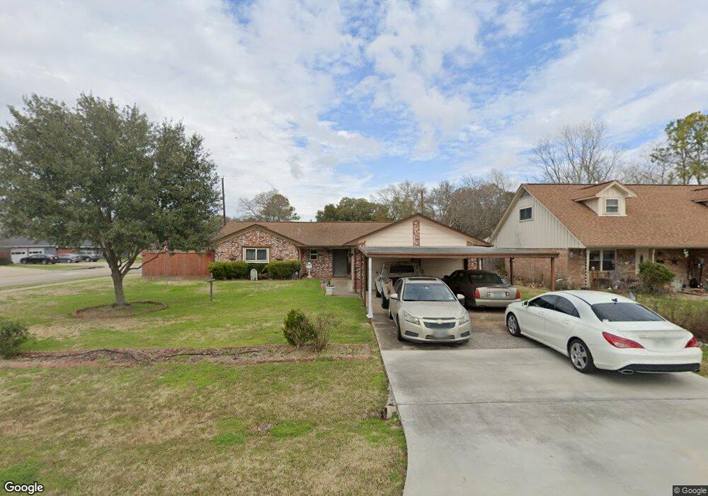
1103 Sally Anne Dr Rosenberg, TX 77471
Estimated Value: $231,526 - $262,000
3
Beds
2
Baths
1,680
Sq Ft
$148/Sq Ft
Est. Value
About This Home
This home is located at 1103 Sally Anne Dr, Rosenberg, TX 77471 and is currently estimated at $247,882, approximately $147 per square foot. 1103 Sally Anne Dr is a home located in Fort Bend County with nearby schools including Smith Elementary School, J J Wessendorff Middle School, and Lamar Junior High School.
Ownership History
Date
Name
Owned For
Owner Type
Purchase Details
Closed on
Dec 30, 2009
Sold by
Scherer C Michael
Bought by
Devlin Arturo and Devlin Carrie
Current Estimated Value
Purchase Details
Closed on
Aug 13, 2009
Sold by
Sbr Land Co
Bought by
Scherer C Michael
Purchase Details
Closed on
Jul 6, 2006
Sold by
Eben Hebert C
Bought by
Sbr Land Co
Create a Home Valuation Report for This Property
The Home Valuation Report is an in-depth analysis detailing your home's value as well as a comparison with similar homes in the area
Home Values in the Area
Average Home Value in this Area
Purchase History
| Date | Buyer | Sale Price | Title Company |
|---|---|---|---|
| Devlin Arturo | -- | None Available | |
| Scherer C Michael | -- | None Available | |
| Devlin Arturo | -- | -- | |
| Sbr Land Co | -- | First American Title | |
| Devlin Arturo | -- | -- |
Source: Public Records
Mortgage History
| Date | Status | Borrower | Loan Amount |
|---|---|---|---|
| Closed | Devlin Arturo | $0 |
Source: Public Records
Tax History Compared to Growth
Tax History
| Year | Tax Paid | Tax Assessment Tax Assessment Total Assessment is a certain percentage of the fair market value that is determined by local assessors to be the total taxable value of land and additions on the property. | Land | Improvement |
|---|---|---|---|---|
| 2025 | $2,737 | $210,769 | $14,196 | $196,573 |
| 2024 | $2,737 | $223,124 | $7,140 | $215,984 |
| 2023 | $2,450 | $202,840 | $0 | $217,509 |
| 2022 | $2,983 | $184,400 | $0 | $210,700 |
| 2021 | $3,478 | $167,640 | $13,060 | $154,580 |
| 2020 | $3,275 | $154,310 | $13,060 | $141,250 |
| 2019 | $3,457 | $151,350 | $13,060 | $138,290 |
| 2018 | $3,472 | $149,600 | $13,060 | $136,540 |
| 2017 | $3,174 | $136,000 | $13,060 | $122,940 |
| 2016 | $2,886 | $123,640 | $13,060 | $110,580 |
| 2015 | $2,504 | $127,840 | $13,060 | $114,780 |
| 2014 | $2,418 | $116,500 | $13,060 | $103,440 |
Source: Public Records
Map
Nearby Homes
- 1109 Frances Dr
- 1809 Hawthorn Dr
- 1805 Hawthorn Dr
- 4602 Avenue H
- 4502 River Rd
- 1922 Teakwood St
- 1004 Country Club Dr
- 5121 Alderney Ct
- 5002 Quebec Blvd
- 5027 Quebec Blvd
- 512 and 514 Travis St
- 000 Fm 2218 Rd
- 5106 Alderney Ct
- 4707 E Parma Dr
- 1230 Law Ct
- 0 Fm 2218 Unit 25550047
- 6219 Deep Gulch Dr
- 6215 Deep Gulch Dr
- 6218 Deep Gulch Dr
- 5303 Rivers Edge Dr
- 1109 Sally Anne Dr
- 1102 Lindsey Dr
- 1069 Sally Anne Dr
- 1115 Sally Anne Dr
- 1112 Lindsey Dr
- 1102 Sally Anne Dr
- 1108 Sally Anne Dr
- 1046 Lindsey Dr
- 1114 Sally Anne Dr
- 1121 Sally Anne Dr
- 1067 Sally Anne Dr
- 1070 Sally Anne Dr
- 1122 Lindsey Dr
- 1120 Sally Anne Dr
- 1103 Lindsey Dr
- 1111 Lindsey Dr
- 1042 Lindsey Dr
- 1126 Sally Anne Dr
- 1066 Sally Anne Dr
- 1063 Sally Anne Dr