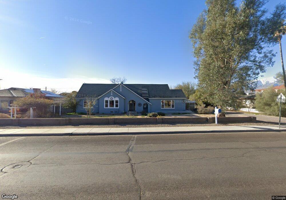
1103 W Relation St Safford, AZ 85546
Estimated Value: $318,000 - $376,000
Studio
--
Bath
3,697
Sq Ft
$94/Sq Ft
Est. Value
About This Home
This home is located at 1103 W Relation St, Safford, AZ 85546 and is currently estimated at $349,323, approximately $94 per square foot. 1103 W Relation St is a home located in Graham County with nearby schools including Ruth Powell Elementary School, Dorothy Stinson School, and Lafe Nelson School.
Ownership History
Date
Name
Owned For
Owner Type
Purchase Details
Closed on
Apr 14, 2018
Sold by
Lowery Ronald E
Bought by
Lowery Ronald E and Doyle Patricia A
Current Estimated Value
Home Financials for this Owner
Home Financials are based on the most recent Mortgage that was taken out on this home.
Original Mortgage
$216,930
Outstanding Balance
$127,587
Interest Rate
4.46%
Mortgage Type
VA
Estimated Equity
$221,736
Create a Home Valuation Report for This Property
The Home Valuation Report is an in-depth analysis detailing your home's value as well as a comparison with similar homes in the area
Purchase History
| Date | Buyer | Sale Price | Title Company |
|---|---|---|---|
| Lowery Ronald E | -- | None Available |
Source: Public Records
Mortgage History
| Date | Status | Borrower | Loan Amount |
|---|---|---|---|
| Open | Lowery Ronald E | $216,930 |
Source: Public Records
Tax History
| Year | Tax Paid | Tax Assessment Tax Assessment Total Assessment is a certain percentage of the fair market value that is determined by local assessors to be the total taxable value of land and additions on the property. | Land | Improvement |
|---|---|---|---|---|
| 2026 | $1,221 | -- | -- | -- |
| 2025 | $1,221 | $25,492 | $4,086 | $21,406 |
| 2024 | $1,267 | $24,241 | $4,086 | $20,155 |
| 2023 | $1,267 | $20,311 | $3,766 | $16,545 |
| 2022 | $1,226 | $18,025 | $3,766 | $14,259 |
| 2021 | $1,370 | $0 | $0 | $0 |
| 2020 | $1,319 | $0 | $0 | $0 |
| 2019 | $1,387 | $0 | $0 | $0 |
| 2018 | $1,321 | $0 | $0 | $0 |
| 2017 | $1,230 | $0 | $0 | $0 |
| 2016 | $1,223 | $0 | $0 | $0 |
| 2015 | $1,204 | $0 | $0 | $0 |
Source: Public Records
Map
Nearby Homes
- 1115 W Relation St
- 1292 W Relation St
- 828 W Navajo Ln
- 1108 S 9th Ave
- 1120 S 8th Ave
- 702 W 16th St
- 1227 S 7th Ave
- 1305 W Crimson Canyon Dr
- 1601 W 14th Dr
- 1204 S Central Ave Unit A
- 1204 S Central Ave Unit B
- 1227 S Central Ave
- 1225 S Central Ave
- 1104 S Central Ave
- 1385 S Meadow Ln
- 1017 S 5th Ave
- 1630 W Cobblestone Dr
- 5052 S 20th Ave
- 295 Geronimo Rd
- 0 S 20th Ave Unit no
- 1101 W Relation St
- TBD Relation St
- 1105 W Relation St
- 1009 W Relation St
- 1444 S 10th Ave
- 1325 S 11th Ave
- 1326 S 11th Ave
- 1107 W Relation St
- 1120 W Relation St
- 1446 S 10th Ave
- 1001 W Relation St
- 1001 W Relation St
- 1315 S 11th Ave
- 1320 S 11th Ave
- 1006 W Relation St
- 1407 S 12th Ave
- 986 W Kimball Ln
- 1200 W Relation St
- 1448 S 10th Ave
- 1313 S 11th Ave
Your Personal Tour Guide
Ask me questions while you tour the home.