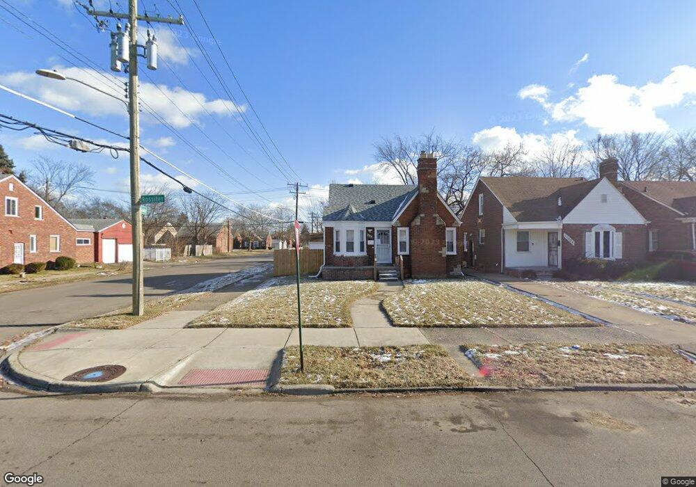
11030 Rossiter St Detroit, MI 48224
Denby NeighborhoodEstimated Value: $75,000 - $101,000
3
Beds
1
Bath
1,206
Sq Ft
$73/Sq Ft
Est. Value
About This Home
This home is located at 11030 Rossiter St, Detroit, MI 48224 and is currently estimated at $87,733, approximately $72 per square foot. 11030 Rossiter St is a home located in Wayne County with nearby schools including Wayne Elementary School, Edward 'Duke' Ellington Conservatory of Music and Art, and Charles L. Spain Elementary-Middle School.
Ownership History
Date
Name
Owned For
Owner Type
Purchase Details
Closed on
Jul 15, 2024
Sold by
Deanyeler Tawan King
Bought by
Palmer Bill Jeffire
Current Estimated Value
Purchase Details
Closed on
Mar 10, 2009
Sold by
Secretary Of Housing & Urban Development
Bought by
King Tawana
Purchase Details
Closed on
Jan 22, 2008
Sold by
Everhome Mortgage Co
Bought by
Hud
Purchase Details
Closed on
Jun 6, 2007
Sold by
Gibson October L
Bought by
Everhome Mortgage Co and Alliance Mortgage Co
Create a Home Valuation Report for This Property
The Home Valuation Report is an in-depth analysis detailing your home's value as well as a comparison with similar homes in the area
Home Values in the Area
Average Home Value in this Area
Purchase History
| Date | Buyer | Sale Price | Title Company |
|---|---|---|---|
| Palmer Bill Jeffire | $8,500 | None Listed On Document | |
| King Tawana | $3,000 | None Available | |
| Hud | -- | None Available | |
| Everhome Mortgage Co | $67,575 | None Available |
Source: Public Records
Tax History Compared to Growth
Tax History
| Year | Tax Paid | Tax Assessment Tax Assessment Total Assessment is a certain percentage of the fair market value that is determined by local assessors to be the total taxable value of land and additions on the property. | Land | Improvement |
|---|---|---|---|---|
| 2025 | $1,260 | $32,500 | $0 | $0 |
| 2024 | $1,260 | $30,000 | $0 | $0 |
| 2023 | $1,223 | $24,100 | $0 | $0 |
| 2022 | $1,303 | $19,400 | $0 | $0 |
| 2021 | $1,268 | $15,700 | $0 | $0 |
| 2020 | $1,267 | $14,600 | $0 | $0 |
| 2019 | $1,248 | $12,700 | $0 | $0 |
| 2018 | $1,097 | $11,500 | $0 | $0 |
| 2017 | $207 | $10,900 | $0 | $0 |
| 2016 | $1,397 | $15,300 | $0 | $0 |
| 2015 | $1,530 | $15,300 | $0 | $0 |
| 2013 | $2,128 | $21,279 | $0 | $0 |
| 2010 | -- | $31,199 | $1,254 | $29,945 |
Source: Public Records
Map
Nearby Homes
- 11010 Rossiter St
- 10897 Lakepointe St
- 11110 Wayburn St
- 10811 Roxbury St
- 11059 Lakepointe St
- 10731 Roxbury St
- 10947 Roxbury St
- 10597 Beaconsfield St
- 10713 Beaconsfield St
- 11320 Wayburn St
- 11009 Roxbury St
- 10773 Beaconsfield St
- 10521 Roxbury St
- 10603 Lakepointe St
- 11365 Whitehill St
- 11521 Whitehill St
- 10508 Nottingham Rd
- 10800 Stratman St
- 11038 Whitehill St
- 10468 Nottingham Rd
- 11024 Rossiter St Unit Bldg-Unit
- 11016 Rossiter St
- 11100 Rossiter St
- 11108 Rossiter St
- 11002 Rossiter St
- 10931 Lakepointe St
- 10927 Lakepointe St
- 10915 Lakepointe St
- 11116 Rossiter St
- 11031 Rossiter St
- 11003 Lakepointe St
- 10996 Rossiter St
- 10909 Lakepointe St
- 11025 Rossiter St
- 11015 Rossiter St
- 11011 Lakepointe St
- 10901 Lakepointe St
- 11101 Rossiter St
- 11011 Rossiter St
- 11122 Rossiter St